Estimated Value: $157,924 - $194,000
2
Beds
2
Baths
985
Sq Ft
$175/Sq Ft
Est. Value
About This Home
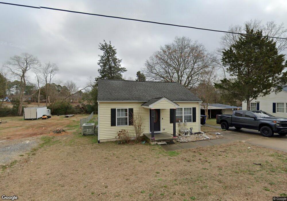
This home is located at 315 S Railroad St, Coats, NC 27521 and is currently estimated at $172,481, approximately $175 per square foot. 315 S Railroad St is a home located in Harnett County with nearby schools including Coats Elementary School, Coats-Erwin Middle School, and Triton High School.
Ownership History
Date
Name
Owned For
Owner Type
Purchase Details
Closed on
Mar 4, 2021
Sold by
Tucker Nicholas B and Tucker Erica Faith
Bought by
Tucker Erica Faith
Current Estimated Value
Home Financials for this Owner
Home Financials are based on the most recent Mortgage that was taken out on this home.
Original Mortgage
$101,010
Outstanding Balance
$90,548
Interest Rate
2.7%
Mortgage Type
New Conventional
Estimated Equity
$81,933
Purchase Details
Closed on
Apr 3, 2012
Sold by
Celey Garry J and Celey Suzanne R
Bought by
Tucker Nicholas B
Create a Home Valuation Report for This Property
The Home Valuation Report is an in-depth analysis detailing your home's value as well as a comparison with similar homes in the area
Home Values in the Area
Average Home Value in this Area
Purchase History
| Date | Buyer | Sale Price | Title Company |
|---|---|---|---|
| Tucker Erica Faith | $100,000 | None Available | |
| Tucker Nicholas B | $59,000 | None Available |
Source: Public Records
Mortgage History
| Date | Status | Borrower | Loan Amount |
|---|---|---|---|
| Open | Tucker Erica Faith | $101,010 |
Source: Public Records
Tax History Compared to Growth
Tax History
| Year | Tax Paid | Tax Assessment Tax Assessment Total Assessment is a certain percentage of the fair market value that is determined by local assessors to be the total taxable value of land and additions on the property. | Land | Improvement |
|---|---|---|---|---|
| 2025 | $1,368 | $107,727 | $0 | $0 |
| 2024 | $1,368 | $107,727 | $0 | $0 |
| 2023 | $1,368 | $107,727 | $0 | $0 |
| 2022 | $895 | $107,727 | $0 | $0 |
| 2021 | $895 | $55,870 | $0 | $0 |
| 2020 | $884 | $55,870 | $0 | $0 |
| 2019 | $869 | $55,870 | $0 | $0 |
| 2018 | $869 | $55,870 | $0 | $0 |
| 2017 | $869 | $55,870 | $0 | $0 |
| 2016 | $925 | $59,810 | $0 | $0 |
| 2015 | -- | $59,810 | $0 | $0 |
| 2014 | -- | $59,810 | $0 | $0 |
Source: Public Records
Map
Nearby Homes
- 355 S Church St
- 221 E Jackson St
- 211 E Washington St
- 221 E Washington St
- 229 E Washington St
- 0 Brick Mill Rd Unit 10081282
- 486 S Denise Ave
- 205 Regis Ln
- 205 Regis Ln Unit 11
- 96 Regis Ln
- 96 Regis Ln Unit 19
- 78 Regis Ln
- 78 Regis Ln Unit 20
- 62 Regis Ln Unit 21
- 62 Regis Ln
- 0 S Lincoln St Unit 10068953
- 2113 N Carolina 55
- 121 Ash St
- 87 E Williams St
- 203 W Stewart St
- 315 S Railroad St
- 299 S Railroad St
- 327 S Railroad St
- 312 S Railroad St
- 283 & 287 S Railroad St
- 287 S Railroad St
- 330 S Railroad St
- 283 S Railroad St
- 292 S Railroad St
- 347 S Railroad St
- 357 S Railroad St
- 261 S Railroad St
- 262 S Railroad St
- 287 S Mckinley St
- 260 S Ida St
- 40 W South St
- 501 S Ida St
- 319 S Ida St
- 301 S Ida St
- 283 S Ida St