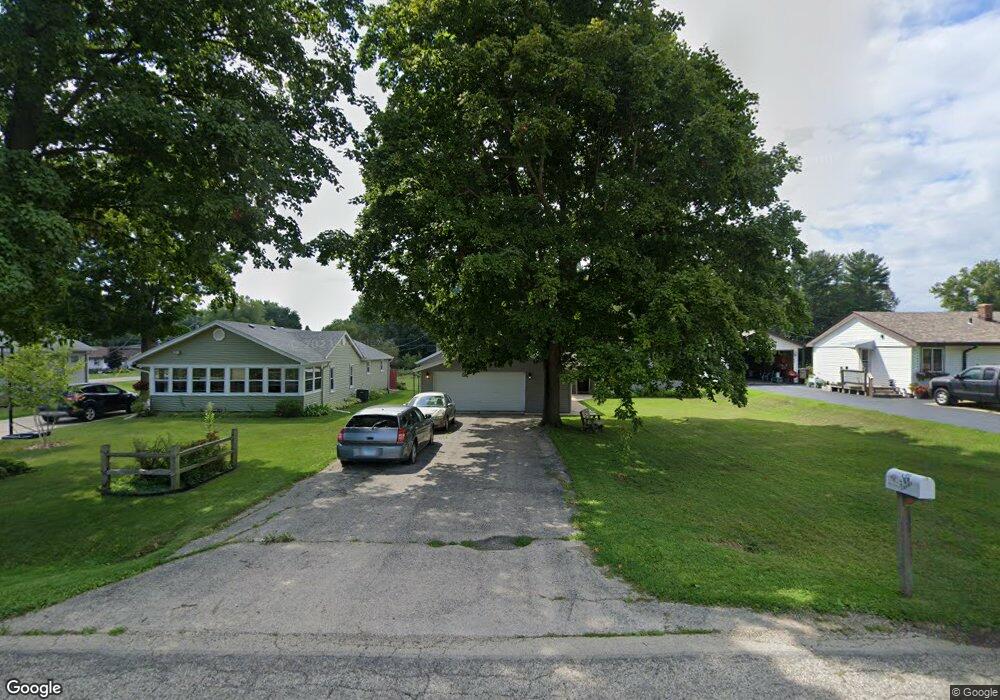
315 S Swift St Winnebago, IL 61088
Estimated Value: $130,000 - $191,405
3
Beds
1
Bath
1,119
Sq Ft
$134/Sq Ft
Est. Value
About This Home
This home is located at 315 S Swift St, Winnebago, IL 61088 and is currently estimated at $150,351, approximately $134 per square foot. 315 S Swift St is a home located in Winnebago County with nearby schools including Dorothy Simon Elementary School, Jean McNair Elementary School, and Winnebago Middle School.
Ownership History
Date
Name
Owned For
Owner Type
Purchase Details
Closed on
May 24, 2019
Sold by
Lisa Hardman and Lisa John R
Bought by
Dailey Mandy L and Watts Gary E
Current Estimated Value
Home Financials for this Owner
Home Financials are based on the most recent Mortgage that was taken out on this home.
Original Mortgage
$59,900
Outstanding Balance
$53,721
Interest Rate
5.25%
Mortgage Type
New Conventional
Estimated Equity
$96,630
Purchase Details
Closed on
Jun 22, 2011
Bought by
Hardman Lisa
Create a Home Valuation Report for This Property
The Home Valuation Report is an in-depth analysis detailing your home's value as well as a comparison with similar homes in the area
Home Values in the Area
Average Home Value in this Area
Purchase History
| Date | Buyer | Sale Price | Title Company |
|---|---|---|---|
| Dailey Mandy L | $68,500 | Floski Law Office Llc | |
| Hardman Lisa | $58,400 | -- |
Source: Public Records
Mortgage History
| Date | Status | Borrower | Loan Amount |
|---|---|---|---|
| Open | Dailey Mandy L | $59,900 | |
| Closed | Dailey Mandy L | $7,500 |
Source: Public Records
Tax History Compared to Growth
Tax History
| Year | Tax Paid | Tax Assessment Tax Assessment Total Assessment is a certain percentage of the fair market value that is determined by local assessors to be the total taxable value of land and additions on the property. | Land | Improvement |
|---|---|---|---|---|
| 2024 | $3,069 | $40,114 | $4,652 | $35,462 |
| 2023 | $2,963 | $36,866 | $4,275 | $32,591 |
| 2022 | $2,814 | $33,882 | $3,969 | $29,913 |
| 2021 | $2,701 | $32,244 | $3,777 | $28,467 |
| 2020 | $2,675 | $30,870 | $3,616 | $27,254 |
| 2019 | $3,193 | $29,617 | $3,469 | $26,148 |
| 2018 | $3,011 | $28,610 | $3,351 | $25,259 |
| 2017 | $2,948 | $27,441 | $3,214 | $24,227 |
| 2016 | $3,069 | $26,879 | $3,148 | $23,731 |
| 2015 | $2,858 | $24,879 | $3,148 | $21,731 |
| 2014 | $2,539 | $23,604 | $3,240 | $20,364 |
Source: Public Records
Map
Nearby Homes
- 603 S Church St
- 514 S Goodling St
- 402 N Benton St
- 307 Shelden Dr
- 0000 Mcnair Rd
- 1470 Lamson Dr
- 0 Mcnair Rd
- 000 U S 20
- 7952 Weldon Woods Close
- 8231 Highview Dr
- 9281 Auburn Rd
- 7795 Weldon Woods Close
- 1483 Hidden Oak Trail
- 3771 & 3773 Lakeview Dr
- 12432 Barberry Dr
- 3727 Westlake Village Dr
- 13915 Berglund Rd
- 13246 Foxglove Ln
- 7XX Homestead Ln
- 7662 Brookeborough Ln
- 317 S Swift St
- 313 S Swift St
- 313 S Swift St
- 401 W Cunningham St
- 311 S Swift St
- 322 W Cunningham St
- 307 S Swift St
- 406 W Cunningham St
- 406 W Cunningham St
- 406 W Cunningham St
- 402 Woodrow St
- 403 Woodrow St
- 303 S Swift St
- 406 Woodrow St
- 301 S Swift St
- 405 Woodrow St
- 415 W Cunningham St
- 315 S Pecatonica St
- 404 E McDamyn Cir
- 321 S Pecatonica St