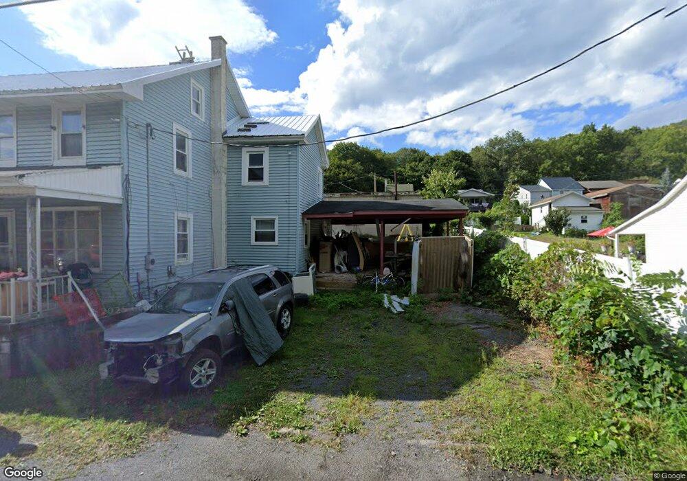
315 State Route 2026 Coal Township, PA 17866
Estimated Value: $53,000 - $100,000
--
Bed
--
Bath
--
Sq Ft
6,752
Sq Ft Lot
About This Home
This home is located at 315 State Route 2026, Coal Township, PA 17866 and is currently estimated at $73,167. 315 State Route 2026 is a home located in Northumberland County with nearby schools including Shamokin Area Elementary School, Shamokin Area Middle School, and Shamokin Area High School.
Ownership History
Date
Name
Owned For
Owner Type
Purchase Details
Closed on
Mar 10, 2023
Sold by
Lubeskie Stephanie and Lubeskie Nicole
Bought by
Russell Brett N
Current Estimated Value
Purchase Details
Closed on
Oct 5, 2015
Sold by
Mostik Frank J and Mostik Frank J
Bought by
Mostik Frank J and Mostik Frank J
Purchase Details
Closed on
Jan 9, 2008
Sold by
Kozar Cynthia M
Bought by
Mostik Frank J and Mostik Frank J
Home Financials for this Owner
Home Financials are based on the most recent Mortgage that was taken out on this home.
Original Mortgage
$25,000
Interest Rate
6.21%
Mortgage Type
New Conventional
Create a Home Valuation Report for This Property
The Home Valuation Report is an in-depth analysis detailing your home's value as well as a comparison with similar homes in the area
Home Values in the Area
Average Home Value in this Area
Purchase History
| Date | Buyer | Sale Price | Title Company |
|---|---|---|---|
| Russell Brett N | $3,750 | -- | |
| Mostik Frank J | -- | None Available | |
| Mostik Frank J | $28,000 | None Available |
Source: Public Records
Mortgage History
| Date | Status | Borrower | Loan Amount |
|---|---|---|---|
| Previous Owner | Mostik Frank J | $25,000 |
Source: Public Records
Tax History Compared to Growth
Tax History
| Year | Tax Paid | Tax Assessment Tax Assessment Total Assessment is a certain percentage of the fair market value that is determined by local assessors to be the total taxable value of land and additions on the property. | Land | Improvement |
|---|---|---|---|---|
| 2025 | $834 | $7,300 | $690 | $6,610 |
| 2024 | $775 | $7,300 | $690 | $6,610 |
| 2023 | $775 | $7,300 | $690 | $6,610 |
| 2022 | $761 | $7,300 | $690 | $6,610 |
| 2021 | $732 | $7,300 | $690 | $6,610 |
| 2020 | $728 | $7,300 | $690 | $6,610 |
| 2019 | $660 | $7,300 | $690 | $6,610 |
| 2018 | $652 | $7,300 | $690 | $6,610 |
| 2017 | $619 | $7,300 | $690 | $6,610 |
| 2016 | -- | $7,300 | $690 | $6,610 |
| 2015 | -- | $7,300 | $690 | $6,610 |
| 2014 | -- | $7,300 | $690 | $6,610 |
Source: Public Records
Map
Nearby Homes
- 0 Old Excelsior Rd
- 108 N Berry St
- 401 Clay St
- 33 35 N Berry St
- 408 Water St
- 1701 Pulaski Ave
- 1221 Chemung St
- 1009 E Packer St
- 1016 E Kase St
- 1004 E Commerce St
- 900 E Sunbury St Unit 902
- 813815 E Commerce
- 813 E Commerce St
- 719 E Dewart St
- 715 E Commerce St
- 722 Race St
- 720 Race St
- 718 N Franklin St
- 122 N Pearl St
- 416 N Shamokin St
- 315 State Route 2026
- 317 State Route 2026
- 325 State Route 2026
- 307 State Route 2026
- 327 State Route 2026
- 305 State Route 2026
- 147 Coal Run Rd
- 155 Coal Run Rd
- 157 Coal Run Rd
- 333 State Route 2026
- 145 Coal Run Rd
- 304 State Route 2026 Unit 306
- 165 Coal Run Rd
- 137 Coal Run Rd
- 130 Coal Run Rd
- 295 State Route 2026
- 173 Coal Run Rd
- 135 Coal Run Rd
- 345 State Route 2026
- 175 Coal Run Rd