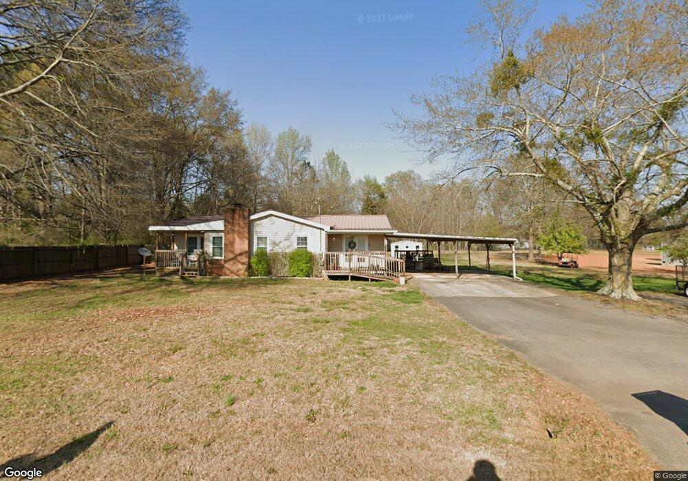
315 Sunset Dr Danielsville, GA 30633
Estimated Value: $114,689 - $209,000
--
Bed
1
Bath
948
Sq Ft
$181/Sq Ft
Est. Value
About This Home
This home is located at 315 Sunset Dr, Danielsville, GA 30633 and is currently estimated at $171,422, approximately $180 per square foot. 315 Sunset Dr is a home located in Madison County with nearby schools including Madison County High School.
Ownership History
Date
Name
Owned For
Owner Type
Purchase Details
Closed on
Nov 7, 2022
Sold by
Morgan Donald Ellis
Bought by
Morgan Tyger Ellis and Morgan Johnnie Fagile
Current Estimated Value
Purchase Details
Closed on
Jun 29, 2018
Sold by
Lord Patti Morgan
Bought by
Morgan Donald Ellis
Purchase Details
Closed on
Jan 8, 2018
Sold by
Morgan Walter G
Bought by
Morgan Donald Ellis and Lord Patti Morgan
Purchase Details
Closed on
Jan 1, 1972
Bought by
Morgan W Gene
Create a Home Valuation Report for This Property
The Home Valuation Report is an in-depth analysis detailing your home's value as well as a comparison with similar homes in the area
Home Values in the Area
Average Home Value in this Area
Purchase History
| Date | Buyer | Sale Price | Title Company |
|---|---|---|---|
| Morgan Tyger Ellis | -- | -- | |
| Morgan Donald Ellis | -- | -- | |
| Morgan Donald Ellis | -- | -- | |
| Morgan W Gene | -- | -- |
Source: Public Records
Tax History Compared to Growth
Tax History
| Year | Tax Paid | Tax Assessment Tax Assessment Total Assessment is a certain percentage of the fair market value that is determined by local assessors to be the total taxable value of land and additions on the property. | Land | Improvement |
|---|---|---|---|---|
| 2024 | $932 | $29,419 | $9,351 | $20,068 |
| 2023 | $970 | $26,501 | $7,793 | $18,708 |
| 2022 | $708 | $21,781 | $5,358 | $16,423 |
| 2021 | $637 | $17,396 | $5,358 | $12,038 |
| 2020 | $611 | $16,616 | $4,578 | $12,038 |
| 2019 | $595 | $16,029 | $4,277 | $11,752 |
| 2018 | $248 | $15,438 | $3,913 | $11,525 |
| 2017 | $508 | $14,842 | $3,640 | $11,202 |
| 2016 | $135 | $12,609 | $3,308 | $9,301 |
| 2015 | $78 | $12,609 | $3,308 | $9,301 |
| 2014 | $78 | $12,610 | $3,308 | $9,301 |
| 2013 | -- | $12,610 | $3,308 | $9,301 |
Source: Public Records
Map
Nearby Homes
- 430 Sherwood Cir
- 255 Hillwood Dr Unit 1
- 105 Georgia 98
- 00 Highway 29 Unit A
- 0 Colbert Danielsville Lot 12 Rd
- 0 Colbert Danielsville Lot 10 Rd
- 0 Colbert Danielsville Lot 11 Rd
- 170 Northridge Dr
- 150 Northridge Dr Unit 3
- 150 Northridge Dr
- 140 Northridge Dr
- 140 Northridge Dr Unit 6
- 112 Northridge Dr Unit 8
- 112 Northridge Dr
- 96 Northridge Dr Unit 10
- 96 Northridge Dr
- 49 Ridgeway Dr
- 0 Veterans Dr Unit 10462425
- 0 Veterans Dr Unit 10462434
- 0 Veterans Dr Unit 10462428
- 00 Sunset Dr
- 251 Sunset Dr
- 146 Sherwood Cir
- 166 Sherwood Cir
- 166 Sherwood Cir Unit 1
- 108 Sherwood Cir
- 151 Sherwood Cir
- 175 Sherwood Cir
- 175 Sherwood Cir Unit 1
- 60 Sherwood Cir
- 205 Sherwood Cir
- 205 Sunset Dr
- 85 Sherwood Cir
- 355 Sherwood Cir
- 52 Sherwood Dr
- 70 Sherwood Dr
- 45 Sherwood Cir
- 273 Highway 98 E
- 273 Highway 98 E
- 247 Highway 98 E