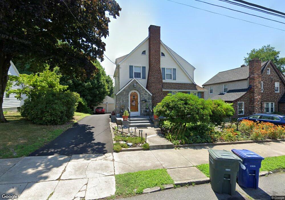
315 Taft Ave Bridgeport, CT 06604
Brooklawn-Saint Vincent NeighborhoodEstimated Value: $379,000 - $452,000
3
Beds
2
Baths
1,799
Sq Ft
$238/Sq Ft
Est. Value
About This Home
This home is located at 315 Taft Ave, Bridgeport, CT 06604 and is currently estimated at $427,477, approximately $237 per square foot. 315 Taft Ave is a home located in Fairfield County with nearby schools including Madison School, Central High School, and Catholic Academy of Bridgeport-St. Raphael Academy.
Ownership History
Date
Name
Owned For
Owner Type
Purchase Details
Closed on
Mar 30, 1994
Sold by
Moore Betty
Bought by
Quinones Dennis and Quinones Joanne
Current Estimated Value
Home Financials for this Owner
Home Financials are based on the most recent Mortgage that was taken out on this home.
Original Mortgage
$99,750
Interest Rate
7.07%
Mortgage Type
Unknown
Create a Home Valuation Report for This Property
The Home Valuation Report is an in-depth analysis detailing your home's value as well as a comparison with similar homes in the area
Home Values in the Area
Average Home Value in this Area
Purchase History
| Date | Buyer | Sale Price | Title Company |
|---|---|---|---|
| Quinones Dennis | $105,000 | -- | |
| Quinones Dennis | $105,000 | -- |
Source: Public Records
Mortgage History
| Date | Status | Borrower | Loan Amount |
|---|---|---|---|
| Open | Quinones Dennis | $50,000 | |
| Closed | Quinones Dennis | $30,000 | |
| Closed | Quinones Dennis | $99,750 |
Source: Public Records
Tax History Compared to Growth
Tax History
| Year | Tax Paid | Tax Assessment Tax Assessment Total Assessment is a certain percentage of the fair market value that is determined by local assessors to be the total taxable value of land and additions on the property. | Land | Improvement |
|---|---|---|---|---|
| 2025 | $6,803 | $156,570 | $78,430 | $78,140 |
| 2024 | $6,803 | $156,570 | $78,430 | $78,140 |
| 2023 | $6,803 | $156,570 | $78,430 | $78,140 |
| 2022 | $6,803 | $156,570 | $78,430 | $78,140 |
| 2021 | $6,803 | $156,570 | $78,430 | $78,140 |
| 2020 | $6,426 | $119,030 | $47,520 | $71,510 |
| 2019 | $6,426 | $119,030 | $47,520 | $71,510 |
| 2018 | $6,472 | $119,030 | $47,520 | $71,510 |
| 2017 | $6,472 | $119,030 | $47,520 | $71,510 |
| 2016 | $6,472 | $119,030 | $47,520 | $71,510 |
| 2015 | $6,446 | $152,740 | $52,710 | $100,030 |
| 2014 | $6,446 | $152,740 | $52,710 | $100,030 |
Source: Public Records
Map
Nearby Homes
- 412 Jackson Ave
- 97 Calvin Ave
- 31 Taft Ave
- 100 Lorraine St
- 2445 Park Ave Unit 23
- 201 High Ridge Dr
- 45 Sampson St
- 191 Oak St
- 1213 Wood Ave
- 390 Charles St Unit 109
- 390 Charles St Unit 216
- 390 Charles St Unit 110
- 1872 North Ave Unit 1874
- 125 Sampson St
- 125 Alexander Dr
- 76 Suburban Ave
- 724 Capitol Ave Unit 726
- 119 Madison Terrace
- 2625 Park Ave Unit 12L
- 2625 Park Ave Unit 10F