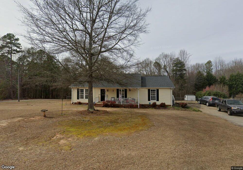
315 Tranquil Dr Spartanburg, SC 29307
Estimated Value: $229,000 - $308,000
4
Beds
2
Baths
1,650
Sq Ft
$154/Sq Ft
Est. Value
About This Home
This home is located at 315 Tranquil Dr, Spartanburg, SC 29307 and is currently estimated at $254,760, approximately $154 per square foot. 315 Tranquil Dr is a home located in Spartanburg County with nearby schools including Broome High School and Mountain View Christian Academy.
Ownership History
Date
Name
Owned For
Owner Type
Purchase Details
Closed on
Oct 3, 2012
Sold by
Federal National Mortgage Association
Bought by
Stubblefield Michael T and Stubblefield Susan G
Current Estimated Value
Home Financials for this Owner
Home Financials are based on the most recent Mortgage that was taken out on this home.
Original Mortgage
$80,510
Outstanding Balance
$55,514
Interest Rate
3.42%
Mortgage Type
New Conventional
Estimated Equity
$199,246
Purchase Details
Closed on
May 15, 2012
Sold by
Klein Scott J
Bought by
Federal National Mortgage Associatin
Create a Home Valuation Report for This Property
The Home Valuation Report is an in-depth analysis detailing your home's value as well as a comparison with similar homes in the area
Home Values in the Area
Average Home Value in this Area
Purchase History
| Date | Buyer | Sale Price | Title Company |
|---|---|---|---|
| Stubblefield Michael T | $86,000 | -- | |
| Federal National Mortgage Associatin | $2,500 | -- |
Source: Public Records
Mortgage History
| Date | Status | Borrower | Loan Amount |
|---|---|---|---|
| Open | Stubblefield Michael T | $80,510 |
Source: Public Records
Tax History Compared to Growth
Tax History
| Year | Tax Paid | Tax Assessment Tax Assessment Total Assessment is a certain percentage of the fair market value that is determined by local assessors to be the total taxable value of land and additions on the property. | Land | Improvement |
|---|---|---|---|---|
| 2025 | $722 | $5,792 | $346 | $5,446 |
| 2024 | $722 | $5,792 | $346 | $5,446 |
| 2023 | $722 | $5,792 | $346 | $5,446 |
| 2022 | $605 | $5,037 | $343 | $4,694 |
| 2021 | $605 | $5,037 | $343 | $4,694 |
| 2020 | $591 | $5,037 | $343 | $4,694 |
| 2019 | $676 | $5,037 | $343 | $4,694 |
| 2018 | $558 | $5,037 | $343 | $4,694 |
| 2017 | $460 | $4,380 | $468 | $3,912 |
| 2016 | $799 | $4,380 | $468 | $3,912 |
| 2015 | $788 | $4,380 | $468 | $3,912 |
| 2014 | $783 | $4,380 | $468 | $3,912 |
Source: Public Records
Map
Nearby Homes
- 157 Sunset Dr
- 127 Crystal Dr
- 121 E Brookwood Ln
- 150 Greenway Dr
- 137 Mcbeth Rd
- 106 Washington Ct
- 110 Washington Ct
- 126 W Church St
- 103 Mimosa St
- 5286 S Main St
- 112 Riverview Park
- 193 Brown St
- 126 Patti Ct
- 171 Brown St
- 114 Ashley St
- 4891 S Main St
- 107 Murph Hill Rd
- 350 Old Pacolet Rd
- 124 Childress Rd
- 450 Tumble Rock Dr
- 325 Tranquil Dr
- 320 Tranquil Dr
- 173 Reynolds Rd
- 350 Tranquil Dr
- 345 Tranquil Dr
- 375 Tranquil Dr
- 398 Tranquil Dr
- 4580 Cannons Campground Rd
- 101 Garden Creek Ln
- 112 Reynolds Rd
- 4640 Cannons Campground Rd
- 105 Garden Creek Ln
- 4532 Cannons Campground Rd
- 4516 Cannons Campground Rd
- 4510 Cannons Campground Rd
- 141 Garden Creek Ln
- 172 Seagle Rd
- 162 Seagle Rd
- 191 Edgewood Dr
- 4662 Cannons Campground Rd