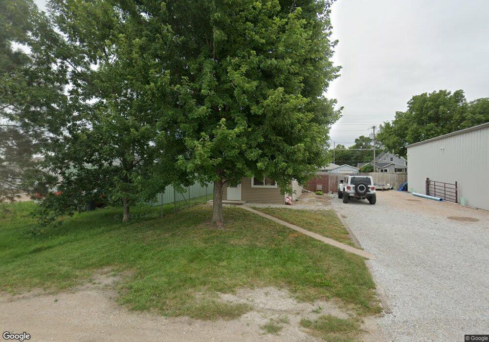
315 W 15th St Hastings, NE 68901
Estimated Value: $127,000 - $192,000
3
Beds
2
Baths
1,177
Sq Ft
$132/Sq Ft
Est. Value
About This Home
This home is located at 315 W 15th St, Hastings, NE 68901 and is currently estimated at $154,953, approximately $131 per square foot. 315 W 15th St is a home located in Adams County with nearby schools including Hastings Senior High School and St. Cecilia High School.
Ownership History
Date
Name
Owned For
Owner Type
Purchase Details
Closed on
Oct 11, 2013
Sold by
Vraspir William E and Vraspir Roleta K
Bought by
Rutt Land Company Llc
Current Estimated Value
Home Financials for this Owner
Home Financials are based on the most recent Mortgage that was taken out on this home.
Original Mortgage
$26,500
Outstanding Balance
$19,944
Interest Rate
4.54%
Mortgage Type
Unknown
Estimated Equity
$135,009
Purchase Details
Closed on
Jun 6, 2006
Sold by
Harwick Steven D and Harwick Angela M
Bought by
Vraspir William E
Home Financials for this Owner
Home Financials are based on the most recent Mortgage that was taken out on this home.
Original Mortgage
$40,200
Interest Rate
6.58%
Mortgage Type
New Conventional
Purchase Details
Closed on
Aug 11, 2005
Sold by
Budd J Osborn
Bought by
Harwick Steven D and Harwick Angela M
Create a Home Valuation Report for This Property
The Home Valuation Report is an in-depth analysis detailing your home's value as well as a comparison with similar homes in the area
Home Values in the Area
Average Home Value in this Area
Purchase History
| Date | Buyer | Sale Price | Title Company |
|---|---|---|---|
| Rutt Land Company Llc | $67,000 | Prairie Title | |
| Vraspir William E | $41,000 | None Available | |
| Harwick Steven D | $7,000 | None Available |
Source: Public Records
Mortgage History
| Date | Status | Borrower | Loan Amount |
|---|---|---|---|
| Open | Rutt Land Company Llc | $26,500 | |
| Previous Owner | Vraspir William E | $40,200 |
Source: Public Records
Tax History Compared to Growth
Tax History
| Year | Tax Paid | Tax Assessment Tax Assessment Total Assessment is a certain percentage of the fair market value that is determined by local assessors to be the total taxable value of land and additions on the property. | Land | Improvement |
|---|---|---|---|---|
| 2024 | $1,350 | $84,423 | $16,875 | $67,548 |
| 2023 | $1,639 | $79,420 | $16,875 | $62,545 |
| 2022 | $1,884 | $83,624 | $16,875 | $66,749 |
| 2021 | $1,682 | $76,721 | $13,750 | $62,971 |
| 2020 | $1,590 | $73,722 | $13,750 | $59,972 |
| 2019 | $1,478 | $69,280 | $13,750 | $55,530 |
| 2018 | $1,332 | $62,095 | $6,565 | $55,530 |
| 2017 | $1,285 | $59,960 | $0 | $0 |
| 2016 | $1,286 | $59,960 | $6,565 | $53,395 |
| 2011 | -- | $44,170 | $6,250 | $37,920 |
Source: Public Records
Map
Nearby Homes
- 1402 N Saint Joseph Ave
- 514 W 14th St
- 1407 N Denver Ave
- 1233 N Colorado Ave
- 1142 N Minnesota Ave
- 1113 N Colorado Ave
- 1131 N Denver Ave
- 1238 N Pine Ave
- 1101 N Hastings Ave
- 208 Ringland Rd
- 914 N Colorado Ave
- 615 W 10th St
- 903 N Saint Joseph Ave
- 919 N Hastings Ave
- 1000 N Burlington Ave
- TBD Kansas Ave
- 216 Forest Blvd
- 1127 N Bellevue Ave
- 234 Forest Blvd
- 1123-1125 N Bellevue Ave
- 309 W 15th St
- 1414 N Kansas Ave
- 314 W 14th St
- 310 W 14th St
- 318 W 14th St
- 308 W 14th St
- 1400 N Kansas Ave
- 302 W 14th St
- 1415 N Kansas Ave
- 1419 N Kansas Ave
- 1411 N Kansas Ave
- 1501 N Kansas Ave
- 1407 N Kansas Ave
- 1507 N Kansas Ave
- 1401 N Kansas Ave
- 311 W 14th St
- 1344 N Kansas Ave
- 1345 N Colorado Ave
- 1511 N Kansas Ave
- 1513 N Kansas Ave