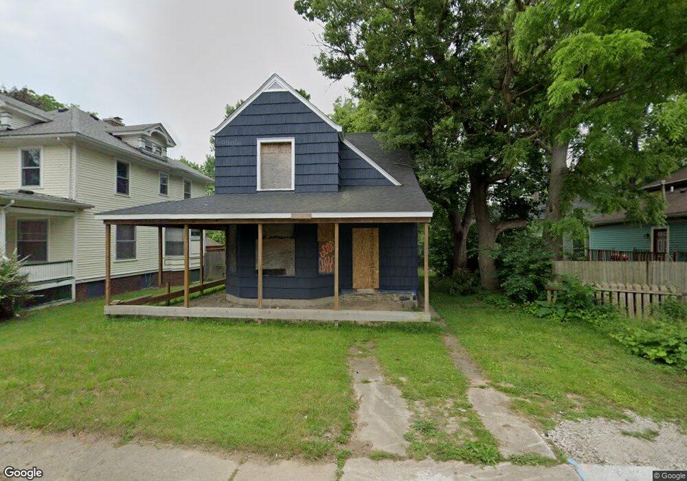
315 W 4th Ave Flint, MI 48503
Downtown Flint NeighborhoodEstimated Value: $86,000 - $140,000
3
Beds
3
Baths
1,778
Sq Ft
$62/Sq Ft
Est. Value
About This Home
This home is located at 315 W 4th Ave, Flint, MI 48503 and is currently estimated at $109,993, approximately $61 per square foot. 315 W 4th Ave is a home located in Genesee County with nearby schools including Doyle/Ryder School, Flint Cultural Center Academy, and WAY Academy of Flint.
Ownership History
Date
Name
Owned For
Owner Type
Purchase Details
Closed on
Nov 13, 2019
Sold by
Genesee County Land Bank Authority
Bought by
Cardinal Real Estate Llc
Current Estimated Value
Purchase Details
Closed on
Dec 17, 2015
Sold by
Genesee County
Bought by
Genesee County Land Bank
Purchase Details
Closed on
Mar 29, 2006
Sold by
Trent Ray M
Bought by
Hsbc Bank Usa
Purchase Details
Closed on
Jun 30, 2005
Sold by
Urbina Santos and Grohoski Michael
Bought by
Trent Ray M
Purchase Details
Closed on
Jun 25, 1999
Sold by
Jensen Mark J
Bought by
Urbina Santos and Grohoski Michael
Create a Home Valuation Report for This Property
The Home Valuation Report is an in-depth analysis detailing your home's value as well as a comparison with similar homes in the area
Home Values in the Area
Average Home Value in this Area
Purchase History
| Date | Buyer | Sale Price | Title Company |
|---|---|---|---|
| Cardinal Real Estate Llc | $1,500 | None Available | |
| Genesee County Land Bank | -- | None Available | |
| Hsbc Bank Usa | $66,894 | None Available | |
| Trent Ray M | $89,900 | Consolidated Title Services | |
| Urbina Santos | $18,000 | -- |
Source: Public Records
Tax History Compared to Growth
Tax History
| Year | Tax Paid | Tax Assessment Tax Assessment Total Assessment is a certain percentage of the fair market value that is determined by local assessors to be the total taxable value of land and additions on the property. | Land | Improvement |
|---|---|---|---|---|
| 2025 | $1,418 | $43,200 | $0 | $0 |
| 2024 | $1,347 | $24,300 | $0 | $0 |
| 2023 | $923 | $17,000 | $0 | $0 |
| 2022 | $0 | $9,500 | $0 | $0 |
| 2021 | $1,307 | $9,900 | $0 | $0 |
| 2020 | $1,232 | $9,600 | $0 | $0 |
| 2019 | $0 | $0 | $0 | $0 |
| 2018 | $0 | $0 | $0 | $0 |
| 2017 | $0 | $0 | $0 | $0 |
| 2016 | $0 | $0 | $0 | $0 |
| 2015 | -- | $0 | $0 | $0 |
| 2014 | -- | $0 | $0 | $0 |
| 2012 | -- | $15,700 | $0 | $0 |
Source: Public Records
Map
Nearby Homes