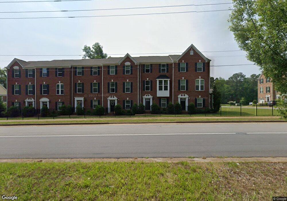
315 W Constance Rd Unit 219 Suffolk, VA 23434
Downtown Suffolk NeighborhoodEstimated Value: $314,000 - $340,000
3
Beds
3
Baths
2,074
Sq Ft
$158/Sq Ft
Est. Value
About This Home
This home is located at 315 W Constance Rd Unit 219, Suffolk, VA 23434 and is currently estimated at $327,237, approximately $157 per square foot. 315 W Constance Rd Unit 219 is a home located in Suffolk City with nearby schools including Elephant's Fork Elementary School, King's Fork Middle School, and King's Fork High School.
Ownership History
Date
Name
Owned For
Owner Type
Purchase Details
Closed on
Jan 21, 2011
Sold by
Constance Investors Lc
Bought by
Barnes Morris A
Current Estimated Value
Home Financials for this Owner
Home Financials are based on the most recent Mortgage that was taken out on this home.
Original Mortgage
$236,550
Outstanding Balance
$160,034
Interest Rate
4.62%
Mortgage Type
New Conventional
Estimated Equity
$167,203
Create a Home Valuation Report for This Property
The Home Valuation Report is an in-depth analysis detailing your home's value as well as a comparison with similar homes in the area
Home Values in the Area
Average Home Value in this Area
Purchase History
| Date | Buyer | Sale Price | Title Company |
|---|---|---|---|
| Barnes Morris A | $249,000 | -- |
Source: Public Records
Mortgage History
| Date | Status | Borrower | Loan Amount |
|---|---|---|---|
| Open | Barnes Morris A | $236,550 |
Source: Public Records
Tax History Compared to Growth
Tax History
| Year | Tax Paid | Tax Assessment Tax Assessment Total Assessment is a certain percentage of the fair market value that is determined by local assessors to be the total taxable value of land and additions on the property. | Land | Improvement |
|---|---|---|---|---|
| 2024 | $4,083 | $306,500 | $60,000 | $246,500 |
| 2023 | $3,370 | $290,800 | $50,000 | $240,800 |
| 2022 | $3,018 | $276,900 | $50,000 | $226,900 |
| 2021 | $2,963 | $266,900 | $40,000 | $226,900 |
| 2020 | $2,566 | $231,200 | $40,000 | $191,200 |
| 2019 | $2,566 | $231,200 | $40,000 | $191,200 |
| 2018 | $2,563 | $231,800 | $40,000 | $191,800 |
| 2017 | $2,480 | $231,800 | $40,000 | $191,800 |
| 2016 | $2,480 | $231,800 | $40,000 | $191,800 |
| 2015 | $1,378 | $231,800 | $40,000 | $191,800 |
| 2014 | $1,378 | $231,800 | $40,000 | $191,800 |
Source: Public Records
Map
Nearby Homes
- 315 W Constance Rd Unit 300
- 315 W Constance Rd Unit 266
- 315 W Constance Rd Unit 268
- 315 W Constance Rd Unit 200
- 315 W Constance Rd Unit 202
- 315 W Constance Rd Unit 254
- 315 W Constance Rd Unit 254
- 315 W Constance Rd Unit 240
- 315 W Constance Rd Unit 247
- 315 W Constance Rd Unit 264
- 315 W Constance Rd Unit 12A
- 315 W Constance Rd Unit 12B
- 315 W Constance Rd Unit 248
- 315 W Constance Rd Unit 258
- 315 W Constance Rd Unit 250
- 315 W Constance Rd Unit 256
- 315 W Constance Rd Unit 260
- 315 W Constance Rd Unit 244
- 315 W Constance Rd Unit 217
- 315 W Constance Rd Unit 303