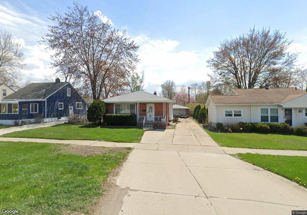
315 W Maple Rd Clawson, MI 48017
Estimated Value: $284,326 - $313,000
3
Beds
2
Baths
1,063
Sq Ft
$281/Sq Ft
Est. Value
About This Home
This home is located at 315 W Maple Rd, Clawson, MI 48017 and is currently estimated at $299,082, approximately $281 per square foot. 315 W Maple Rd is a home located in Oakland County with nearby schools including Clawson Middle School, Clawson High School, and Guardian Angels School.
Ownership History
Date
Name
Owned For
Owner Type
Purchase Details
Closed on
Jun 30, 2008
Sold by
The Andre Roy Revocable Trust and Roy Andre
Bought by
Wright Larry N
Current Estimated Value
Home Financials for this Owner
Home Financials are based on the most recent Mortgage that was taken out on this home.
Original Mortgage
$114,086
Outstanding Balance
$74,241
Interest Rate
6.5%
Mortgage Type
FHA
Estimated Equity
$224,841
Purchase Details
Closed on
Jun 28, 2007
Sold by
Roy Andre and Roy Lysette
Bought by
Roy Andre L and Andre Roy Revocable Trust
Create a Home Valuation Report for This Property
The Home Valuation Report is an in-depth analysis detailing your home's value as well as a comparison with similar homes in the area
Home Values in the Area
Average Home Value in this Area
Purchase History
We collect this data history from publicly available records. To have your information removed, we recommend requesting removal directly through your county’s website.
| Date | Buyer | Sale Price | Title Company |
|---|---|---|---|
| Wright Larry N | $115,000 | Bcc Title Agency Llc | |
| Roy Andre L | -- | None Available |
Source: Public Records
Mortgage History
We collect this data history from publicly available records. To have your information removed, we recommend requesting removal directly through your county’s website.
| Date | Status | Borrower | Loan Amount |
|---|---|---|---|
| Open | Wright Larry N | $114,086 |
Source: Public Records
Tax History
| Year | Tax Paid | Tax Assessment Tax Assessment Total Assessment is a certain percentage of the fair market value that is determined by local assessors to be the total taxable value of land and additions on the property. | Land | Improvement |
|---|---|---|---|---|
| 2025 | $3,181 | $127,810 | $0 | $0 |
| 2024 | $2,975 | $120,800 | $0 | $0 |
| 2023 | $2,853 | $113,730 | $0 | $0 |
| 2022 | $2,875 | $105,540 | $0 | $0 |
| 2021 | $2,816 | $99,740 | $0 | $0 |
| 2020 | $2,729 | $92,840 | $0 | $0 |
| 2019 | $2,820 | $89,160 | $0 | $0 |
| 2018 | $2,800 | $86,010 | $0 | $0 |
| 2017 | $2,783 | $83,570 | $0 | $0 |
| 2016 | $2,821 | $78,720 | $0 | $0 |
| 2015 | -- | $62,630 | $0 | $0 |
| 2014 | -- | $57,800 | $0 | $0 |
| 2011 | -- | $53,940 | $0 | $0 |
Source: Public Records
Map
Nearby Homes
- 285 W Maple Rd
- 1330 N Custer Ave
- 659 W Maple Rd
- 124 Leroy Ave
- 104 Leroy Ave
- 547 Leroy Ave
- 710 Dr
- 65 W Elmwood Ave
- 919 Elmsford Dr
- 1686 Beech Lane Dr
- 1450 Dreon Dr
- 68 Highland Ave
- 151 Highland Ave
- 53 Highland Ave
- 819 Kirts Blvd Unit A2
- 1109 Kenilworth Place
- 31 Starr Dr
- 955 Kirts Blvd Unit 27
- 979 Kirts Blvd Unit 15
- 35 Starr Dr
- 293 W Maple Rd
- 275 W Maple Rd
- 301 W Maple Rd
- 265 W Maple Rd
- 1542 N Custer Ave
- 282 Council Ave
- 327 W Maple Rd
- 300 Council Ave
- 270 Council Ave
- 1530 N Custer Ave
- 1518 N Custer Ave
- 254 Council Ave
- 405 W Maple Rd
- 248 Council Ave
- 1506 N Custer Ave
- 246 Council Ave
- 1541 N Custer Ave
- 415 W Maple Rd
- 224 Council Ave
- 1476 N Custer Ave
Your Personal Tour Guide
Ask me questions while you tour the home.