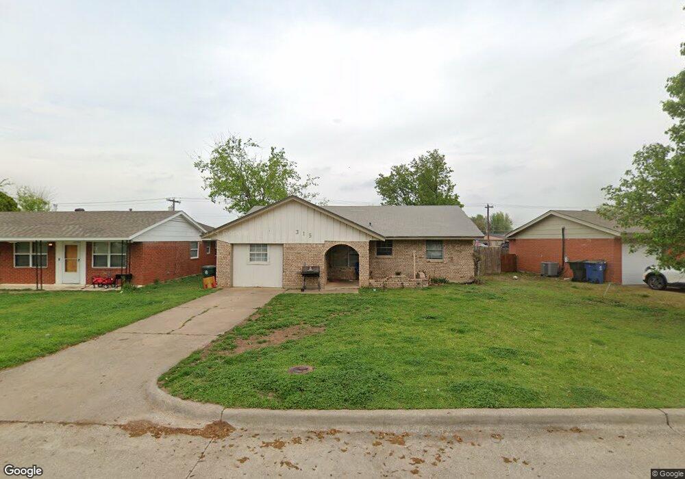
315 W Michael Dr Oklahoma City, OK 73110
Estimated Value: $129,000 - $166,000
3
Beds
2
Baths
1,012
Sq Ft
$138/Sq Ft
Est. Value
About This Home
This home is located at 315 W Michael Dr, Oklahoma City, OK 73110 and is currently estimated at $139,723, approximately $138 per square foot. 315 W Michael Dr is a home located in Oklahoma County with nearby schools including Crutcho Public School and St Philip Neri School.
Ownership History
Date
Name
Owned For
Owner Type
Purchase Details
Closed on
Jun 20, 2008
Sold by
White Tyrone and White Valerie
Bought by
Whites Real Estate & Investments Llc
Current Estimated Value
Purchase Details
Closed on
Nov 17, 2006
Sold by
Vega Narda L and Hartzog Cary Truman
Bought by
White Tyrone and White Valerie
Home Financials for this Owner
Home Financials are based on the most recent Mortgage that was taken out on this home.
Original Mortgage
$43,200
Interest Rate
6.41%
Mortgage Type
Purchase Money Mortgage
Create a Home Valuation Report for This Property
The Home Valuation Report is an in-depth analysis detailing your home's value as well as a comparison with similar homes in the area
Home Values in the Area
Average Home Value in this Area
Purchase History
| Date | Buyer | Sale Price | Title Company |
|---|---|---|---|
| Whites Real Estate & Investments Llc | -- | None Available | |
| White Tyrone | $48,000 | Stewart Escrow & Title Midwe |
Source: Public Records
Mortgage History
| Date | Status | Borrower | Loan Amount |
|---|---|---|---|
| Previous Owner | White Tyrone | $43,200 |
Source: Public Records
Tax History Compared to Growth
Tax History
| Year | Tax Paid | Tax Assessment Tax Assessment Total Assessment is a certain percentage of the fair market value that is determined by local assessors to be the total taxable value of land and additions on the property. | Land | Improvement |
|---|---|---|---|---|
| 2024 | $978 | $9,151 | $1,430 | $7,721 |
| 2023 | $978 | $8,716 | $1,437 | $7,279 |
| 2022 | $946 | $8,300 | $1,184 | $7,116 |
| 2021 | $916 | $7,905 | $1,370 | $6,535 |
| 2020 | $889 | $7,529 | $1,441 | $6,088 |
| 2019 | $832 | $7,171 | $1,443 | $5,728 |
| 2018 | $796 | $6,830 | $0 | $0 |
| 2017 | $747 | $6,504 | $1,402 | $5,102 |
| 2016 | $650 | $6,194 | $1,379 | $4,815 |
| 2015 | $635 | $5,899 | $1,407 | $4,492 |
| 2014 | $609 | $5,618 | $1,412 | $4,206 |
Source: Public Records
Map
Nearby Homes
- 304 W Campbell Dr
- 315 W Silverwood Dr
- 3701 Ridgehaven Dr
- 3620 Ridgehaven Dr
- 4213 N Shadybrook Dr
- 4208 N Shadybrook Dr
- 4206 N Shadybrook Dr
- 3605 Mount Pleasant Dr
- 3909 Rosewood Dr
- 3413 Shadybrook Dr
- 3409 Shadybrook Dr
- 3803 Penny Dr
- 3601 Rosewood Dr
- 3407 Woodvale Dr
- 112 W Silver Meadow Dr
- 104 W Silver Meadow Dr
- 3307 Mockingbird Ln
- 3609 Sunvalley Dr
- 9187 NE 10th St
- 1025 W Idylwild Dr
- 317 W Michael Dr
- 309 W Michael Dr
- 319 W Michael Dr
- 284 Windsor Way
- 301 W Michael Dr
- 290 Windsor Way
- 321 W Michael Dr
- 314 W Michael Dr
- 316 W Michael Dr
- 310 W Michael Dr
- 294 Windsor Way
- 318 W Michael Dr
- 306 W Michael Dr
- 323 W Michael Dr
- 278 Windsor Way
- 320 W Michael Dr
- 235 W Michael Dr
- 276 Windsor Way
- 325 W Michael Dr
- 322 W Michael Dr