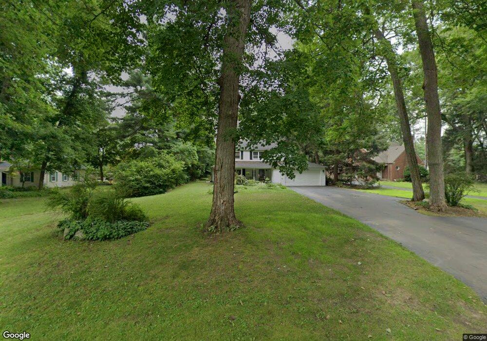
31533 Grove Dr Unit Bldg-Unit Livonia, MI 48154
Estimated Value: $474,704 - $559,000
--
Bed
3
Baths
2,633
Sq Ft
$190/Sq Ft
Est. Value
About This Home
This home is located at 31533 Grove Dr Unit Bldg-Unit, Livonia, MI 48154 and is currently estimated at $501,176, approximately $190 per square foot. 31533 Grove Dr Unit Bldg-Unit is a home located in Wayne County with nearby schools including Buchanan Elementary School, Riley Upper Elementary School, and Holmes Middle School.
Ownership History
Date
Name
Owned For
Owner Type
Purchase Details
Closed on
Oct 9, 2024
Sold by
Brosky Jacob M and Brosky Chelsea C
Bought by
Brosky Trust and Brosky
Current Estimated Value
Purchase Details
Closed on
Nov 18, 2020
Sold by
Brosky Jacob M and Chisolm Chelsea C
Bought by
Brosky Jacob M and Brosky Chelsa C
Purchase Details
Closed on
Mar 5, 2018
Sold by
Hermann Michael L and Hermann Susan L
Bought by
Brosky Jacob M
Home Financials for this Owner
Home Financials are based on the most recent Mortgage that was taken out on this home.
Original Mortgage
$2,520,000
Interest Rate
4.15%
Mortgage Type
New Conventional
Purchase Details
Closed on
Jan 15, 2001
Sold by
Hermann Michael L
Bought by
Hermann Michael L
Create a Home Valuation Report for This Property
The Home Valuation Report is an in-depth analysis detailing your home's value as well as a comparison with similar homes in the area
Home Values in the Area
Average Home Value in this Area
Purchase History
| Date | Buyer | Sale Price | Title Company |
|---|---|---|---|
| Brosky Trust | -- | None Listed On Document | |
| Brosky Jacob M | -- | Peak Title Agency Co | |
| Brosky Jacob M | $315,000 | Stewart Title | |
| Hermann Michael L | -- | -- |
Source: Public Records
Mortgage History
| Date | Status | Borrower | Loan Amount |
|---|---|---|---|
| Previous Owner | Brosky Jacob M | $2,520,000 |
Source: Public Records
Tax History Compared to Growth
Tax History
| Year | Tax Paid | Tax Assessment Tax Assessment Total Assessment is a certain percentage of the fair market value that is determined by local assessors to be the total taxable value of land and additions on the property. | Land | Improvement |
|---|---|---|---|---|
| 2025 | $3,755 | $197,100 | $0 | $0 |
| 2024 | $3,755 | $181,700 | $0 | $0 |
| 2023 | $3,583 | $165,600 | $0 | $0 |
| 2022 | $6,291 | $160,500 | $0 | $0 |
| 2021 | $6,110 | $155,500 | $0 | $0 |
| 2019 | $5,750 | $141,600 | $0 | $0 |
| 2018 | $2,249 | $133,200 | $0 | $0 |
| 2017 | $3,982 | $124,000 | $0 | $0 |
| 2016 | $3,990 | $119,200 | $0 | $0 |
| 2015 | $9,659 | $112,500 | $0 | $0 |
| 2012 | -- | $92,330 | $35,000 | $57,330 |
Source: Public Records
Map
Nearby Homes
- 31069 Munger Dr
- 32525 6 Mile Rd
- 31366 Mayville St
- 15600 Auburndale St
- 30115 Munger Dr
- 32920 6 Mile Rd
- 31005 Roycroft St
- 17760 Loveland St
- 16962 Farmington Rd Unit 20
- 15345 Bainbridge St
- 31257 Hillbrook St
- 29945 6 Mile Rd
- 15873 Shadyside Dr
- 18341 Sunset St
- 16385 Farmington Rd
- 16365 Farmington Rd
- 15040 Berwick St
- 18565 Sunset St
- 18500 Mayfield St
- 15075 Hubbard St Unit 5
- 31533 Grove Dr
- 31545 Grove Dr
- 31515 Grove Dr
- 31507 Grove Dr
- 31522 Grove Dr
- 31542 Grove Dr
- 31761 Balmoral Dr
- 31512 Grove Dr
- 31562 Grove Dr
- 31831 Balmoral Ct
- 31861 Balmoral Ct
- 31500 Grove Dr
- 31801 Balmoral Ct
- 31731 Balmoral Dr
- 16705 Merriman Rd
- 31642 Grove Dr
- 16781 Merriman Rd
- 31901 Balmoral Ct
- 16826 Canterbury St
- 31480 Grove Dr