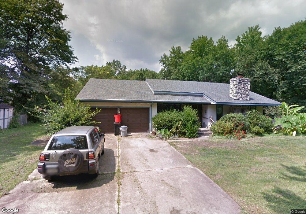
316 Cedar Ave Somerdale, NJ 08083
Estimated Value: $353,000 - $381,000
--
Bed
--
Bath
1,596
Sq Ft
$228/Sq Ft
Est. Value
About This Home
This home is located at 316 Cedar Ave, Somerdale, NJ 08083 and is currently estimated at $364,413, approximately $228 per square foot. 316 Cedar Ave is a home located in Camden County with nearby schools including Somerdale Park School and Sterling High School.
Ownership History
Date
Name
Owned For
Owner Type
Purchase Details
Closed on
Jun 10, 2019
Sold by
Robinson Joanne S
Bought by
Robinson Joanne S and Schimpf Frederick J
Current Estimated Value
Home Financials for this Owner
Home Financials are based on the most recent Mortgage that was taken out on this home.
Interest Rate
3.82%
Purchase Details
Closed on
Dec 21, 2000
Sold by
Mitchell John T
Bought by
Robinson Joanne S
Home Financials for this Owner
Home Financials are based on the most recent Mortgage that was taken out on this home.
Original Mortgage
$120,000
Interest Rate
7.52%
Create a Home Valuation Report for This Property
The Home Valuation Report is an in-depth analysis detailing your home's value as well as a comparison with similar homes in the area
Home Values in the Area
Average Home Value in this Area
Purchase History
| Date | Buyer | Sale Price | Title Company |
|---|---|---|---|
| Robinson Joanne S | -- | -- | |
| Robinson Joanne S | $150,000 | -- |
Source: Public Records
Mortgage History
| Date | Status | Borrower | Loan Amount |
|---|---|---|---|
| Closed | Robinson Joanne S | -- | |
| Previous Owner | Robinson Joanne S | $120,000 |
Source: Public Records
Tax History Compared to Growth
Tax History
| Year | Tax Paid | Tax Assessment Tax Assessment Total Assessment is a certain percentage of the fair market value that is determined by local assessors to be the total taxable value of land and additions on the property. | Land | Improvement |
|---|---|---|---|---|
| 2025 | $7,150 | $153,400 | $47,100 | $106,300 |
| 2024 | $6,843 | $153,400 | $47,100 | $106,300 |
| 2023 | $6,843 | $153,400 | $47,100 | $106,300 |
| 2022 | $6,552 | $153,400 | $47,100 | $106,300 |
| 2021 | $6,733 | $153,400 | $47,100 | $106,300 |
| 2020 | $6,566 | $153,400 | $47,100 | $106,300 |
| 2019 | $6,446 | $153,400 | $47,100 | $106,300 |
| 2018 | $6,604 | $153,400 | $47,100 | $106,300 |
| 2017 | $6,533 | $153,400 | $47,100 | $106,300 |
| 2016 | $6,352 | $153,400 | $47,100 | $106,300 |
| 2015 | $6,262 | $153,400 | $47,100 | $106,300 |
| 2014 | $6,001 | $153,400 | $47,100 | $106,300 |
Source: Public Records
Map
Nearby Homes
- 12 Country Ln
- 25 Country Ln
- 208 Ashley Run
- 217 Hartner Ave
- 0 Orchard Ave
- 1100 Rural Ave
- 412 N White Horse Pike
- 10 N Hilltop Ave
- 117 N Hilltop Ave
- 804 S Burnt Mill Rd
- 209 Garden Ave
- 21 Hiawatha Rd
- 211 Park Ave
- 8 Pennsylvania Ave
- 69 Franklin Cir
- 1 Ava Ave
- 316 Garden Ave
- 4801 Gina Ct
- 5 Perot Ave
- 313 E Washington Ave