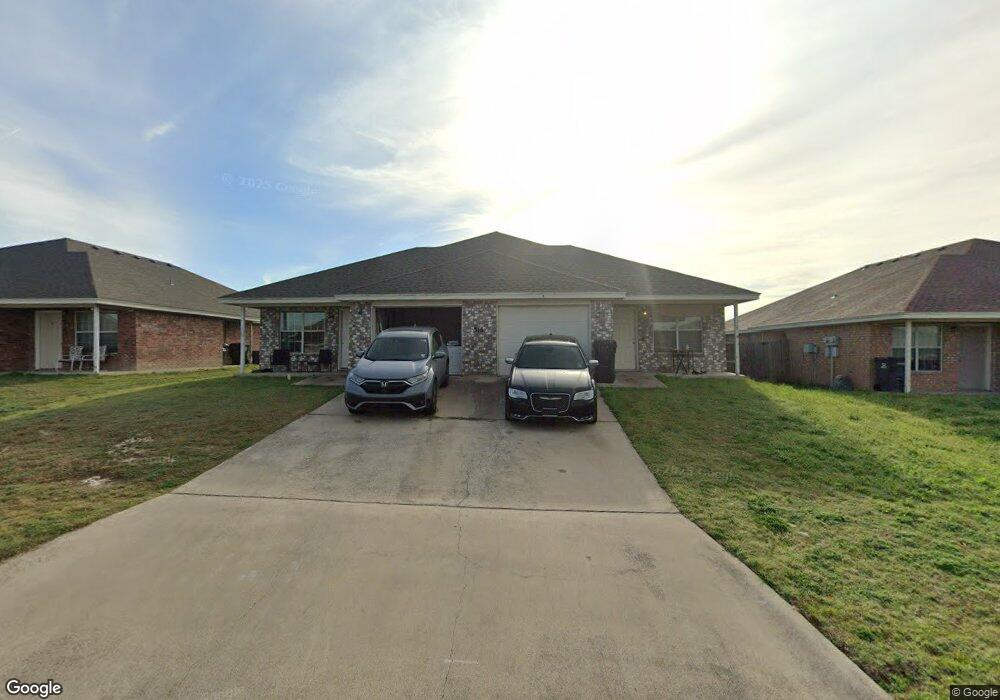
316 Cedar Ridge Dr Unit A Nolanville, TX 76559
Estimated Value: $280,000 - $300,000
3
Beds
2
Baths
1,150
Sq Ft
$254/Sq Ft
Est. Value
About This Home
This home is located at 316 Cedar Ridge Dr Unit A, Nolanville, TX 76559 and is currently estimated at $292,388, approximately $254 per square foot. 316 Cedar Ridge Dr Unit A is a home located in Bell County with nearby schools including Richard E. Cavazos Elementary School, Nolan Middle School, and Harker Heights High School.
Ownership History
Date
Name
Owned For
Owner Type
Purchase Details
Closed on
Aug 25, 2009
Sold by
Citimortgage Inc
Bought by
Hardin Patrick B
Current Estimated Value
Home Financials for this Owner
Home Financials are based on the most recent Mortgage that was taken out on this home.
Original Mortgage
$94,500
Outstanding Balance
$61,834
Interest Rate
5.2%
Mortgage Type
New Conventional
Estimated Equity
$230,554
Purchase Details
Closed on
Nov 4, 2008
Sold by
Nazareno Nenette
Bought by
Citimortgage Inc
Create a Home Valuation Report for This Property
The Home Valuation Report is an in-depth analysis detailing your home's value as well as a comparison with similar homes in the area
Home Values in the Area
Average Home Value in this Area
Purchase History
| Date | Buyer | Sale Price | Title Company |
|---|---|---|---|
| Hardin Patrick B | -- | First American Title Co | |
| Citimortgage Inc | $121,109 | None Available |
Source: Public Records
Mortgage History
| Date | Status | Borrower | Loan Amount |
|---|---|---|---|
| Open | Hardin Patrick B | $94,500 |
Source: Public Records
Tax History Compared to Growth
Tax History
| Year | Tax Paid | Tax Assessment Tax Assessment Total Assessment is a certain percentage of the fair market value that is determined by local assessors to be the total taxable value of land and additions on the property. | Land | Improvement |
|---|---|---|---|---|
| 2025 | $6,447 | $319,222 | $55,000 | $264,222 |
| 2024 | $6,447 | $344,589 | $55,000 | $289,589 |
| 2023 | $6,404 | $355,669 | $30,000 | $325,669 |
| 2022 | $5,248 | $268,038 | $30,000 | $238,038 |
| 2021 | $4,954 | $221,373 | $30,000 | $191,373 |
| 2020 | $4,266 | $183,459 | $30,000 | $153,459 |
| 2019 | $4,254 | $173,787 | $13,400 | $160,387 |
| 2018 | $3,198 | $145,047 | $13,400 | $131,647 |
| 2017 | $3,250 | $146,404 | $13,400 | $133,004 |
| 2016 | $2,792 | $125,798 | $13,400 | $112,398 |
| 2015 | $2,680 | $119,378 | $13,400 | $105,978 |
| 2014 | $2,680 | $120,446 | $0 | $0 |
Source: Public Records
Map
Nearby Homes
- 210 Cedar Ridge Dr
- 212 Oak Ridge Dr
- 112 Cedar Ridge Dr
- 512 N Main St
- 222 W Dogwood St
- 503 N Main St
- 180 W Birch St
- 130 Jesse James Dr
- 403 W Dale Ave
- 303 N 5th St
- 152 Ryan Cir
- 1027 Winchester Dr
- 209 Ryan Cir
- 640 Fm-439-spur
- 117 Pointer St
- 111 Pointer St
- 122 Pointer St
- 120 Pointer St
- 714 Freedom Cir
- 766 Freedom Cir
- 316 Cedar Ridge Dr
- 318 Cedar Ridge Dr
- 314 Cedar Ridge Dr
- 317 Sims Ridge Dr
- 320 Cedar Ridge Dr
- 312 Cedar Ridge Dr
- 317 Cedar Ridge Dr
- 321 Sims Ridge Dr
- 313 Sims Ridge Dr
- 319 Cedar Ridge Dr
- 319 Cedar Ridge Dr Unit B
- 319 Cedar Ridge Dr Unit A
- 315 Cedar Ridge Dr
- 322 Cedar Ridge Dr
- 310 Cedar Ridge Dr
- 321 Cedar Ridge Dr
- 313 Cedar Ridge Dr
- 313 Cedar Ridge Dr Unit B
- 313 Cedar Ridge Dr Unit A
- 323 Sims Ridge Dr