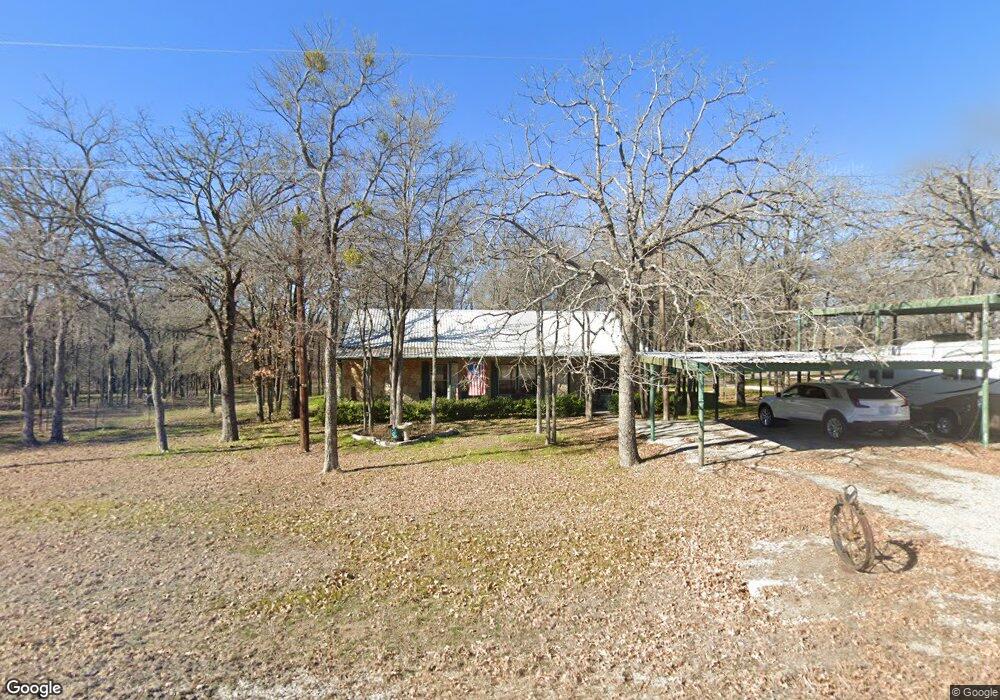
316 Coy Rd Weatherford, TX 76087
Estimated Value: $382,524 - $478,000
--
Bed
--
Bath
1,872
Sq Ft
$233/Sq Ft
Est. Value
About This Home
This home is located at 316 Coy Rd, Weatherford, TX 76087 and is currently estimated at $435,881, approximately $232 per square foot. 316 Coy Rd is a home located in Parker County with nearby schools including Brock Intermediate School, Brock Junior High School, and Brock High School.
Ownership History
Date
Name
Owned For
Owner Type
Purchase Details
Closed on
May 1, 2006
Sold by
Carter Coy P and Carter Bobbie J
Bought by
Teskeys Land & Cattle Ltd
Current Estimated Value
Home Financials for this Owner
Home Financials are based on the most recent Mortgage that was taken out on this home.
Original Mortgage
$333,000
Interest Rate
6.01%
Mortgage Type
Purchase Money Mortgage
Purchase Details
Closed on
Apr 17, 2006
Sold by
Carter Acey B
Bought by
Teskeys Land & Cattle Ltd
Home Financials for this Owner
Home Financials are based on the most recent Mortgage that was taken out on this home.
Original Mortgage
$333,000
Interest Rate
6.01%
Mortgage Type
Purchase Money Mortgage
Purchase Details
Closed on
Jan 4, 2002
Sold by
Carter Coy
Bought by
Teskeys Land & Cattle Ltd
Create a Home Valuation Report for This Property
The Home Valuation Report is an in-depth analysis detailing your home's value as well as a comparison with similar homes in the area
Home Values in the Area
Average Home Value in this Area
Purchase History
| Date | Buyer | Sale Price | Title Company |
|---|---|---|---|
| Teskeys Land & Cattle Ltd | -- | -- | |
| Teskeys Land & Cattle Ltd | -- | -- | |
| Carter Coy | -- | None Available | |
| Teskeys Land & Cattle Ltd | -- | -- |
Source: Public Records
Mortgage History
| Date | Status | Borrower | Loan Amount |
|---|---|---|---|
| Closed | Teskeys Land & Cattle Ltd | $333,000 | |
| Closed | Carter Coy | $333,000 |
Source: Public Records
Tax History Compared to Growth
Tax History
| Year | Tax Paid | Tax Assessment Tax Assessment Total Assessment is a certain percentage of the fair market value that is determined by local assessors to be the total taxable value of land and additions on the property. | Land | Improvement |
|---|---|---|---|---|
| 2025 | $6,875 | $400,000 | $104,150 | $295,850 |
| 2024 | $6,875 | $320,000 | $72,050 | $247,950 |
| 2023 | $6,875 | $320,000 | $72,050 | $247,950 |
| 2022 | $5,182 | $217,120 | $35,000 | $182,120 |
| 2021 | $5,467 | $217,120 | $35,000 | $182,120 |
| 2020 | $4,428 | $172,490 | $30,000 | $142,490 |
| 2019 | $4,700 | $172,490 | $30,000 | $142,490 |
| 2018 | $4,358 | $159,580 | $25,000 | $134,580 |
| 2017 | $4,328 | $159,580 | $25,000 | $134,580 |
| 2016 | $3,457 | $150,270 | $22,340 | $127,930 |
| 2015 | $3,413 | $150,270 | $22,340 | $127,930 |
| 2014 | $3,265 | $143,230 | $17,410 | $125,820 |
Source: Public Records
Map
Nearby Homes
- TBD Diamond Ridge Ln
- 111 Diamond Ridge Ln
- 2045 Eagles Ridge Dr
- 112 Tigers Eye Ct
- 3180 Old Brock Rd
- 2894 Ranger Hwy
- 2800 Ranger Hwy
- 330 Pack Saddle Ct
- TBD Old Brock Rd
- 4600 Old Brock Rd
- 3380 Westridge Dr Unit B
- 3380 Westridge Dr
- 3380 Westridge Dr Unit C
- 169 Pack Saddle Trail
- 177 Pack Saddle Trail
- 673 E Canyon Creek Ln
- 305 Wrangler Ct
- 313 Wrangler Ct
- 151 Canyon Creek Ct
- 833 N Savage Creek Ln
- 312 Coy Rd
- 310 Coy Rd
- 390 Coy Rd
- 11 Falcons Eye Ct
- 12 Falcons Eye Ct
- 14 Falcons Eye Ct
- 1252 Eagles Bluff Dr
- 123 Diamond Ridge Ln
- 277 Coy Rd
- 127 Diamond Ridge Ln
- 150 Prairie Ln
- 415 Coy Rd
- 142 Prairie Ln
- 131 Diamond Ridge Ln
- 132 Diamond Ridge Ln
- 115 Diamond Ridge Ln
- 401 Quincy Ln
- 465 Quincy Ln
- 101 Falcons Eye Ct
- 13 Falcons Eye Ct