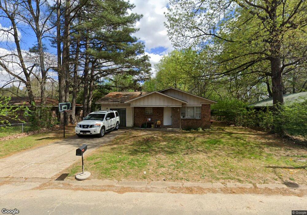
316 Logan St Newport, AR 72112
Estimated Value: $85,649 - $129,000
--
Bed
2
Baths
1,539
Sq Ft
$68/Sq Ft
Est. Value
About This Home
This home is located at 316 Logan St, Newport, AR 72112 and is currently estimated at $105,162, approximately $68 per square foot. 316 Logan St is a home located in Jackson County with nearby schools including Newport Elementary School and Newport High School.
Ownership History
Date
Name
Owned For
Owner Type
Purchase Details
Closed on
May 19, 2006
Bought by
M & F Properties Llc
Current Estimated Value
Purchase Details
Closed on
Dec 9, 2005
Bought by
D H U and C/O Cityside Mgmt Corp
Purchase Details
Closed on
May 6, 2005
Bought by
U S Bank Na
Purchase Details
Closed on
Mar 22, 2004
Bought by
Brandon Edgar
Purchase Details
Closed on
Mar 28, 2003
Bought by
Conseco Finance Servicing Corp and Attn
Purchase Details
Closed on
Jun 13, 1986
Bought by
Wilson Steve L and Wilson Shirley
Purchase Details
Closed on
Sep 20, 1985
Bought by
Usa-Fha
Create a Home Valuation Report for This Property
The Home Valuation Report is an in-depth analysis detailing your home's value as well as a comparison with similar homes in the area
Home Values in the Area
Average Home Value in this Area
Purchase History
| Date | Buyer | Sale Price | Title Company |
|---|---|---|---|
| M & F Properties Llc | -- | -- | |
| D H U | -- | -- | |
| U S Bank Na | -- | -- | |
| Brandon Edgar | -- | -- | |
| Conseco Finance Servicing Corp | -- | -- | |
| Wilson Steve L | -- | -- | |
| Usa-Fha | -- | -- |
Source: Public Records
Tax History Compared to Growth
Tax History
| Year | Tax Paid | Tax Assessment Tax Assessment Total Assessment is a certain percentage of the fair market value that is determined by local assessors to be the total taxable value of land and additions on the property. | Land | Improvement |
|---|---|---|---|---|
| 2024 | $297 | $11,180 | $600 | $10,580 |
| 2023 | $270 | $5,200 | $200 | $5,000 |
| 2022 | $281 | $5,200 | $200 | $5,000 |
| 2021 | $276 | $5,200 | $200 | $5,000 |
| 2020 | $276 | $5,200 | $200 | $5,000 |
| 2019 | $276 | $5,200 | $200 | $5,000 |
| 2018 | $287 | $5,630 | $200 | $5,430 |
| 2017 | $287 | $5,630 | $200 | $5,430 |
| 2015 | -- | $5,604 | $200 | $5,404 |
| 2014 | -- | $5,137 | $200 | $4,937 |
| 2013 | -- | $4,670 | $400 | $4,270 |
| 2012 | -- | $4,670 | $400 | $4,270 |
Source: Public Records
Map
Nearby Homes
- 604 Mclain St
- 721 Mclain St
- 623 Holden Ave
- 900 Josephine St
- 900 Dill St
- 208 Forrest Dr
- 910 & 914 Dill St
- 000 Forrest Dr
- 318 Wilkerson Dr
- 0 Holmes St Unit 25033630
- 0 Holmes St Unit 25-486
- 1311 Dill St
- 1407 Dill St
- 2001 S Main St
- 4 Virginia Rd
- 418 Pine St
- 315 Pine St
- 203 Alice Ct
- 304 Ash St
- 1016 Front St