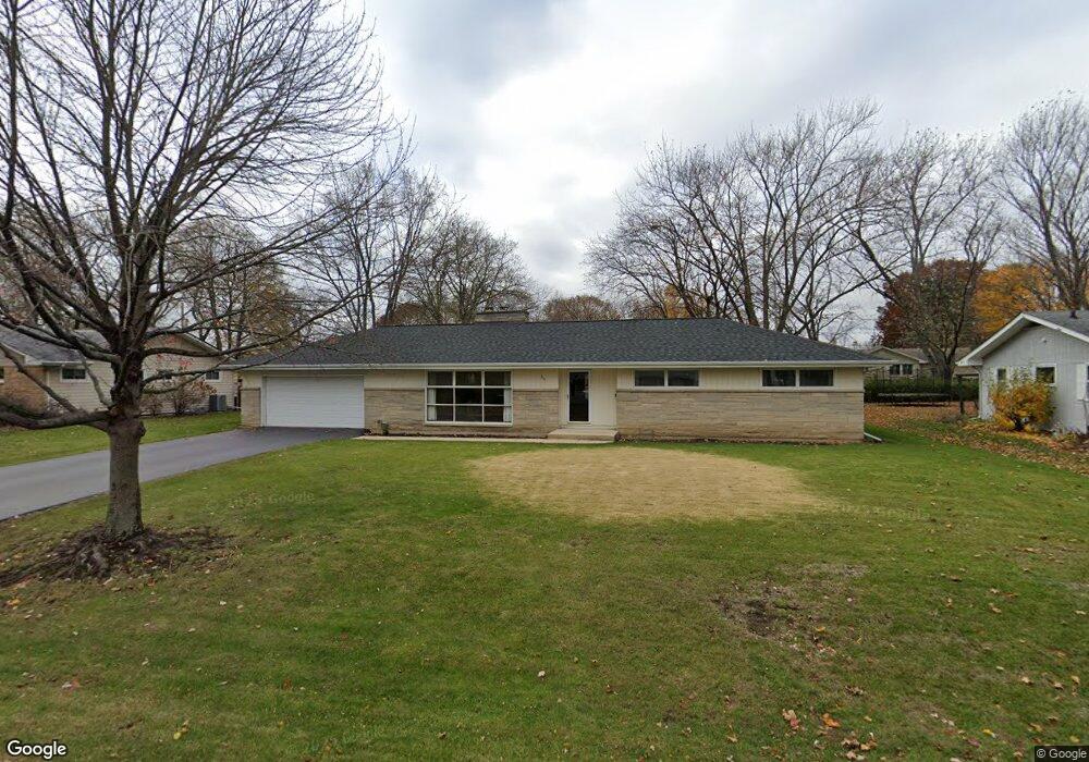
316 Maple Ln Geneva, IL 60134
Northwest Central Geneva NeighborhoodEstimated Value: $419,337 - $535,000
3
Beds
2
Baths
1,468
Sq Ft
$321/Sq Ft
Est. Value
About This Home
This home is located at 316 Maple Ln, Geneva, IL 60134 and is currently estimated at $471,334, approximately $321 per square foot. 316 Maple Ln is a home located in Kane County with nearby schools including Williamsburg Elementary School, Geneva Community High School, and Kensington School - Geneva.
Ownership History
Date
Name
Owned For
Owner Type
Purchase Details
Closed on
Sep 9, 2020
Sold by
Pinzino Betty J
Bought by
The State Bank Of Geneva
Current Estimated Value
Purchase Details
Closed on
Apr 1, 2009
Sold by
Pinzino Betty J and Szot Linda J
Bought by
Pinzino Betty J
Purchase Details
Closed on
Mar 27, 2009
Sold by
Pinzino Betty J
Bought by
Pinzino Betty J and Szot Linda J
Create a Home Valuation Report for This Property
The Home Valuation Report is an in-depth analysis detailing your home's value as well as a comparison with similar homes in the area
Home Values in the Area
Average Home Value in this Area
Purchase History
| Date | Buyer | Sale Price | Title Company |
|---|---|---|---|
| The State Bank Of Geneva | -- | None Available | |
| Pinzino Betty J | -- | None Available | |
| Pinzino Betty J | -- | None Available |
Source: Public Records
Tax History
| Year | Tax Paid | Tax Assessment Tax Assessment Total Assessment is a certain percentage of the fair market value that is determined by local assessors to be the total taxable value of land and additions on the property. | Land | Improvement |
|---|---|---|---|---|
| 2024 | $2,125 | $117,013 | $43,508 | $73,505 |
| 2023 | $2,291 | $106,376 | $39,553 | $66,823 |
| 2022 | $2,749 | $97,231 | $36,752 | $60,479 |
| 2021 | $2,777 | $93,617 | $35,386 | $58,231 |
| 2020 | $2,790 | $92,188 | $34,846 | $57,342 |
| 2019 | $2,839 | $90,442 | $34,186 | $56,256 |
| 2018 | $2,835 | $86,649 | $34,186 | $52,463 |
| 2017 | $2,884 | $84,338 | $33,274 | $51,064 |
| 2016 | $2,941 | $79,084 | $32,824 | $46,260 |
| 2015 | -- | $75,189 | $31,207 | $43,982 |
| 2014 | -- | $79,779 | $31,207 | $48,572 |
| 2013 | -- | $79,779 | $31,207 | $48,572 |
Source: Public Records
Map
Nearby Homes
- 624 Willow Ln
- 525 Bradbury Ln Unit 525
- 544 Bradbury Ln Unit 544
- 1736 Kaneville Rd
- 524 Bradbury Ln
- 629 N Lincoln Ave
- 301 Country Club Place
- 640 Anderson Blvd
- 518 Illinois St
- 1334 S 5th St
- 632 Illinois St
- 549 Bloomfield Cir
- 369 Fritz Ln
- 422 Hamilton St
- 1342 S 14th St Unit A2
- 1949 Gary Ln
- 2309 Sudbury Ln
- 1326 Elm St
- 2250 South St
- 1219 Elm St
Your Personal Tour Guide
Ask me questions while you tour the home.