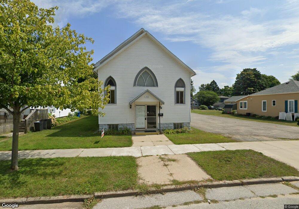
316 N Robert St Ludington, MI 49431
Estimated Value: $262,000 - $315,241
--
Bed
--
Bath
1,848
Sq Ft
$163/Sq Ft
Est. Value
About This Home
This home is located at 316 N Robert St, Ludington, MI 49431 and is currently estimated at $300,310, approximately $162 per square foot. 316 N Robert St is a home with nearby schools including Ludington Elementary School, Lakeview Elementary School, and O.J. DeJonge Middle School.
Ownership History
Date
Name
Owned For
Owner Type
Purchase Details
Closed on
Nov 29, 2022
Sold by
Living Word Church Of Ludington
Bought by
Superior Real Estate Group Llc
Current Estimated Value
Purchase Details
Closed on
Apr 15, 2004
Sold by
Ludington Free Methodist Church
Bought by
Living Word Church Of Muskegon
Home Financials for this Owner
Home Financials are based on the most recent Mortgage that was taken out on this home.
Original Mortgage
$60,000
Interest Rate
5.48%
Mortgage Type
Purchase Money Mortgage
Create a Home Valuation Report for This Property
The Home Valuation Report is an in-depth analysis detailing your home's value as well as a comparison with similar homes in the area
Home Values in the Area
Average Home Value in this Area
Purchase History
| Date | Buyer | Sale Price | Title Company |
|---|---|---|---|
| Superior Real Estate Group Llc | $250,000 | -- | |
| Land Word Church Of Muskegon | -- | -- | |
| Living Word Church Of Muskegon | $75,000 | Lakeshore Land & Title |
Source: Public Records
Mortgage History
| Date | Status | Borrower | Loan Amount |
|---|---|---|---|
| Previous Owner | Living Word Church Of Muskegon | $60,000 | |
| Closed | Living Word Church Of Muskegon | $15,000 | |
| Closed | Superior Real Estate Group Llc | $0 |
Source: Public Records
Tax History Compared to Growth
Tax History
| Year | Tax Paid | Tax Assessment Tax Assessment Total Assessment is a certain percentage of the fair market value that is determined by local assessors to be the total taxable value of land and additions on the property. | Land | Improvement |
|---|---|---|---|---|
| 2025 | $5,672 | $109,100 | $109,100 | $0 |
| 2024 | -- | $102,800 | $102,800 | $0 |
| 2023 | -- | $20,000 | $20,000 | $0 |
| 2022 | -- | $0 | $0 | $0 |
| 2021 | -- | $0 | $0 | $0 |
| 2020 | -- | -- | $0 | $0 |
| 2019 | -- | -- | $0 | $0 |
| 2018 | -- | -- | $0 | $0 |
| 2017 | -- | -- | $0 | $0 |
| 2016 | -- | -- | $0 | $0 |
| 2015 | -- | -- | $0 | $0 |
| 2013 | -- | -- | $0 | $0 |
Source: Public Records
Map
Nearby Homes
- 207 N Rath Ave
- 200 S Robert St Unit 54
- 416 N Rath Ave
- 420 N Robert St
- 404 W Court St
- 319 N Rowe St
- 601 N Rath Ave
- 502 W Loomis St Unit Lot 11, Bk 49
- 502 W Loomis St Unit Lot 10, Bk 49
- 502 W Loomis St Unit Lot 9, Bk 49
- 502 W Loomis St Unit Lot 12, Bk 49
- 302 S James St
- 210 N Lavinia St
- 505 E Pere Marquette St
- 402 N Park St
- 413 S Rath Ave Unit Site 2
- 710 W Ludington Ave
- 115 N Emily St
- 802 N Rath Ave
- 706 W Loomis St
- 318 N Robert St
- 320 N Robert St
- 312 N Robert St
- 317 N Robert St
- 322 N Robert St
- 315 N Robert St
- 321 N Robert St
- 319 N Robert St
- 315 N Rath Ave
- 310 N Robert St
- 313 N Rath Ave
- 317 N Rath Ave
- 319 N Rath Ave
- 313 N Robert St
- 311 N Robert St
- 303 W Haight St
- 321 N Rath Ave
- 311 N Rath Ave
- 311 N Rath Ave Unit 5
- 309 N Robert St