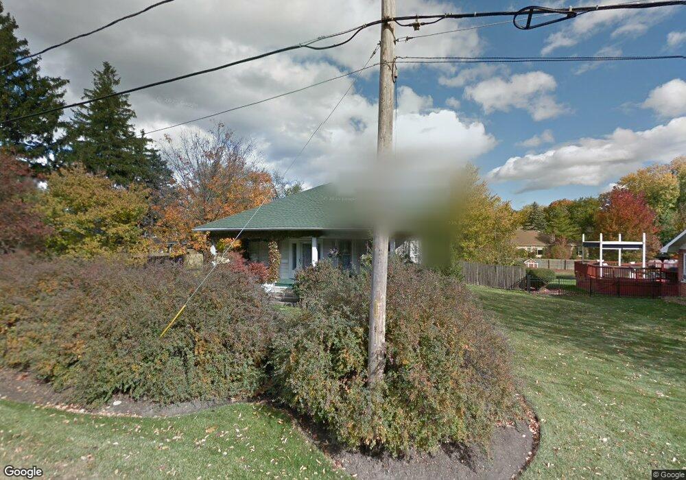
316 S Butterfield Rd Libertyville, IL 60048
South Libertyville NeighborhoodEstimated Value: $338,862 - $475,000
--
Bed
1
Bath
1,342
Sq Ft
$305/Sq Ft
Est. Value
About This Home
This home is located at 316 S Butterfield Rd, Libertyville, IL 60048 and is currently estimated at $409,466, approximately $305 per square foot. 316 S Butterfield Rd is a home located in Lake County with nearby schools including Rockland Elementary School, Highland Middle School, and Libertyville High School.
Ownership History
Date
Name
Owned For
Owner Type
Purchase Details
Closed on
Oct 24, 2020
Sold by
Young Leslie
Bought by
Young Leslie and Filipiak Sara
Current Estimated Value
Purchase Details
Closed on
Oct 15, 1998
Sold by
Hillier David R
Bought by
Young Leslie
Create a Home Valuation Report for This Property
The Home Valuation Report is an in-depth analysis detailing your home's value as well as a comparison with similar homes in the area
Home Values in the Area
Average Home Value in this Area
Purchase History
| Date | Buyer | Sale Price | Title Company |
|---|---|---|---|
| Young Leslie | -- | Burnet Title | |
| Young Leslie | -- | None Listed On Document |
Source: Public Records
Tax History Compared to Growth
Tax History
| Year | Tax Paid | Tax Assessment Tax Assessment Total Assessment is a certain percentage of the fair market value that is determined by local assessors to be the total taxable value of land and additions on the property. | Land | Improvement |
|---|---|---|---|---|
| 2024 | $5,463 | $90,894 | $50,771 | $40,123 |
| 2023 | $5,521 | $83,835 | $46,828 | $37,007 |
| 2022 | $5,521 | $80,032 | $45,009 | $35,023 |
| 2021 | $5,301 | $78,309 | $44,040 | $34,269 |
| 2020 | $5,091 | $76,993 | $43,300 | $33,693 |
| 2019 | $4,967 | $76,261 | $42,888 | $33,373 |
| 2018 | $4,797 | $76,442 | $42,671 | $33,771 |
| 2017 | $4,720 | $74,029 | $41,324 | $32,705 |
| 2016 | $4,530 | $70,190 | $39,181 | $31,009 |
| 2015 | $4,443 | $65,604 | $36,621 | $28,983 |
| 2014 | $5,257 | $74,213 | $36,360 | $37,853 |
| 2012 | $5,252 | $74,856 | $36,675 | $38,181 |
Source: Public Records
Map
Nearby Homes
- 1137 Pine Tree Ln
- 1330 W Park Ave
- 20924 & 20902 W Park Ave
- 223 Kenloch Ave
- 533 Drake St
- 423 Ames St
- 551 W Park Ave Unit E
- 0 Ames St
- 777 Garfield Ave Unit A
- 747 Garfield Ave Unit C
- 308 Mckinley Ave
- 2245 Hazeltime Dr
- 1017 Juniper Pkwy
- 851 Garfield Ave Unit C
- 1754 Glenmore Rd
- 420 W Cook Ave
- 505 Lange Ct
- 323 W Golf Rd
- 422 Shadow Creek Dr
- 832 Interlaken Ln
- 320 S Butterfield Rd
- 317 S Butterfield Rd
- 1137 Pinetree Ln
- 1135 Pinetree Ln
- 1202 N Pointe Dr
- 1201 N Pointe Dr
- 1107 Pinetree Ln
- 1144 Harms Ave
- 1140 Harms Ave
- 1133 Pinetree Ln
- 1103 Pinetree Ln
- 1134 Harms Ave
- 305 S Butterfield Rd
- 1128 Harms Ave
- 1109 Pinetree Ln
- 1131 Pinetree Ln
- 1206 North Pointe Dr
- 1136 Pinetree Ln
- 403 S Butterfield Rd
- 1122 Harms Ave