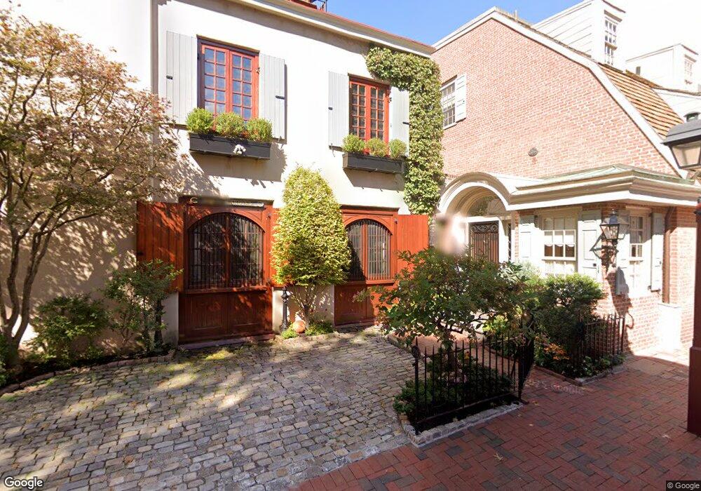
316 S Philip St Philadelphia, PA 19106
Society Hill NeighborhoodEstimated Value: $1,784,606 - $2,015,000
--
Bed
--
Bath
3,758
Sq Ft
$492/Sq Ft
Est. Value
About This Home
This home is located at 316 S Philip St, Philadelphia, PA 19106 and is currently estimated at $1,847,902, approximately $491 per square foot. 316 S Philip St is a home located in Philadelphia County with nearby schools including General George A McCall Public School, Benjamin Franklin High School, and Mastery Charter High School Lenfest Campus.
Ownership History
Date
Name
Owned For
Owner Type
Purchase Details
Closed on
Nov 23, 2010
Sold by
Block Alvin R and Block Judith R
Bought by
Block Alvin and Block Judith R
Current Estimated Value
Purchase Details
Closed on
Feb 10, 2005
Sold by
Block Alvin R and Block Judith R
Bought by
Block Alvin R and Block Judith R
Create a Home Valuation Report for This Property
The Home Valuation Report is an in-depth analysis detailing your home's value as well as a comparison with similar homes in the area
Home Values in the Area
Average Home Value in this Area
Purchase History
| Date | Buyer | Sale Price | Title Company |
|---|---|---|---|
| Block Alvin | -- | None Available | |
| Block Alvin R | -- | -- |
Source: Public Records
Tax History Compared to Growth
Tax History
| Year | Tax Paid | Tax Assessment Tax Assessment Total Assessment is a certain percentage of the fair market value that is determined by local assessors to be the total taxable value of land and additions on the property. | Land | Improvement |
|---|---|---|---|---|
| 2026 | $24,040 | $1,795,899 | $359,180 | $1,436,719 |
| 2025 | $24,040 | $1,795,899 | $359,180 | $1,436,719 |
| 2024 | $24,040 | $1,795,899 | $359,180 | $1,436,719 |
| 2023 | $24,040 | $1,717,399 | $343,480 | $1,373,919 |
| 2022 | $22,170 | $1,697,400 | $343,480 | $1,353,920 |
| 2021 | $22,450 | $0 | $0 | $0 |
| 2020 | $22,450 | $0 | $0 | $0 |
| 2019 | $21,725 | $0 | $0 | $0 |
| 2018 | $21,099 | $0 | $0 | $0 |
| 2017 | $21,099 | $0 | $0 | $0 |
| 2016 | $20,889 | $0 | $0 | $0 |
| 2015 | -- | $0 | $0 | $0 |
| 2014 | -- | $1,507,300 | $168,203 | $1,339,097 |
| 2012 | -- | $162,720 | $27,614 | $135,106 |
Source: Public Records
Map
Nearby Homes
- 202 Spruce St
- 302 S 2nd St
- 220 Locust St Unit 2D
- 220 Locust St Unit 26AS
- 210 Locust St Unit 16EW
- 210 Locust St Unit 21E
- 210 Locust St Unit 15EW
- 210 Locust St Unit 29EFW
- 210 Locust St Unit 29HW
- 242 Locust St
- 410 S Front St Unit 209
- 410 S Front St Unit 210
- 530 S 2nd St Unit 610
- 283 Locust St
- 302 Lombard St Unit B
- 200 10 Lombard St Unit 804
- 200 10 Lombard St Unit 607
- 104 Lombard St
- 105 Lombard St Unit B
- 254 S 3rd St
- 314 S Philip St
- 312 S Philip St
- 319 S American St
- 223 Delancey St
- 317 S American St
- 310 S Philip St
- 225 Delancey St
- 315 S American St
- 217 Delancey St
- 227 Delancey St
- 308 S Philip St
- 311 S Philip St Unit 15
- 313 S American St
- 311 S American St
- 306 S Philip St
- 229 Delancey St
- 309 S American St
- 307 S Philip St Unit 9
- 316 S American St
- 211 Delancey St