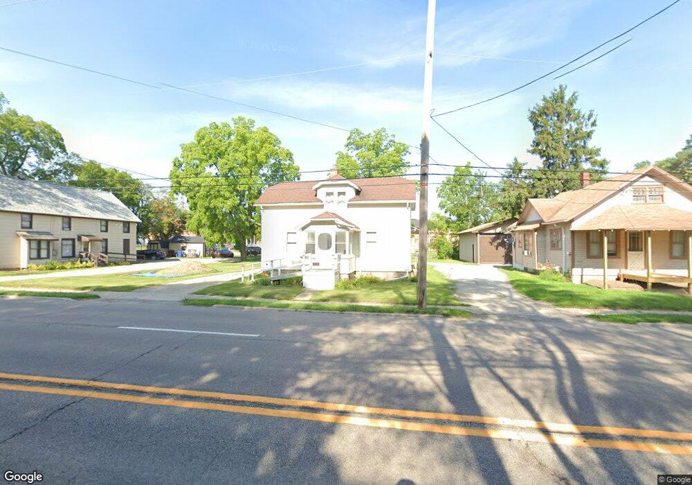
316 S State Rd Davison, MI 48423
Estimated Value: $173,972 - $184,000
3
Beds
1
Bath
1,208
Sq Ft
$148/Sq Ft
Est. Value
About This Home
This home is located at 316 S State Rd, Davison, MI 48423 and is currently estimated at $178,493, approximately $147 per square foot. 316 S State Rd is a home located in Genesee County with nearby schools including Thomson Elementary School, Hill Elementary School, and Gates Elementary School.
Ownership History
Date
Name
Owned For
Owner Type
Purchase Details
Closed on
Jan 19, 2017
Sold by
Plon Larry E
Bought by
Burley Robert A and Burley Carole L
Current Estimated Value
Home Financials for this Owner
Home Financials are based on the most recent Mortgage that was taken out on this home.
Original Mortgage
$56,250
Outstanding Balance
$46,408
Interest Rate
4.16%
Mortgage Type
Commercial
Estimated Equity
$132,085
Purchase Details
Closed on
Jan 29, 2015
Sold by
Lindsay Donald E and Lindsay Roxann J
Bought by
Pion Larry E
Purchase Details
Closed on
Sep 28, 2011
Sold by
Lindsay Donald E and Lindsay Roxann J
Bought by
Lindsay Donald E and Lindsay Roxann J
Purchase Details
Closed on
Aug 26, 2009
Sold by
Lindsay Donald E
Bought by
Lindsay Roxann J and Lindsay Donald E
Create a Home Valuation Report for This Property
The Home Valuation Report is an in-depth analysis detailing your home's value as well as a comparison with similar homes in the area
Home Values in the Area
Average Home Value in this Area
Purchase History
| Date | Buyer | Sale Price | Title Company |
|---|---|---|---|
| Burley Robert A | $75,000 | Transnation Title | |
| Pion Larry E | $40,000 | None Available | |
| Pion Larry E | -- | None Available | |
| Lindsay Donald E | -- | None Available | |
| Lindsay Roxann J | -- | None Available |
Source: Public Records
Mortgage History
| Date | Status | Borrower | Loan Amount |
|---|---|---|---|
| Open | Burley Robert A | $56,250 |
Source: Public Records
Tax History Compared to Growth
Tax History
| Year | Tax Paid | Tax Assessment Tax Assessment Total Assessment is a certain percentage of the fair market value that is determined by local assessors to be the total taxable value of land and additions on the property. | Land | Improvement |
|---|---|---|---|---|
| 2025 | $3,321 | $60,200 | $0 | $0 |
| 2024 | $1,578 | $56,200 | $0 | $0 |
| 2023 | $1,516 | $53,200 | $0 | $0 |
| 2022 | $3,002 | $50,800 | $0 | $0 |
| 2021 | $2,873 | $48,900 | $0 | $0 |
| 2020 | $1,315 | $47,700 | $0 | $0 |
| 2019 | $1,299 | $44,800 | $0 | $0 |
| 2018 | $2,592 | $38,900 | $0 | $0 |
| 2017 | $1,389 | $30,000 | $0 | $0 |
| 2016 | $1,378 | $28,100 | $0 | $0 |
| 2015 | $1,362 | $0 | $0 | $0 |
| 2012 | -- | $26,800 | $26,800 | $0 |
Source: Public Records
Map
Nearby Homes
- 304 S State Rd
- 218 E Rising St
- 322 North Dr
- 330 Rosemore Dr
- 334 E Clark St Unit 340 344
- 222 N Davison St
- 405 Viet St
- 505 N Main St
- 527 Amesbury Dr
- 230 W Flint St
- 530 Hemlock Dr
- 625 Charles St
- 10294 Carriage Way
- 612 Carriage Way
- 9469 Parkwood N Unit 2B
- 1067 Julie Dr
- 0 Davison Rd Unit 218068693
- 9216 Davison Rd
- 9417 Linda Dr
- 9448 Linda Dr