Estimated Value: $125,000 - $188,000
3
Beds
2
Baths
1,658
Sq Ft
$95/Sq Ft
Est. Value
About This Home
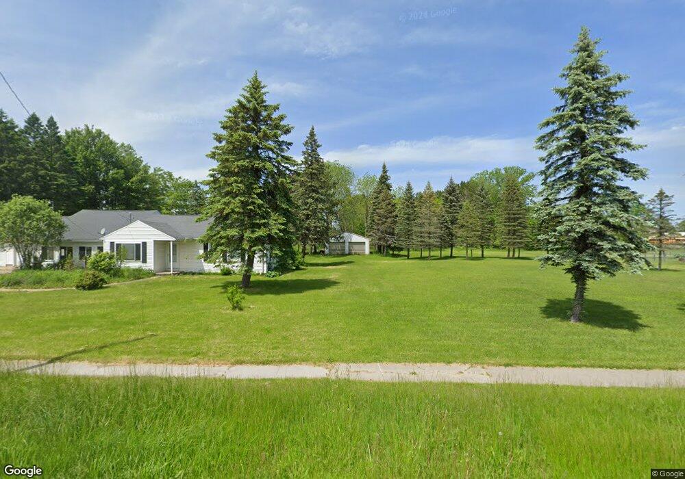
This home is located at 316 W Main St, Hale, MI 48739 and is currently estimated at $157,769, approximately $95 per square foot. 316 W Main St is a home located in Iosco County with nearby schools including Hale Elementary/Middle School and Hale High School.
Ownership History
Date
Name
Owned For
Owner Type
Purchase Details
Closed on
Apr 3, 2019
Sold by
Kaspryzyk Beverly A
Bought by
Kasper Michelle
Current Estimated Value
Purchase Details
Closed on
Jun 16, 2009
Sold by
Putnam Carol H and Beulah M Putnam Trust
Bought by
Kasprzyk Beverly A
Home Financials for this Owner
Home Financials are based on the most recent Mortgage that was taken out on this home.
Original Mortgage
$52,000
Interest Rate
4.86%
Create a Home Valuation Report for This Property
The Home Valuation Report is an in-depth analysis detailing your home's value as well as a comparison with similar homes in the area
Home Values in the Area
Average Home Value in this Area
Purchase History
| Date | Buyer | Sale Price | Title Company |
|---|---|---|---|
| Kasper Michelle | -- | -- | |
| Kasprzyk Beverly A | $65,000 | -- |
Source: Public Records
Mortgage History
| Date | Status | Borrower | Loan Amount |
|---|---|---|---|
| Previous Owner | Kasprzyk Beverly A | $52,000 |
Source: Public Records
Tax History Compared to Growth
Tax History
| Year | Tax Paid | Tax Assessment Tax Assessment Total Assessment is a certain percentage of the fair market value that is determined by local assessors to be the total taxable value of land and additions on the property. | Land | Improvement |
|---|---|---|---|---|
| 2025 | $1,377 | $46,800 | $46,800 | $0 |
| 2024 | $1,335 | $53,600 | $0 | $0 |
| 2023 | $950 | $44,400 | $44,400 | $0 |
| 2022 | $1,244 | $32,100 | $32,100 | $0 |
| 2021 | $1,416 | $39,600 | $39,600 | $0 |
| 2020 | $860 | $37,000 | $37,000 | $0 |
| 2019 | $723 | $35,700 | $35,700 | $0 |
| 2018 | $710 | $33,600 | $33,600 | $0 |
| 2017 | $656 | $33,400 | $33,400 | $0 |
| 2016 | $630 | $33,400 | $0 | $0 |
| 2015 | -- | $31,600 | $0 | $0 |
| 2014 | -- | $33,200 | $0 | $0 |
| 2013 | -- | $34,800 | $0 | $0 |
Source: Public Records
Map
Nearby Homes
- 301 E Main St
- 7388 W Esmond Rd
- 0000 E M-55
- 7549 Hillsdale Dr
- 0 O'Connor Rd
- 7380 Shellenbarger Rd
- 6525 Shellenbarger Rd
- 00 Runyon Ln
- 6536 Shellenbarger Rd
- 7527 Cove Rd
- 00 Wild Cherry Ln Unit 4
- 7797 Lakeside Blvd
- 7924 Campbell Ave
- 8084 Campbell Ave
- 8705 Birch Dr
- 0 Campbell Unit 1938677
- 2995 Maple Rd
- 2855 E County Line Rd
- 00 Lot 8 Countyline Rd
- 00 Lot 5 Countyline Rd
- 414 W Main St
- 304 W Main St
- 317 W Main St
- 315 W Main St
- 418 W Main St
- 8376 W Main St
- 409 W Main St
- 311 W Main St
- 0 Esmond Rd Unit 1849004
- 0 Esmond Rd Unit 1844879
- 0 Esmond Rd Unit 1777105
- 0 Esmond Rd Unit 1786032
- 0 Esmond Rd Unit 1806454
- 0 Esmond Rd Unit 1824970
- 0 Esmond Rd Unit 1914992
- 0 Esmond Rd Unit 1882988
- 0 Esmond Rd Unit 1896091
- 0 Esmond Rd Unit 1890923
- 0 Esmond Rd Unit 1890514
- 0 Esmond Rd Unit 1887712