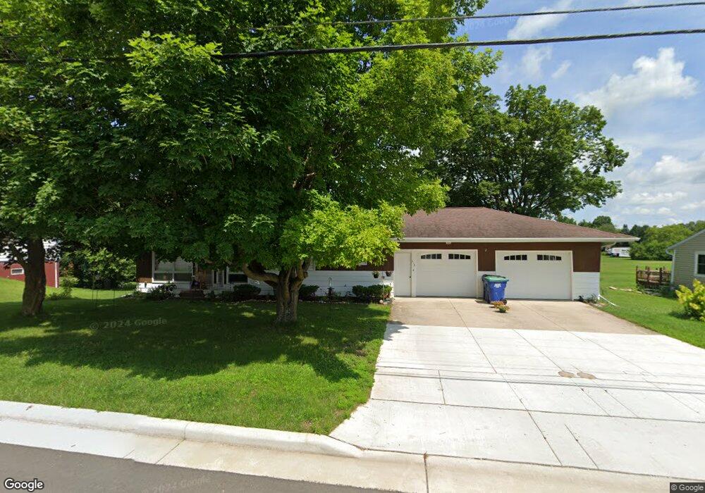
316 W Ramsdell St Marion, WI 54950
Estimated Value: $171,819 - $185,000
--
Bed
--
Bath
--
Sq Ft
0.28
Acres
About This Home
This home is located at 316 W Ramsdell St, Marion, WI 54950 and is currently estimated at $177,955. 316 W Ramsdell St is a home located in Waupaca County with nearby schools including Marion Elementary School, Marion High School, and Mielke School.
Ownership History
Date
Name
Owned For
Owner Type
Purchase Details
Closed on
Mar 10, 2023
Sold by
Arno D D and Arno Marjorie A
Bought by
Mielke Carolyn K
Current Estimated Value
Home Financials for this Owner
Home Financials are based on the most recent Mortgage that was taken out on this home.
Original Mortgage
$91,000
Outstanding Balance
$88,328
Interest Rate
6.5%
Mortgage Type
Seller Take Back
Estimated Equity
$89,627
Purchase Details
Closed on
Dec 2, 2022
Sold by
Mielke Arno and Mielke Marjorie
Bought by
Arno D And Marjorie A Mielke Revocable Trust
Create a Home Valuation Report for This Property
The Home Valuation Report is an in-depth analysis detailing your home's value as well as a comparison with similar homes in the area
Home Values in the Area
Average Home Value in this Area
Purchase History
| Date | Buyer | Sale Price | Title Company |
|---|---|---|---|
| Mielke Carolyn K | $91,000 | None Listed On Document | |
| Arno D And Marjorie A Mielke Revocable Trust | -- | -- |
Source: Public Records
Mortgage History
| Date | Status | Borrower | Loan Amount |
|---|---|---|---|
| Open | Mielke Carolyn K | $91,000 |
Source: Public Records
Tax History Compared to Growth
Tax History
| Year | Tax Paid | Tax Assessment Tax Assessment Total Assessment is a certain percentage of the fair market value that is determined by local assessors to be the total taxable value of land and additions on the property. | Land | Improvement |
|---|---|---|---|---|
| 2024 | $2,317 | $135,100 | $9,400 | $125,700 |
| 2023 | $2,317 | $135,100 | $9,400 | $125,700 |
| 2022 | $1,857 | $69,800 | $6,100 | $63,700 |
| 2021 | $1,714 | $69,800 | $6,100 | $63,700 |
| 2020 | $1,676 | $69,800 | $6,100 | $63,700 |
| 2019 | $1,729 | $69,800 | $6,100 | $63,700 |
| 2018 | $1,608 | $69,800 | $6,100 | $63,700 |
| 2017 | $1,377 | $69,800 | $6,100 | $63,700 |
| 2016 | $1,377 | $69,800 | $6,100 | $63,700 |
| 2015 | $1,527 | $69,800 | $6,100 | $63,700 |
| 2014 | $1,489 | $69,800 | $6,100 | $63,700 |
| 2013 | $1,649 | $69,800 | $6,100 | $63,700 |
Source: Public Records
Map
Nearby Homes
- 411 W Ramsdell St
- 825 S Main St
- 1207 Kussman Rd
- E7206 Magolski Rd
- E5885 County Rd S
- W13231 Mielke Rd
- E6170 Hidde Rd
- W12799 County Road M
- W12796 Elm St
- N3755 Netzel St
- N8321 Knitt Rd
- 0 Swamp Rd
- E5254 E Circle j Rd
- Parcel 10-30-34 Buck Rd
- N10971 Yaeger Rd
- W14856 County Road Ss
- N9878 Sprenger Rd
- * Begrow Rd
- N11924 County Rd E
- 11100 Grandt Rd
- 318 W Ramsdell St
- 312 W Ramsdell St
- 308 W Ramsdell St
- 321 W Ramsdell St
- 315 W Ramsdell St
- 420 W Ramsdell St
- 304 W Ramsdell St
- 216 W Ramsdell St
- 417 W Ramsdell St
- 422 W Ramsdell St
- 213 Wood
- 212 W Ramsdell St
- 419 W Ramsdell St
- 204 W Ramsdell St
- 207 Wood
- 103 Milbauer St
- 510 W Ramsdell St
- 107 Milbauer St
- 240 W Garfield Ave
- 239 W Garfield Ave