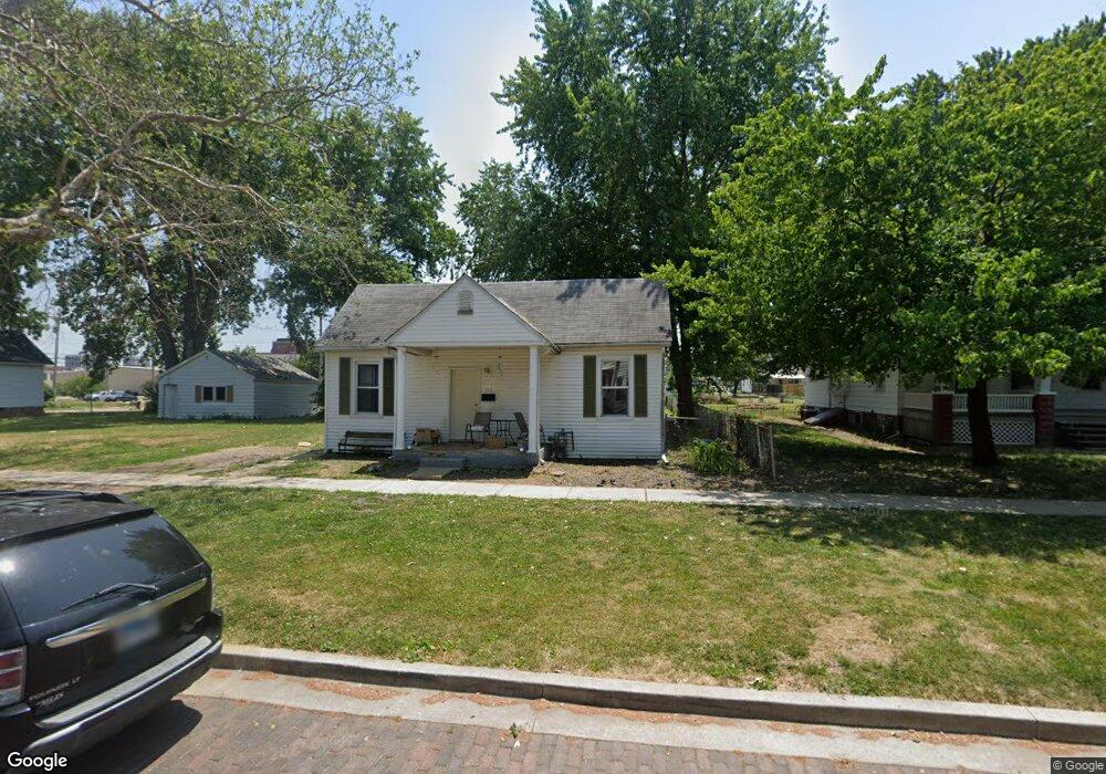
316 W Reynolds St Springfield, IL 62702
Oak Ridge NeighborhoodEstimated Value: $58,000 - $80,000
--
Bed
--
Bath
--
Sq Ft
7,013
Sq Ft Lot
About This Home
This home is located at 316 W Reynolds St, Springfield, IL 62702 and is currently estimated at $71,131. 316 W Reynolds St is a home located in Sangamon County with nearby schools including Enos Elementary School, U.S. Grant Middle School, and Springfield High School.
Ownership History
Date
Name
Owned For
Owner Type
Purchase Details
Closed on
Jun 21, 2018
Sold by
Zino Michele J
Bought by
Zino Properties Llc
Current Estimated Value
Purchase Details
Closed on
Jul 2, 2007
Purchase Details
Closed on
Jan 19, 2007
Purchase Details
Closed on
Aug 23, 2006
Purchase Details
Closed on
Jun 25, 1999
Purchase Details
Closed on
Mar 14, 1997
Purchase Details
Closed on
Aug 23, 1996
Purchase Details
Closed on
Nov 2, 1995
Purchase Details
Closed on
Aug 26, 1994
Create a Home Valuation Report for This Property
The Home Valuation Report is an in-depth analysis detailing your home's value as well as a comparison with similar homes in the area
Home Values in the Area
Average Home Value in this Area
Purchase History
| Date | Buyer | Sale Price | Title Company |
|---|---|---|---|
| Zino Properties Llc | -- | Delano Law Offices Llc | |
| -- | $25,000 | -- | |
| -- | $65,400 | -- | |
| -- | -- | -- | |
| -- | $57,500 | -- | |
| -- | $37,600 | -- | |
| -- | -- | -- | |
| -- | $27,000 | -- | |
| -- | -- | -- |
Source: Public Records
Tax History Compared to Growth
Tax History
| Year | Tax Paid | Tax Assessment Tax Assessment Total Assessment is a certain percentage of the fair market value that is determined by local assessors to be the total taxable value of land and additions on the property. | Land | Improvement |
|---|---|---|---|---|
| 2024 | $1,527 | $18,182 | $3,064 | $15,118 |
| 2023 | $1,468 | $16,608 | $2,799 | $13,809 |
| 2022 | $1,412 | $15,754 | $2,655 | $13,099 |
| 2021 | $1,365 | $15,165 | $2,556 | $12,609 |
| 2020 | $1,338 | $15,188 | $2,560 | $12,628 |
| 2019 | $1,313 | $15,135 | $2,551 | $12,584 |
| 2018 | $916 | $10,842 | $2,539 | $8,303 |
| 2017 | $897 | $10,702 | $2,506 | $8,196 |
| 2016 | $879 | $10,545 | $2,469 | $8,076 |
| 2015 | $871 | $10,418 | $2,439 | $7,979 |
| 2014 | $858 | $10,350 | $2,423 | $7,927 |
| 2013 | $839 | $10,350 | $2,423 | $7,927 |
Source: Public Records
Map
Nearby Homes
- 342 W Reynolds St
- 420 W Reynolds St
- 411 W Carpenter St
- 524 W Carpenter St
- 519 W Herndon St
- 700 W Jefferson St
- 629 W Washington St
- 206 S Walnut St
- 616 W Calhoun Ave
- 202 S Glenwood Ave
- 1042 N 1st St
- 922 N 4th St
- 401 W Elliott Ave
- 421 Jackson Pkwy
- 923 N 5th St
- 225 N English Ave
- 108 S Macarthur Blvd
- 165 N English Ave
- 8 S Old State Capitol Plaza Unit A
- 1028 N 4th St
- 320 W Reynolds St
- 324 W Reynolds St
- 302 W Reynolds St
- 328 W Reynolds St
- 319 W Reynolds St
- 309 W Reynolds St
- 321 W Reynolds St
- 323 W Reynolds St
- 332 W Reynolds St
- 325 W Reynolds St
- 336 W Reynolds St
- 329 W Reynolds St
- 327 W Reynolds St
- 301 W Reynolds St
- 321 W Mason St
- 420 N Rutledge St
- 309 W Mason St
- 319 W Mason St
- 327 W Mason St
- 331 W Reynolds St