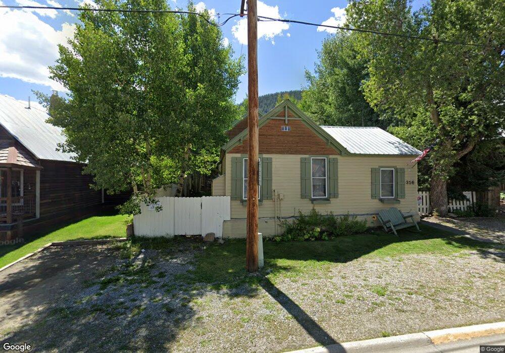
316 Whiterock Ave Crested Butte, CO 81224
Estimated Value: $1,843,000 - $2,810,591
5
Beds
4
Baths
2,446
Sq Ft
$938/Sq Ft
Est. Value
About This Home
This home is located at 316 Whiterock Ave, Crested Butte, CO 81224 and is currently estimated at $2,293,398, approximately $937 per square foot. 316 Whiterock Ave is a home located in Gunnison County with nearby schools including Gunnison Elementary School, Crested Butte Community School, and Gunnison Middle School.
Ownership History
Date
Name
Owned For
Owner Type
Purchase Details
Closed on
Sep 14, 2023
Sold by
Spahin James Ray and Spahin Carolyn Connolly
Bought by
Nimmo Michael and Nimmo Keren
Current Estimated Value
Home Financials for this Owner
Home Financials are based on the most recent Mortgage that was taken out on this home.
Original Mortgage
$726,200
Outstanding Balance
$710,624
Interest Rate
6.9%
Mortgage Type
New Conventional
Estimated Equity
$1,582,774
Purchase Details
Closed on
Aug 12, 2014
Sold by
Lucy M Hecker Revocable Trust
Bought by
Wyant Family Trust
Purchase Details
Closed on
Jul 30, 1998
Sold by
Beltz Kevin
Bought by
Hecker Lucy Trust
Create a Home Valuation Report for This Property
The Home Valuation Report is an in-depth analysis detailing your home's value as well as a comparison with similar homes in the area
Home Values in the Area
Average Home Value in this Area
Purchase History
| Date | Buyer | Sale Price | Title Company |
|---|---|---|---|
| Nimmo Michael | $1,750,000 | Land Title | |
| Wyant Family Trust | $760,000 | None Available | |
| Hecker Lucy Trust | $268,000 | -- |
Source: Public Records
Mortgage History
| Date | Status | Borrower | Loan Amount |
|---|---|---|---|
| Open | Nimmo Michael | $726,200 |
Source: Public Records
Tax History Compared to Growth
Tax History
| Year | Tax Paid | Tax Assessment Tax Assessment Total Assessment is a certain percentage of the fair market value that is determined by local assessors to be the total taxable value of land and additions on the property. | Land | Improvement |
|---|---|---|---|---|
| 2024 | $10,396 | $148,990 | $19,850 | $129,140 |
| 2023 | $10,242 | $145,300 | $19,350 | $125,950 |
| 2022 | $8,303 | $105,930 | $16,300 | $89,630 |
| 2021 | $7,519 | $108,980 | $16,770 | $92,210 |
| 2020 | $6,797 | $99,440 | $17,820 | $81,620 |
| 2019 | $5,379 | $80,320 | $17,820 | $62,500 |
Source: Public Records
Map
Nearby Homes
- 308 Whiterock Ave
- 602 & 604 Fourth St
- 309 Belleview #2-C Residential Unit 2-C
- 309 Belleview #2-B Residential Unit 2-B
- 309 Belleview #2-A Residential Unit 2-A
- 513 Third St
- 223 Sopris Ave
- 209 Whiterock Ave
- 418 Elk Ave
- 315 Elk Ave
- 414 Maroon Ave
- 609 2nd St
- 413 2nd St
- 398 Journey's End Rd
- 218 Maroon Ave Unit E
- 310 2nd St
- 119 Elk Ave
- 108 Maroon Ave Unit B
- 28 Whiterock Ave Unit 2
- 22 Elk Ave
- 316 & 316 1/2 Whiterock Ave
- 316 and 316 1/2 Whiterock Ave
- 310 Whiterock Ave
- 320 Whiterock Ave
- 324 & 324. Whiterock
- 315 Belleview Unit B
- 315 Belleview Unit 2B
- 315 Belleview Ave Unit 2B
- 315 Belleview Unit 2C
- 315 Belleview Ave Unit D
- 315 Belleview Unit D
- 315 2c & 2b Belleview Ave
- 0 Belleview 2b & 2c Ave Unit 13378
- 0 Belleview 2b Ave Unit 2B 735999
- 304 Whiterock Ave
- 306 Whiterock Ave
- 315 Belleview 2b & 2c
- 309 Belleview #2-C Residential Unit 2-C
- 309 Belleview #2-A Ave Unit 2-A
- 325 Belleview