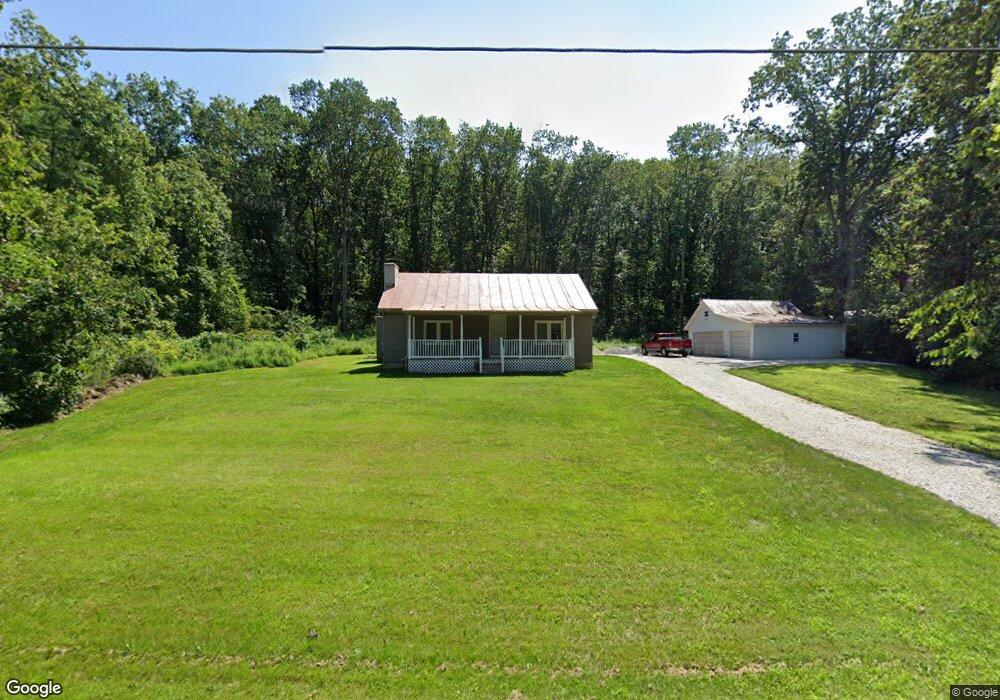
3160 Rosstown Rd Wellsville, PA 17365
Warrington Township NeighborhoodEstimated Value: $209,000 - $335,000
4
Beds
1
Bath
1,512
Sq Ft
$179/Sq Ft
Est. Value
About This Home
This home is located at 3160 Rosstown Rd, Wellsville, PA 17365 and is currently estimated at $270,908, approximately $179 per square foot. 3160 Rosstown Rd is a home located in York County with nearby schools including Northern Middle School and Northern High School.
Ownership History
Date
Name
Owned For
Owner Type
Purchase Details
Closed on
May 20, 2014
Sold by
Bobb Luann and Yost Michael
Bought by
Danner Gregory
Current Estimated Value
Home Financials for this Owner
Home Financials are based on the most recent Mortgage that was taken out on this home.
Original Mortgage
$87,875
Outstanding Balance
$66,971
Interest Rate
4.33%
Mortgage Type
New Conventional
Estimated Equity
$203,937
Purchase Details
Closed on
Dec 9, 1959
Bought by
Yost Mildred P
Create a Home Valuation Report for This Property
The Home Valuation Report is an in-depth analysis detailing your home's value as well as a comparison with similar homes in the area
Home Values in the Area
Average Home Value in this Area
Purchase History
| Date | Buyer | Sale Price | Title Company |
|---|---|---|---|
| Danner Gregory | $92,500 | None Available | |
| Yost Mildred P | $1,600 | -- |
Source: Public Records
Mortgage History
| Date | Status | Borrower | Loan Amount |
|---|---|---|---|
| Open | Danner Gregory | $87,875 |
Source: Public Records
Tax History Compared to Growth
Tax History
| Year | Tax Paid | Tax Assessment Tax Assessment Total Assessment is a certain percentage of the fair market value that is determined by local assessors to be the total taxable value of land and additions on the property. | Land | Improvement |
|---|---|---|---|---|
| 2025 | $2,733 | $100,330 | $44,000 | $56,330 |
| 2024 | $2,704 | $100,330 | $44,000 | $56,330 |
| 2023 | $2,649 | $100,330 | $44,000 | $56,330 |
| 2022 | $2,593 | $100,330 | $44,000 | $56,330 |
| 2021 | $2,424 | $100,330 | $44,000 | $56,330 |
| 2020 | $2,366 | $100,330 | $44,000 | $56,330 |
| 2019 | $2,307 | $100,330 | $44,000 | $56,330 |
| 2018 | $2,257 | $100,330 | $44,000 | $56,330 |
| 2017 | $2,257 | $100,330 | $44,000 | $56,330 |
| 2016 | $0 | $100,330 | $44,000 | $56,330 |
| 2015 | -- | $100,330 | $44,000 | $56,330 |
| 2014 | -- | $100,330 | $44,000 | $56,330 |
Source: Public Records
Map
Nearby Homes
- 0 W Camping Area Rd
- 480 Mount Airy Rd Unit 13
- 329 Mount Airy Rd
- 1967 Pinetown Rd
- Tract #1 Carlisle Rd
- 450 Stone Jug Rd
- 6520 Old Carlisle Rd
- 6200 Old Carlisle Rd
- 6031 Mountain Rd
- 270 S Winding Rd
- 375 Mount Zion Rd
- 5840 Old Carlisle Rd
- 5790 Carlisle Rd
- 5790 Mountain Rd
- 2530 Sky Top Trail
- 6691 Harmony Grove Rd
- 1735 Temple School Rd
- 0 Bull Rd Unit PAYK2080900
- 859 Pinetown Rd
- 138 S Peiffer Rd
- 0 Old York Rd Unit 1002781527
- 3185 Rosstown Rd
- 3165 Rosstown Rd
- 3220 Rosstown Rd
- 3240 Rosstown Rd
- 3225 Rosstown Rd
- 3200 Rosstown Rd
- 3205 Rosstown Rd
- 3260 Rosstown Rd
- 3265 Rosstown Rd
- 3271 Rosstown Rd
- 0 Rosstown Rd Unit Farm and Woodland
- 0 Rosstown Rd Unit PAYK128008
- 0 Rosstown Rd Unit 1009216820
- 3266 Rosstown Rd Unit 12
- 3266 Rosstown Rd
- 3266 Rosstown Rd Unit 7
- 3266 Rosstown Rd
- 3266 Rosstown Rd
- 3266 Rosstown Rd