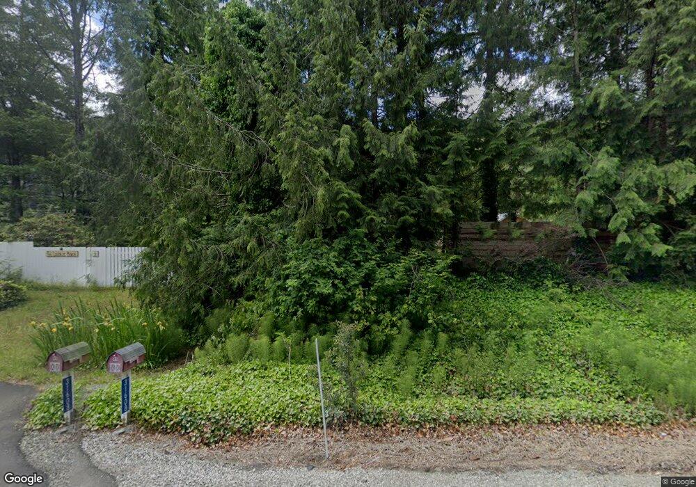
31608 State Route 530 NE Arlington, WA 98223
Estimated Value: $91,397
4
Beds
3
Baths
1,960
Sq Ft
$47/Sq Ft
Est. Value
About This Home
This home is located at 31608 State Route 530 NE, Arlington, WA 98223 and is currently estimated at $91,397, approximately $46 per square foot. 31608 State Route 530 NE is a home located in Snohomish County with nearby schools including Darrington Elementary School and Darrington High School.
Ownership History
Date
Name
Owned For
Owner Type
Purchase Details
Closed on
Jul 10, 2012
Sold by
Dro Ip Ltd
Bought by
Lugonjie Zoran
Current Estimated Value
Purchase Details
Closed on
Apr 2, 2012
Sold by
Federal National Mortgage Association
Bought by
Dro 1P Ltd
Purchase Details
Closed on
Feb 21, 2012
Sold by
Federal National Mortgage Association
Bought by
Dro Ip Ltd
Purchase Details
Closed on
Aug 13, 2010
Sold by
Kendall Trent C
Bought by
Federal National Mortgage Association
Purchase Details
Closed on
Oct 12, 2003
Sold by
Kendall Karen M
Bought by
Kendall Trent C
Purchase Details
Closed on
Jun 20, 2000
Sold by
Kendall Trent C and Marsh Trent Charles
Bought by
Kendall Trent C and Kendall Karen M
Home Financials for this Owner
Home Financials are based on the most recent Mortgage that was taken out on this home.
Original Mortgage
$103,200
Interest Rate
10.12%
Create a Home Valuation Report for This Property
The Home Valuation Report is an in-depth analysis detailing your home's value as well as a comparison with similar homes in the area
Home Values in the Area
Average Home Value in this Area
Purchase History
| Date | Buyer | Sale Price | Title Company |
|---|---|---|---|
| Lugonjie Zoran | $27,280 | Ticor Title | |
| Dro 1P Ltd | -- | Service Link | |
| Dro Ip Ltd | -- | Service Link | |
| Federal National Mortgage Association | $172,000 | First American | |
| Kendall Trent C | -- | -- | |
| Kendall Trent C | -- | -- |
Source: Public Records
Mortgage History
| Date | Status | Borrower | Loan Amount |
|---|---|---|---|
| Previous Owner | Kendall Trent C | $103,200 |
Source: Public Records
Tax History Compared to Growth
Tax History
| Year | Tax Paid | Tax Assessment Tax Assessment Total Assessment is a certain percentage of the fair market value that is determined by local assessors to be the total taxable value of land and additions on the property. | Land | Improvement |
|---|---|---|---|---|
| 2025 | $977 | $133,700 | $88,800 | $44,900 |
| 2024 | $977 | $113,100 | $77,500 | $35,600 |
| 2023 | $1,156 | $140,100 | $104,000 | $36,100 |
| 2022 | $1,042 | $108,600 | $71,900 | $36,700 |
| 2020 | $905 | $82,300 | $44,700 | $37,600 |
| 2019 | $833 | $75,900 | $37,800 | $38,100 |
| 2018 | $950 | $69,500 | $29,800 | $39,700 |
| 2017 | $851 | $62,900 | $23,200 | $39,700 |
| 2016 | $716 | $47,300 | $16,200 | $31,100 |
| 2015 | $714 | $43,500 | $22,000 | $21,500 |
| 2013 | $777 | $47,500 | $25,700 | $21,800 |
Source: Public Records
Map
Nearby Homes
- 33110 State Route 530 NE
- 34228 310th Place NE
- 305th 138th St NE
- 31511 367th Ave NE
- 36817 State Route 530 NE
- 38324 State Route 530 NE
- 31015 W Whitehorse Dr
- 39615 309th St NE
- 30600 412th Dr NE
- 27525 W Lake Riley Rd
- 35046 N Shore Dr
- 6 Stillaguamish
- 34989 N Shore Dr
- 935 Madison Ave
- 1225 Darrington St Unit 1
- 618 Tamara Ln
- 930 Commercial Ave
- 18 Xxx Jim Creek Rd
- 1035 Darrington St
- 1025 Darrington St
- 31608 Sr530 NE
- 31608B State Route 530 NE
- 31708 State Route 530 NE
- 31722 State Route 530 NE
- 31523 State Route 530 NE
- 31828 State Route 530 NE
- 32012 State Route 530 NE
- 31414 State Route 530 NE
- 31020 State Route 530 NE
- 31010 State Route 530 NE
- 31124 Boulder Creek Dr
- 32610 Washington 530
- 32610 State Route 530 NE
- 32621 State Route 530 NE
- 32606 State Route 530 NE
- 31120 Boulder Creek Dr
- 31211 Boulder Creek Dr
- 30516 State Route 530 NE
- 31830 State Route 530 NE
- 32726 State Route 530 NE
