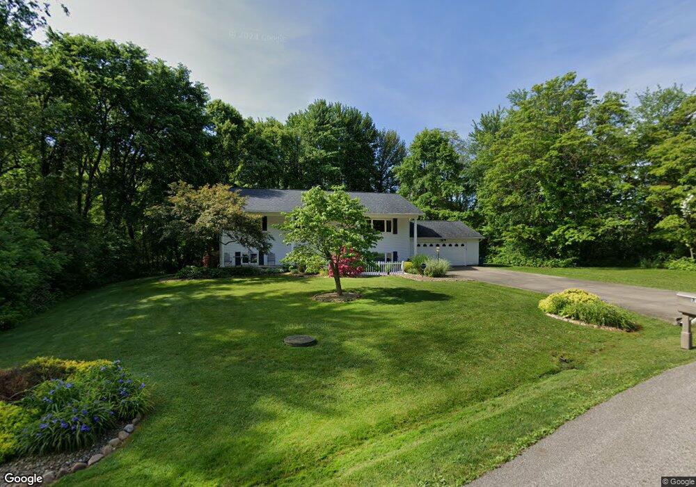
3162 Brogle Rd Norton, OH 44203
Estimated Value: $267,000 - $306,000
3
Beds
1
Bath
1,344
Sq Ft
$217/Sq Ft
Est. Value
About This Home
This home is located at 3162 Brogle Rd, Norton, OH 44203 and is currently estimated at $291,802, approximately $217 per square foot. 3162 Brogle Rd is a home located in Summit County with nearby schools including Norton Primary Elementary School, Norton Middle School, and Norton High School.
Ownership History
Date
Name
Owned For
Owner Type
Purchase Details
Closed on
Mar 5, 2024
Sold by
Molnar Carol and Smerekanich Carol
Bought by
Cross Christy Marie and Cross Brian David
Current Estimated Value
Home Financials for this Owner
Home Financials are based on the most recent Mortgage that was taken out on this home.
Original Mortgage
$143,850
Outstanding Balance
$141,484
Interest Rate
6.69%
Mortgage Type
New Conventional
Estimated Equity
$150,318
Create a Home Valuation Report for This Property
The Home Valuation Report is an in-depth analysis detailing your home's value as well as a comparison with similar homes in the area
Home Values in the Area
Average Home Value in this Area
Purchase History
| Date | Buyer | Sale Price | Title Company |
|---|---|---|---|
| Cross Christy Marie | $168,850 | None Listed On Document |
Source: Public Records
Mortgage History
| Date | Status | Borrower | Loan Amount |
|---|---|---|---|
| Open | Cross Christy Marie | $143,850 |
Source: Public Records
Tax History Compared to Growth
Tax History
| Year | Tax Paid | Tax Assessment Tax Assessment Total Assessment is a certain percentage of the fair market value that is determined by local assessors to be the total taxable value of land and additions on the property. | Land | Improvement |
|---|---|---|---|---|
| 2025 | $3,120 | $76,199 | $14,711 | $61,488 |
| 2024 | $3,120 | $76,199 | $14,711 | $61,488 |
| 2023 | $3,120 | $76,199 | $14,711 | $61,488 |
| 2022 | $3,114 | $62,458 | $12,058 | $50,400 |
| 2021 | $3,129 | $62,458 | $12,058 | $50,400 |
| 2020 | $2,922 | $62,460 | $12,060 | $50,400 |
| 2019 | $2,964 | $55,640 | $9,450 | $46,190 |
| 2018 | $2,914 | $55,640 | $9,450 | $46,190 |
| 2017 | $2,818 | $55,640 | $9,450 | $46,190 |
| 2016 | $2,818 | $49,300 | $9,450 | $39,850 |
| 2015 | $2,818 | $49,300 | $9,450 | $39,850 |
| 2014 | $2,792 | $49,300 | $9,450 | $39,850 |
| 2013 | $2,896 | $51,680 | $9,450 | $42,230 |
Source: Public Records
Map
Nearby Homes
- 3371 Brenner Rd
- 2711 S Cleveland Massillon Rd
- 3270 Glenbrook Dr
- 3303 Glenbrook Dr
- 2817 Kay Blvd
- 2394 Jacoby Rd
- 2395 Hull Dr
- 2881 Wilbanks Dr
- 2995 Wilbanks Dr
- 3007 Wilbanks Dr
- 3012 Shellhart Rd
- 3666 Minor Rd
- 3520 Shellhart Rd
- 3141 Fair Oaks Dr
- 2910 S/L 17 Willow Way
- 2783 Shellhart Rd
- 3837 S Cleveland Massillon Rd
- 3837 S Cleveland Massillon Rd
- 3837 S Cleveland Massillon Rd
- V/L 3837C S Cleveland Massillon Rd
- 2654 Waldern Rd
- 3165 Brogle Rd
- 2668 Waldern Rd
- 2678 Waldern Rd
- 2688 Waldern Rd
- 3126 Brogle Rd
- 2669 Waldern Rd
- 3125 Brogle Rd
- 2706 Moyer Ave
- 2700 Waldern Rd
- 2679 Waldern Rd
- 3112 Brogle Rd
- 2718 Moyer Ave
- 3113 Brogle Rd
- 2715 Waldern Rd
- 2722 Waldern Rd
- 2691 Waldern Rd
- 3098 Brogle Rd
- 3099 Brogle Rd
- 2717 Waldern Rd