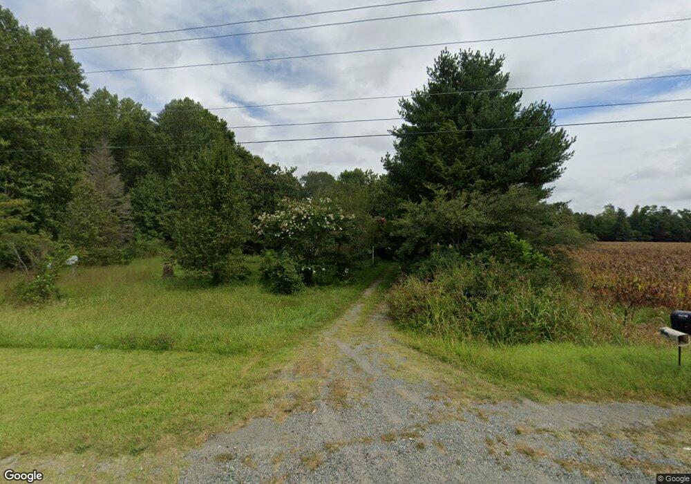
31629 King William Rd West Point, VA 23181
Estimated Value: $178,000 - $396,000
4
Beds
1
Bath
1,411
Sq Ft
$186/Sq Ft
Est. Value
About This Home
This home is located at 31629 King William Rd, West Point, VA 23181 and is currently estimated at $262,052, approximately $185 per square foot. 31629 King William Rd is a home located in King William County with nearby schools including Cool Spring Primary School, Acquinton Elementary School, and Hamilton Holmes Middle School.
Ownership History
Date
Name
Owned For
Owner Type
Purchase Details
Closed on
Nov 10, 2010
Sold by
The Bank Of New York Mellon
Bought by
Turner Barbara
Current Estimated Value
Purchase Details
Closed on
Nov 10, 2006
Sold by
Mozingo Charles L
Bought by
Gresham Jason E
Home Financials for this Owner
Home Financials are based on the most recent Mortgage that was taken out on this home.
Original Mortgage
$125,000
Interest Rate
6.31%
Mortgage Type
New Conventional
Create a Home Valuation Report for This Property
The Home Valuation Report is an in-depth analysis detailing your home's value as well as a comparison with similar homes in the area
Home Values in the Area
Average Home Value in this Area
Purchase History
| Date | Buyer | Sale Price | Title Company |
|---|---|---|---|
| Turner Barbara | $57,250 | -- | |
| Gresham Jason E | $125,000 | -- |
Source: Public Records
Mortgage History
| Date | Status | Borrower | Loan Amount |
|---|---|---|---|
| Previous Owner | Gresham Jason E | $125,000 |
Source: Public Records
Tax History Compared to Growth
Tax History
| Year | Tax Paid | Tax Assessment Tax Assessment Total Assessment is a certain percentage of the fair market value that is determined by local assessors to be the total taxable value of land and additions on the property. | Land | Improvement |
|---|---|---|---|---|
| 2025 | $610 | $99,200 | $48,200 | $51,000 |
| 2024 | $575 | $99,200 | $48,200 | $51,000 |
| 2023 | $575 | $99,200 | $48,200 | $51,000 |
| 2022 | $741 | $88,800 | $31,600 | $57,200 |
| 2021 | $191 | $88,800 | $31,600 | $57,200 |
| 2020 | $191 | $93,500 | $38,200 | $55,300 |
| 2019 | $191 | $86,800 | $31,600 | $55,200 |
| 2018 | $195 | $88,800 | $31,600 | $57,200 |
| 2017 | $187 | $86,100 | $31,600 | $54,500 |
| 2016 | $198 | $86,100 | $31,600 | $54,500 |
| 2015 | $809 | $86,100 | $31,600 | $54,500 |
| 2014 | $904 | $0 | $0 | $0 |
Source: Public Records
Map
Nearby Homes
- 0 Custis Millpond Rd Unit 24481309
- 00 Custis Millpond Rd
- 893 Pear Tree Ave
- 00 King William Ave
- 000 King William Ave
- 0 King William Ave Unit 2411669
- 0 King William Ave Unit 2401375
- 10 Mann Hill Farm Ct
- 1976 Custis Millpond Rd
- 1583 Winona Park Dr
- 1647 Winona Park Dr
- Lot 6 Tanager Ct
- 0 Tanager Ct
- 5.1+AC Plantation Place
- 4030 Dogwood Dr
- 1765 Clifton Ln
- 3559 Odi St
- 3557 Odi St
- 00 Clifton Ln
- 313 Pointers Dr
- 42 Custis Millpond Rd
- 31590 King William Rd
- 31773 King William Rd
- 31505 King William Rd
- 31471 King William Rd
- 31472 King William Rd
- 22 Custis Mill Pond Rd
- 22 Custis Millpond Rd
- 6 Custis Millpond Rd
- 0 Custis Millpond Rd
- 0 Custis Millpond Rd Unit 19810460
- 0 Custis Millpond Rd Unit VAKW2000216
- 0TBD Custis Millpond Rd
- 0 Custis Millpond Rd Unit 2402317
- 0 Custis Millpond Rd Unit OLD2620811
- 0 Custis Millpond Rd Unit OLD2741249
- 0 Custis Millpond Rd Unit OLD2632729
- 0 Custis Millpond Rd Unit OLD2632750
- 0 Custis Millpond Rd Unit 2315961
- 0 Custis Millpond Rd Unit OLD2328332
