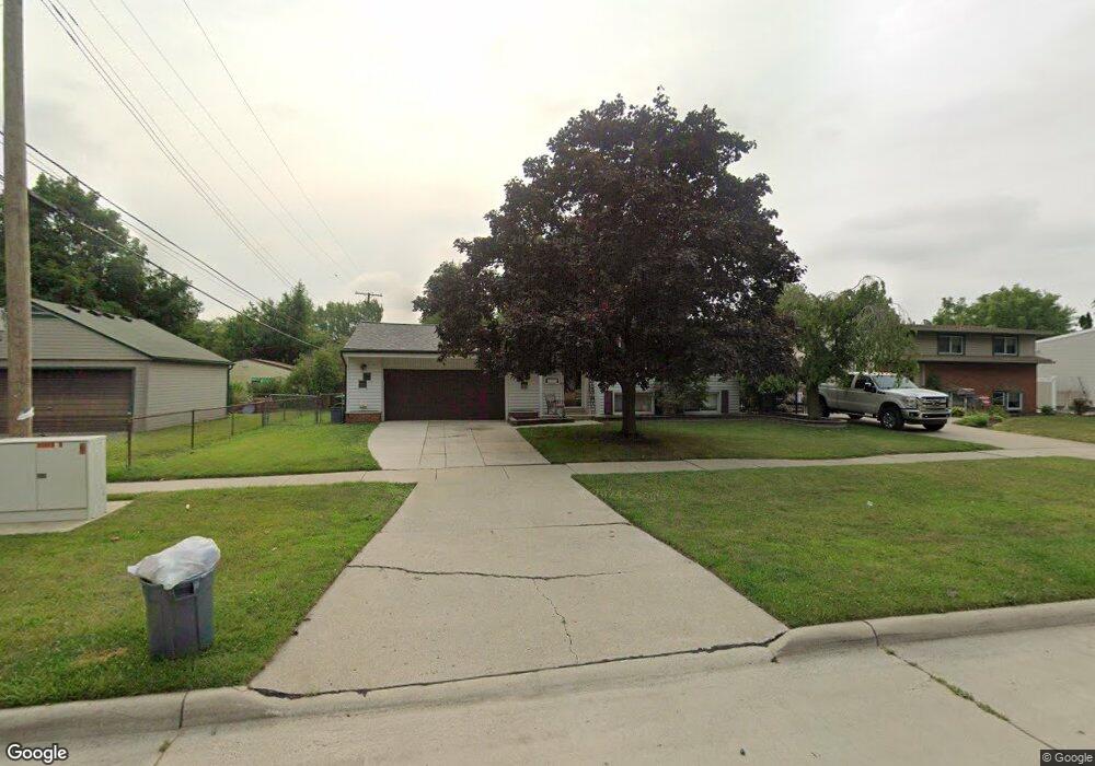
31633 Olmstead Rd Rockwood, MI 48173
Estimated Value: $213,000 - $219,748
3
Beds
2
Baths
1,680
Sq Ft
$129/Sq Ft
Est. Value
About This Home
This home is located at 31633 Olmstead Rd, Rockwood, MI 48173 and is currently estimated at $216,937, approximately $129 per square foot. 31633 Olmstead Rd is a home located in Wayne County with nearby schools including Oscar A. Carlson High School, Summit Academy - Flat Rock, and Calvary Christian Academy.
Ownership History
Date
Name
Owned For
Owner Type
Purchase Details
Closed on
Jan 26, 2012
Sold by
Stevens Kelly
Bought by
Legendre Ronald J
Current Estimated Value
Home Financials for this Owner
Home Financials are based on the most recent Mortgage that was taken out on this home.
Original Mortgage
$88,944
Outstanding Balance
$62,688
Interest Rate
4.5%
Mortgage Type
FHA
Estimated Equity
$154,249
Purchase Details
Closed on
Nov 25, 2007
Sold by
Hill Charles P and Hill Lori L
Bought by
Deutsche Bank National Trust Co and Equifirst Mortgage Loan Trust 2003-1 Ass
Purchase Details
Closed on
Oct 20, 1999
Sold by
Krupp Paul D
Bought by
Hill Charles P
Create a Home Valuation Report for This Property
The Home Valuation Report is an in-depth analysis detailing your home's value as well as a comparison with similar homes in the area
Home Values in the Area
Average Home Value in this Area
Purchase History
| Date | Buyer | Sale Price | Title Company |
|---|---|---|---|
| Legendre Ronald J | -- | Complete Title Services Of S | |
| Deutsche Bank National Trust Co | $142,500 | E Title Agency | |
| Hill Charles P | $124,000 | -- |
Source: Public Records
Mortgage History
| Date | Status | Borrower | Loan Amount |
|---|---|---|---|
| Open | Legendre Ronald J | $88,944 |
Source: Public Records
Tax History Compared to Growth
Tax History
| Year | Tax Paid | Tax Assessment Tax Assessment Total Assessment is a certain percentage of the fair market value that is determined by local assessors to be the total taxable value of land and additions on the property. | Land | Improvement |
|---|---|---|---|---|
| 2025 | $2,185 | $98,900 | $0 | $0 |
| 2024 | $2,185 | $86,400 | $0 | $0 |
| 2023 | $2,001 | $78,000 | $0 | $0 |
| 2022 | $2,696 | $72,100 | $0 | $0 |
| 2021 | $2,639 | $68,800 | $0 | $0 |
| 2020 | $2,613 | $66,600 | $0 | $0 |
| 2019 | $2,566 | $58,900 | $0 | $0 |
| 2018 | $1,777 | $53,600 | $0 | $0 |
| 2017 | $1,869 | $52,700 | $0 | $0 |
| 2016 | $2,623 | $53,600 | $0 | $0 |
| 2015 | $4,387 | $54,100 | $0 | $0 |
| 2013 | $4,250 | $42,500 | $0 | $0 |
| 2012 | $1,719 | $41,100 | $10,500 | $30,600 |
Source: Public Records
Map
Nearby Homes
- 31666 E Ditner Dr
- 31694 Olmstead Rd
- 23135 Candace Dr
- 31651 Hazel St
- 23452 Astrid Ln
- 31792 Lafler Dr
- 31658 Williams Ct
- 30026 Huron Meadows Dr
- 001 Woodruff Rd
- 32338 Church St
- 22421 Huron River Dr
- 0 Gildersleeve St
- 30563 Bradbury Dr
- 0 Woodruff Unit 20251041652
- 0 Huron River Dr Unit 20251015696
- 30218 Torry Ave
- 21301 Woodruff Rd
- 23772 Koszuta
- 33172 Swallow Dr
- 5954 Purple Martin Dr
- 31633 Olmstead Rd
- 31645 Olmstead Rd
- 22659 Candace Dr
- 31657 Olmstead Rd
- 22645 Candace Dr
- 31630 E Ditner Dr
- 22629 Candace Dr
- 31642 E Ditner Dr
- 31671 Olmstead Rd
- 31654 E Ditner Dr
- 31630 Olmstead Rd
- 31616 Olmstead Rd
- 31644 Olmstead Rd
- 22615 Candace Dr
- 31658 Olmstead Rd
- 31683 Olmstead Rd
- 19942 Twin Olmstead Rd
- 31672 Olmstead Rd
- 23123 Candace Dr
- 31678 E Ditner Dr