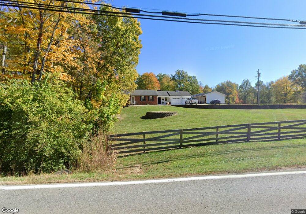
3164 State Route 132 Amelia, OH 45102
Estimated Value: $316,000 - $462,000
3
Beds
2
Baths
1,732
Sq Ft
$227/Sq Ft
Est. Value
About This Home
This home is located at 3164 State Route 132, Amelia, OH 45102 and is currently estimated at $393,535, approximately $227 per square foot. 3164 State Route 132 is a home located in Clermont County with nearby schools including Holly Hill Elementary School, West Clermont Middle School, and West Clermont High School.
Ownership History
Date
Name
Owned For
Owner Type
Purchase Details
Closed on
Nov 7, 2016
Sold by
U S Bank National Association
Bought by
Anderson Jeff
Current Estimated Value
Purchase Details
Closed on
Sep 9, 2015
Sold by
Rodenberg Aj and Mcfarland Richard L
Bought by
Us Bank National Association and Home Equitt Loan Trust Series 2006 He6
Purchase Details
Closed on
Nov 18, 2008
Sold by
Mcfarland Richard L and Mcfarland Rebecca R
Bought by
Mcfarland Richard L and Mcfarland Rebecca R
Purchase Details
Closed on
Feb 4, 2000
Sold by
Gibson Jerry W
Bought by
Mcfarland Richard and Mcfarland Rebecca
Purchase Details
Closed on
Nov 19, 1996
Sold by
Lindsey Raymond E
Bought by
Mcfarland Richard L and Mcfarland Rebecca
Home Financials for this Owner
Home Financials are based on the most recent Mortgage that was taken out on this home.
Original Mortgage
$103,300
Interest Rate
8.18%
Mortgage Type
New Conventional
Create a Home Valuation Report for This Property
The Home Valuation Report is an in-depth analysis detailing your home's value as well as a comparison with similar homes in the area
Home Values in the Area
Average Home Value in this Area
Purchase History
| Date | Buyer | Sale Price | Title Company |
|---|---|---|---|
| Anderson Jeff | $125 | None Available | |
| Us Bank National Association | $135,000 | Attorney | |
| Mcfarland Richard L | -- | Attorney | |
| Mcfarland Richard | $4,500 | -- | |
| Mcfarland Richard L | $144,000 | -- |
Source: Public Records
Mortgage History
| Date | Status | Borrower | Loan Amount |
|---|---|---|---|
| Previous Owner | Mcfarland Richard L | $103,300 | |
| Closed | Us Bank National Association | $0 |
Source: Public Records
Tax History Compared to Growth
Tax History
| Year | Tax Paid | Tax Assessment Tax Assessment Total Assessment is a certain percentage of the fair market value that is determined by local assessors to be the total taxable value of land and additions on the property. | Land | Improvement |
|---|---|---|---|---|
| 2024 | $5,116 | $111,510 | $17,220 | $94,290 |
| 2023 | $5,124 | $111,510 | $17,220 | $94,290 |
| 2022 | $4,698 | $92,190 | $14,070 | $78,120 |
| 2021 | $4,720 | $92,190 | $14,070 | $78,120 |
| 2020 | $4,725 | $92,190 | $14,070 | $78,120 |
| 2019 | $3,401 | $74,870 | $13,410 | $61,460 |
| 2018 | $3,439 | $74,870 | $13,410 | $61,460 |
| 2017 | $3,427 | $74,870 | $13,410 | $61,460 |
| 2016 | $3,427 | $66,850 | $11,970 | $54,880 |
| 2015 | $3,319 | $66,850 | $11,970 | $54,880 |
| 2014 | $3,254 | $66,850 | $11,970 | $54,880 |
| 2013 | $2,668 | $54,290 | $11,970 | $42,320 |
Source: Public Records
Map
Nearby Homes
- 1770 Sunny Acres Ln
- 1742 Petri Dr
- 1742 Tib Day Ln
- 55 Spicewood Dr
- 46 Spicewood Dr
- 2780 Lindale-Mt Holly Rd Unit 73
- 2780 Lindale-Mt Holly Rd Unit 81
- 2780 Lindale-Mt Holly Rd Unit 102
- 2780 Lindale-Mt Holly Rd Unit 105
- 2780 Lindale-Mt Holly Rd Unit 71
- 2780 Lindale-Mt Holly Rd Unit 97
- 19 Bobwhite Ct
- 0 St Rt 125 Unit 1849632
- 3218 Lindale-Mt Holly Rd
- 3163 Lindale-Mt Holly Rd
- 3330 Huntsman Trace Unit 803C
- 4 Hunters Ct
- 10 Hunters Ct
- 8 Mynah Dr
- 28 Hunters Ct Unit 809F
- 3164 State Route 132 Unit 10
- 3164 State Route 132 Unit 9
- 3164 State Route 132 Unit 48
- 3164 State Route 132
- 3173 State Route 132
- 1707 Petri Dr
- 1701 Petri Dr
- 1701 Petri Dr
- 1711 Petri Dr
- 1715 Petri Dr
- 1702 Sara Mae Ln
- 1700 Petri Dr
- 3188 State Route 132
- 1708 Petri Dr
- 3157 State Route 132
- 1719 Petri Dr
- 1712 Petri Dr
- 3144 State Route 132
- 1748 Sunny Acres Ln
- 1723 Petri Dr