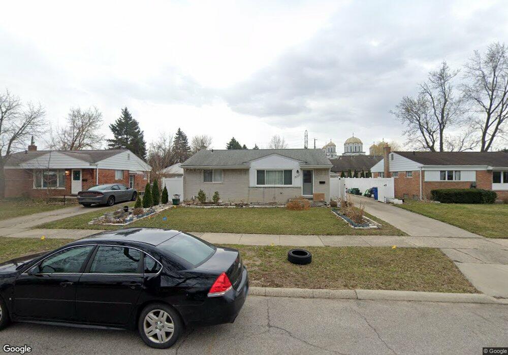
31651 Norrid Cir Unit Bldg-Unit Warren, MI 48092
Northwest Warren NeighborhoodEstimated Value: $218,000 - $247,731
3
Beds
2
Baths
1,073
Sq Ft
$213/Sq Ft
Est. Value
About This Home
This home is located at 31651 Norrid Cir Unit Bldg-Unit, Warren, MI 48092 and is currently estimated at $228,933, approximately $213 per square foot. 31651 Norrid Cir Unit Bldg-Unit is a home located in Macomb County with nearby schools including Green Acres Elementary School, Beer Middle School, and Warren Mott High School.
Ownership History
Date
Name
Owned For
Owner Type
Purchase Details
Closed on
Oct 15, 2024
Sold by
Kani Jan Dark
Bought by
Dark Kani Jan and Dark Sarmad Mansour
Current Estimated Value
Purchase Details
Closed on
Oct 27, 2017
Sold by
Ibrahim Wisam
Bought by
Kani Jan Dark
Home Financials for this Owner
Home Financials are based on the most recent Mortgage that was taken out on this home.
Original Mortgage
$120,280
Interest Rate
3.83%
Mortgage Type
New Conventional
Purchase Details
Closed on
Nov 9, 2007
Sold by
Witmer Kathleen M and Witmer Donald D
Bought by
Deutsche Bank National Trust
Create a Home Valuation Report for This Property
The Home Valuation Report is an in-depth analysis detailing your home's value as well as a comparison with similar homes in the area
Home Values in the Area
Average Home Value in this Area
Purchase History
| Date | Buyer | Sale Price | Title Company |
|---|---|---|---|
| Dark Kani Jan | -- | None Listed On Document | |
| Kani Jan Dark | $124,000 | None Available | |
| Deutsche Bank National Trust | $116,550 | None Available |
Source: Public Records
Mortgage History
| Date | Status | Borrower | Loan Amount |
|---|---|---|---|
| Previous Owner | Kani Jan Dark | $120,280 |
Source: Public Records
Tax History Compared to Growth
Tax History
| Year | Tax Paid | Tax Assessment Tax Assessment Total Assessment is a certain percentage of the fair market value that is determined by local assessors to be the total taxable value of land and additions on the property. | Land | Improvement |
|---|---|---|---|---|
| 2025 | $3,618 | $107,250 | $0 | $0 |
| 2024 | $3,516 | $98,810 | $0 | $0 |
| 2023 | $3,332 | $93,160 | $0 | $0 |
| 2022 | $3,220 | $80,830 | $0 | $0 |
| 2021 | $3,276 | $76,560 | $0 | $0 |
| 2020 | $3,159 | $71,060 | $0 | $0 |
| 2019 | $3,046 | $63,700 | $0 | $0 |
| 2018 | $89 | $55,890 | $0 | $0 |
| 2017 | $3,116 | $52,360 | $11,430 | $40,930 |
| 2016 | $2,112 | $52,360 | $0 | $0 |
| 2015 | -- | $43,470 | $0 | $0 |
| 2013 | $2,085 | $38,220 | $0 | $0 |
Source: Public Records
Map
Nearby Homes
- 4125 Derray Ct Unit 7
- 4519 Reader Dr
- 3651 Chicago Rd
- 3834 Heavenly Ln
- 32120 Heavenly Ct Unit 14
- 4829 Buchanan Ave
- 32302 Ryan Rd
- 32291 Ryan Rd
- 30841 Ohmer Dr
- 4703 Kensington Dr
- 5134 Canterbury Ln
- 31495 Lyons Cir E
- 3868 Elvera Ln Unit 11
- 5239 E 13 Mile Rd
- 4580 Hampton Ct N
- 3410 Girard Dr
- 32252 Warner Ct
- 32930 Chalfonte Dr
- 32725 Grinsell Dr
- 5575 E 14 Mile Rd
- 31651 Norrid Cir
- 31661 Norrid Cir
- 31639 Norrid Cir
- 31627 Norrid Cir
- 31669 Norrid Cir
- 31541 Reid Dr
- 4295 Derray Ct Unit 18
- 4283 Derray Ct
- 4271 Derray Ct
- 4259 Derray Ct Unit 15
- 4247 Derray Ct
- 4235 Derray Ct
- 4235 Derray Ct Unit 12
- 31529 Reid Dr
- 31615 Norrid Cir
- 31646 Norrid Cir
- 31670 Norrid Cir
- 31677 Norrid Cir
- 31634 Norrid Cir
- 31517 Reid Dr