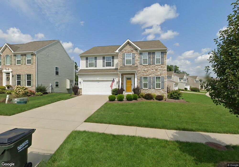
3167 Liberty Ledges Dr Twinsburg, OH 44087
Estimated Value: $485,000 - $516,000
4
Beds
3
Baths
2,960
Sq Ft
$167/Sq Ft
Est. Value
About This Home
This home is located at 3167 Liberty Ledges Dr, Twinsburg, OH 44087 and is currently estimated at $495,275, approximately $167 per square foot. 3167 Liberty Ledges Dr is a home with nearby schools including Wilcox Primary School, Samuel Bissell Elementary School, and Dodge Intermediate School.
Ownership History
Date
Name
Owned For
Owner Type
Purchase Details
Closed on
Feb 5, 2013
Sold by
Nvr Inc
Bought by
Banate Fil M De and Banate Sandra Lena A De
Current Estimated Value
Home Financials for this Owner
Home Financials are based on the most recent Mortgage that was taken out on this home.
Original Mortgage
$246,300
Outstanding Balance
$172,734
Interest Rate
3.48%
Mortgage Type
New Conventional
Estimated Equity
$322,541
Purchase Details
Closed on
Dec 13, 2012
Sold by
Liberty Ledges Llc
Bought by
Nvr Inc and Ryan Homes
Home Financials for this Owner
Home Financials are based on the most recent Mortgage that was taken out on this home.
Original Mortgage
$246,300
Outstanding Balance
$172,734
Interest Rate
3.48%
Mortgage Type
New Conventional
Estimated Equity
$322,541
Create a Home Valuation Report for This Property
The Home Valuation Report is an in-depth analysis detailing your home's value as well as a comparison with similar homes in the area
Home Values in the Area
Average Home Value in this Area
Purchase History
| Date | Buyer | Sale Price | Title Company |
|---|---|---|---|
| Banate Fil M De | $289,880 | None Available | |
| Nvr Inc | $58,000 | Nvr Title Agency Llc |
Source: Public Records
Mortgage History
| Date | Status | Borrower | Loan Amount |
|---|---|---|---|
| Open | Banate Fil M De | $246,300 |
Source: Public Records
Tax History Compared to Growth
Tax History
| Year | Tax Paid | Tax Assessment Tax Assessment Total Assessment is a certain percentage of the fair market value that is determined by local assessors to be the total taxable value of land and additions on the property. | Land | Improvement |
|---|---|---|---|---|
| 2025 | $7,152 | $141,719 | $22,887 | $118,832 |
| 2024 | $7,152 | $141,719 | $22,887 | $118,832 |
| 2023 | $7,152 | $141,719 | $22,887 | $118,832 |
| 2022 | $6,477 | $115,403 | $18,610 | $96,793 |
| 2021 | $6,507 | $115,403 | $18,610 | $96,793 |
| 2020 | $6,586 | $115,400 | $18,610 | $96,790 |
| 2019 | $5,954 | $97,070 | $18,610 | $78,460 |
| 2018 | $5,845 | $97,070 | $18,610 | $78,460 |
| 2017 | $5,438 | $97,070 | $18,610 | $78,460 |
| 2016 | $5,407 | $96,040 | $18,610 | $77,430 |
| 2015 | $5,438 | $96,040 | $18,610 | $77,430 |
| 2014 | $5,424 | $96,040 | $18,610 | $77,430 |
| 2013 | $100 | $670 | $670 | $0 |
Source: Public Records
Map
Nearby Homes
- 3331 Shale Dr
- 10358 Townley Ct
- 3320 Blossom Trail
- 3336 Blossom Trail
- 10497 Kerwick Ct
- 2923 Alling Dr
- 10265 Beaver Trail
- 10169 Timothy Ln
- 3314 Fenmore Ln
- 3123 Killingworth Ln
- 10247 Smugglers Cove
- 10269 Smugglers Cove
- 3624 Nautilus Trail
- 9740 Burton Dr
- 3401 Mallard Ct
- 3660 Ivy Ct
- 10424 Oviatt Ln
- 10502 White Ash Trail
- 7485 Stockwood Dr
- 10400 Maryland St
- 3159 Liberty Ledges Dr
- 10264 Flagstone Dr
- 3151 Liberty Ledges Dr
- 3100 Aspen Ln
- 3127 Aspen Ln
- 3113 Aspen Ln
- 3151 Aspen Ln
- 3129 Aspen Ln
- 3115 Aspen Ln
- 3104 Aspen Ln
- 3107 Aspen Ln
- 3117 Aspen Ln
- 3131 Aspen Ln
- 3111 Aspen Ln
- 3143 Aspen Ln
- 3121 Fenmore Ln
- 3110 Aspen Ln
- 3119 Aspen Ln
- 3102 Aspen Ln
- 3123 Aspen Ln