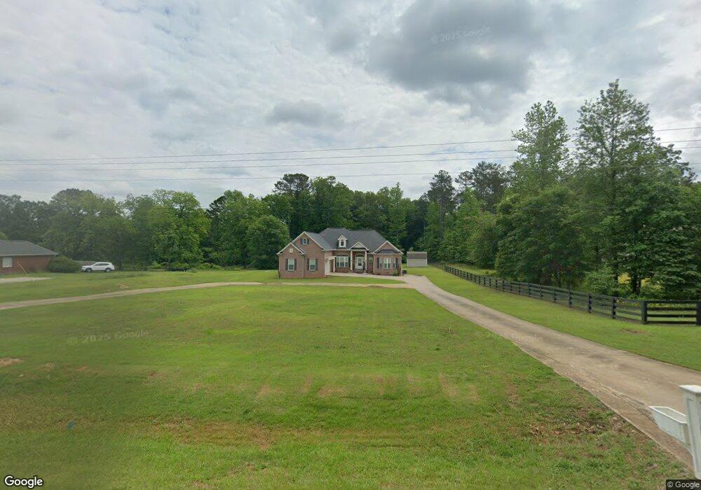
317 Bob Smith Rd Sharpsburg, GA 30277
Estimated Value: $439,431 - $576,000
3
Beds
3
Baths
2,574
Sq Ft
$197/Sq Ft
Est. Value
About This Home
This home is located at 317 Bob Smith Rd, Sharpsburg, GA 30277 and is currently estimated at $506,608, approximately $196 per square foot. 317 Bob Smith Rd is a home with nearby schools including Willis Road Elementary School, Lee Middle School, and East Coweta High School.
Ownership History
Date
Name
Owned For
Owner Type
Purchase Details
Closed on
Aug 23, 2023
Sold by
Simmons Harold L
Bought by
Simmons Harold Lee Tr
Current Estimated Value
Purchase Details
Closed on
Apr 28, 2022
Sold by
Hayes Vergia
Bought by
Simmons Harold L and Simmons Kelly L
Home Financials for this Owner
Home Financials are based on the most recent Mortgage that was taken out on this home.
Original Mortgage
$253,048
Interest Rate
4.42%
Mortgage Type
VA
Purchase Details
Closed on
Jun 27, 1977
Bought by
Hayes Virgie and Hayes Bobby
Create a Home Valuation Report for This Property
The Home Valuation Report is an in-depth analysis detailing your home's value as well as a comparison with similar homes in the area
Home Values in the Area
Average Home Value in this Area
Purchase History
| Date | Buyer | Sale Price | Title Company |
|---|---|---|---|
| Simmons Harold Lee Tr | -- | -- | |
| Simmons Harold L | $253,048 | -- | |
| Hayes Virgie | $3,800 | -- |
Source: Public Records
Mortgage History
| Date | Status | Borrower | Loan Amount |
|---|---|---|---|
| Previous Owner | Simmons Harold L | $253,048 |
Source: Public Records
Tax History Compared to Growth
Tax History
| Year | Tax Paid | Tax Assessment Tax Assessment Total Assessment is a certain percentage of the fair market value that is determined by local assessors to be the total taxable value of land and additions on the property. | Land | Improvement |
|---|---|---|---|---|
| 2025 | $4,557 | $192,899 | $19,166 | $173,733 |
| 2024 | $4,331 | $186,566 | $17,912 | $168,654 |
| 2023 | $4,331 | $192,761 | $16,585 | $176,176 |
| 2022 | $1,906 | $135,992 | $16,585 | $119,407 |
| 2021 | $1,500 | $115,680 | $15,796 | $99,884 |
| 2020 | $1,505 | $115,680 | $15,796 | $99,884 |
| 2019 | $1,225 | $83,491 | $14,650 | $68,840 |
| 2018 | $1,601 | $83,491 | $14,650 | $68,840 |
| 2017 | $1,601 | $83,491 | $14,650 | $68,841 |
| 2016 | $1,564 | $87,668 | $14,650 | $73,017 |
| 2015 | $1,654 | $87,668 | $14,650 | $73,017 |
| 2014 | $414 | $14,650 | $14,650 | $0 |
Source: Public Records
Map
Nearby Homes
- 8 Chiefs Trail
- 250 Bob Smith Rd
- 196 Bob Smith Rd
- 25 Lentry Dr
- 180 Saint James Place
- 25 Chemin Place
- 0 Bob Smith Rd Unit 10562838
- 50 Kay Ct
- 21 Lake Park Ct
- 140 Halo Trace
- 40 Long Branch Trail
- 28 Fawn Ct
- 7483 Highway 54
- 296 Mcintosh Trail
- 1 Mcintosh Trail
- Briarwood Plan at Twelve Parks 55+
- Sullivan Plan at Twelve Parks 55+
- 4 Unicoi Trail
- 12 Unicoi Trail
- Crestwood Plan at Twelve Parks 55+
- 321 Bob Smith Rd
- 287 Bob Smith Rd
- 265 Bob Smith Rd
- 343 Bob Smith Rd
- 115 Melrose Dr
- 365 Bob Smith Rd
- 125 Melrose Dr
- 320 Bob Smith Rd
- 245 Bob Smith Rd
- 130 Melrose Dr
- 366 Bob Smith Rd
- 51 Pinegate Rd
- 391 Bob Smith Rd
- 120 Melrose Dr
- 7142 Highway 54
- 7144 Highway 54
- 7142 Georgia 54
- 7144 Georgia 54
- 386 Bob Smith Rd
- 105 Melrose Dr