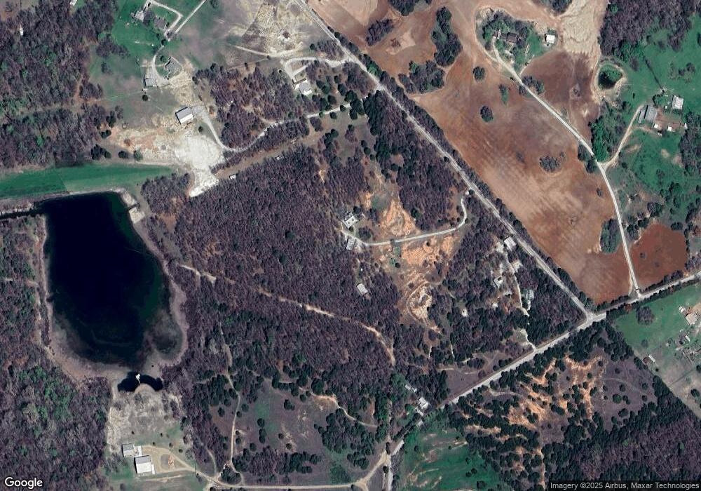
317 County Road 2430 Decatur, TX 76234
Estimated Value: $917,000 - $990,000
3
Beds
3
Baths
2,766
Sq Ft
$341/Sq Ft
Est. Value
About This Home
This home is located at 317 County Road 2430, Decatur, TX 76234 and is currently estimated at $943,487, approximately $341 per square foot. 317 County Road 2430 is a home located in Wise County with nearby schools including Slidell Schools.
Ownership History
Date
Name
Owned For
Owner Type
Purchase Details
Closed on
Oct 14, 2016
Sold by
Bowers Mike and Bowers Susie
Bought by
Morrow Richard Michael and Morrow Sheree L
Current Estimated Value
Home Financials for this Owner
Home Financials are based on the most recent Mortgage that was taken out on this home.
Original Mortgage
$455,078
Outstanding Balance
$364,830
Interest Rate
3.46%
Mortgage Type
VA
Estimated Equity
$578,657
Purchase Details
Closed on
May 25, 2007
Bought by
Morrow Richard M and Morrow Sheree L
Purchase Details
Closed on
Feb 13, 2003
Sold by
Polhemus John Waggoner
Bought by
Morrow Richard M and Morrow Sheree L
Create a Home Valuation Report for This Property
The Home Valuation Report is an in-depth analysis detailing your home's value as well as a comparison with similar homes in the area
Home Values in the Area
Average Home Value in this Area
Purchase History
| Date | Buyer | Sale Price | Title Company |
|---|---|---|---|
| Morrow Richard Michael | -- | Fidelity National Title | |
| Morrow Richard M | -- | -- | |
| Morrow Richard M | -- | -- |
Source: Public Records
Mortgage History
| Date | Status | Borrower | Loan Amount |
|---|---|---|---|
| Open | Morrow Richard Michael | $455,078 |
Source: Public Records
Tax History Compared to Growth
Tax History
| Year | Tax Paid | Tax Assessment Tax Assessment Total Assessment is a certain percentage of the fair market value that is determined by local assessors to be the total taxable value of land and additions on the property. | Land | Improvement |
|---|---|---|---|---|
| 2025 | $1,134 | $544,354 | $30,277 | $514,077 |
| 2024 | $1,134 | $540,715 | $0 | $0 |
| 2023 | $6,528 | $775,529 | $0 | $0 |
| 2022 | $6,420 | $677,527 | $0 | $0 |
| 2021 | $5,949 | $643,940 | $246,120 | $397,820 |
| 2020 | $5,446 | $518,810 | $165,610 | $353,200 |
| 2019 | $5,439 | $507,740 | $171,760 | $335,980 |
| 2018 | $5,465 | $490,580 | $159,440 | $331,140 |
| 2017 | $4,607 | $421,700 | $142,560 | $279,140 |
| 2016 | $3,801 | $375,910 | $127,240 | $248,670 |
| 2015 | -- | $348,050 | $116,490 | $231,560 |
| 2014 | -- | $224,500 | $8,850 | $215,650 |
Source: Public Records
Map
Nearby Homes
- 145 County Road 2327
- TBD Pr 2454
- 459 Private Road 2625
- 2454 Private Rd
- 2080 County Road 2445
- 2727 Greenwood Rd
- 124 Blackstar Ln
- 116 Blackstar Ln
- 132 Blackstar Ln
- 159 Blackstar Ln
- TBD3 N Fm 730
- 0 Highway 287 Unit 21102120
- 0 Highway 287 Unit 21094377
- 392 Pr Road 2625
- TBD County Road 2740
- 200 Pr 2462
- 2591 Fm 1204
- 1430 County Road 2735
- 853 County Road 2215
- 117 County Road 2646
- 323 County Road 2430
- 321 County Road 2430
- 224 Private Road 2431
- 224 Private Road 2431
- 428 County Road 2425
- 325 County Road 2430
- 400 County Road 2425
- 335 County Road 2430
- 332 County Road 2430
- 806 County Road 2425
- 514 County Road 2425
- 999 County Road 2425
- 312 County Road 2425
- 475 County Road 2430
- 365 County Road 2425
- 400 County Road 2430
- 575 County Road 2430
- 669 County Road 2425
- 581 County Road 2430
- 489 County Road 2430
