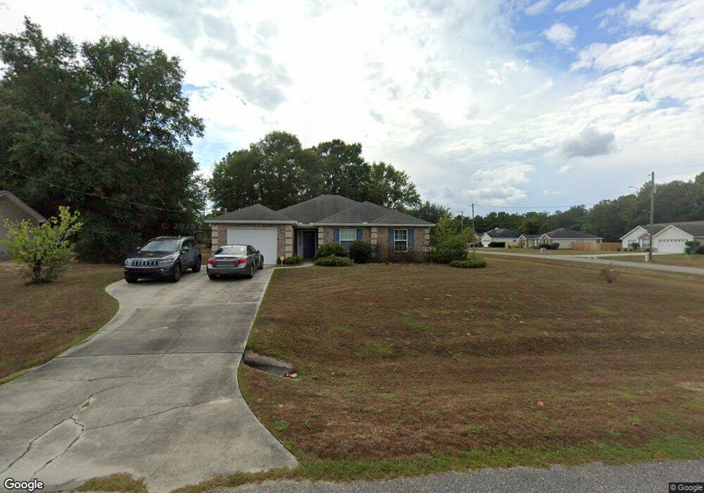
317 James Hinson Dr Midway, FL 32343
Estimated Value: $234,000 - $271,000
3
Beds
2
Baths
1,281
Sq Ft
$193/Sq Ft
Est. Value
About This Home
This home is located at 317 James Hinson Dr, Midway, FL 32343 and is currently estimated at $247,375, approximately $193 per square foot. 317 James Hinson Dr is a home located in Gadsden County.
Ownership History
Date
Name
Owned For
Owner Type
Purchase Details
Closed on
Mar 23, 2010
Sold by
Jsr Construction & Development Inc
Bought by
Hinton William T
Current Estimated Value
Home Financials for this Owner
Home Financials are based on the most recent Mortgage that was taken out on this home.
Original Mortgage
$114,774
Outstanding Balance
$77,089
Interest Rate
5.25%
Mortgage Type
FHA
Estimated Equity
$170,286
Purchase Details
Closed on
Jan 20, 2010
Sold by
Premier Bank
Bought by
Jsr Construction & Development Inc
Purchase Details
Closed on
Oct 21, 2009
Sold by
Russell Construction Inc
Bought by
Premier Bank
Create a Home Valuation Report for This Property
The Home Valuation Report is an in-depth analysis detailing your home's value as well as a comparison with similar homes in the area
Home Values in the Area
Average Home Value in this Area
Purchase History
| Date | Buyer | Sale Price | Title Company |
|---|---|---|---|
| Hinton William T | $144,900 | Owen Title Company Inc | |
| Jsr Construction & Development Inc | $22,000 | Attorney | |
| Premier Bank | -- | None Available |
Source: Public Records
Mortgage History
| Date | Status | Borrower | Loan Amount |
|---|---|---|---|
| Open | Hinton William T | $114,774 |
Source: Public Records
Tax History Compared to Growth
Tax History
| Year | Tax Paid | Tax Assessment Tax Assessment Total Assessment is a certain percentage of the fair market value that is determined by local assessors to be the total taxable value of land and additions on the property. | Land | Improvement |
|---|---|---|---|---|
| 2024 | $1,302 | $111,738 | -- | -- |
| 2023 | $1,258 | $108,484 | $0 | $0 |
| 2022 | $1,201 | $105,325 | $0 | $0 |
| 2021 | $1,170 | $102,258 | $0 | $0 |
| 2020 | $1,142 | $100,847 | $0 | $0 |
| 2019 | $1,121 | $98,580 | $0 | $0 |
| 2018 | $1,116 | $96,742 | $0 | $0 |
| 2017 | $1,080 | $94,752 | $0 | $0 |
| 2016 | $1,056 | $92,803 | $0 | $0 |
| 2015 | $1,046 | $92,158 | $0 | $0 |
| 2014 | $1,017 | $91,427 | $0 | $0 |
Source: Public Records
Map
Nearby Homes
- 34 Frank Run
- 7 Mae Cato Dr
- 164 Deloris Madison Dr
- 65 Deloris Madison Dr
- 920 Rustling Pines Blvd
- 137 Monroe Creek Dr
- 8873 High Bridge Rd
- 8877 High Bridge Rd
- 17 Pine Bark Ln
- 25 Pine Bark Ln
- 274 Forest Cir S
- 6 Slash Ln
- 69 Buckskin Cir
- 81 Knight Rd
- 0 Central Rd
- 668 M l King Blvd
- XX S Lanier Rd
- XX Yvonne Ct
- 10 Yvonne Ct
- 882 Beaver Creek Ln
- 317 James Hinson Dr Unit 1
- 309 James Hinson Dr
- 158 Roosevelt Dr
- 16 Eugene Lamb Rd Unit 1
- 16 Eugene Lamb Rd
- 293 James Hinson Dr
- 306 James Hinson Dr Unit 1
- 306 James Hinson Dr
- 136 Roosevelt Dr
- 324 James Hinson Dr
- 32 Eugene Lamb Rd
- 340 James Hinson Dr
- 114 Roosevelt Dr
- 290 James Hinson Dr Unit 1
- 290 James Hinson Dr
- 50 Eugene Lamb Rd Unit 1
- 50 Eugene Lamb Rd
- 275 James Hinson Dr
- 374 James Hinson Dr
- 64 Eugene Lamb Rd Unit 1