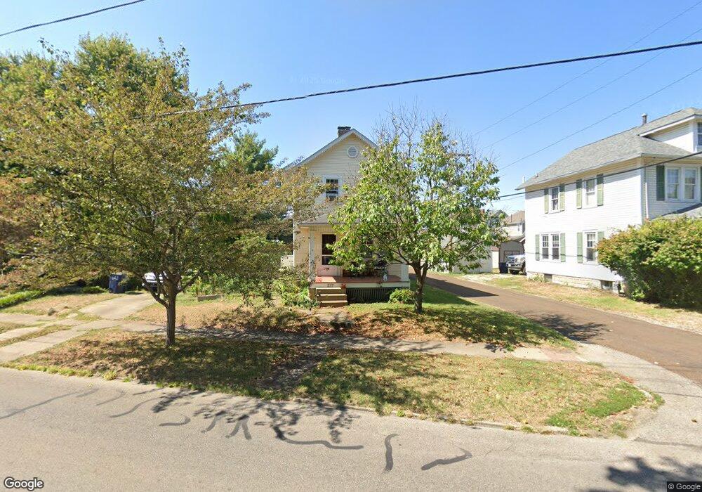
317 N Cherry St Lancaster, OH 43130
Estimated Value: $154,000 - $253,000
3
Beds
2
Baths
1,224
Sq Ft
$156/Sq Ft
Est. Value
About This Home
This home is located at 317 N Cherry St, Lancaster, OH 43130 and is currently estimated at $190,862, approximately $155 per square foot. 317 N Cherry St is a home located in Fairfield County with nearby schools including Thomas Ewing Junior High School, Lancaster High School, and St Mary Elementary School.
Ownership History
Date
Name
Owned For
Owner Type
Purchase Details
Closed on
Oct 26, 2007
Sold by
Kuhn Thomas E and Kuhn Phyllis J
Bought by
Glenn John W and Glenn Leslie A
Current Estimated Value
Home Financials for this Owner
Home Financials are based on the most recent Mortgage that was taken out on this home.
Original Mortgage
$95,000
Interest Rate
6.33%
Mortgage Type
Purchase Money Mortgage
Create a Home Valuation Report for This Property
The Home Valuation Report is an in-depth analysis detailing your home's value as well as a comparison with similar homes in the area
Home Values in the Area
Average Home Value in this Area
Purchase History
| Date | Buyer | Sale Price | Title Company |
|---|---|---|---|
| Glenn John W | $95,000 | Valmer Land Title Agency |
Source: Public Records
Mortgage History
| Date | Status | Borrower | Loan Amount |
|---|---|---|---|
| Closed | Glenn John W | $95,000 |
Source: Public Records
Tax History Compared to Growth
Tax History
| Year | Tax Paid | Tax Assessment Tax Assessment Total Assessment is a certain percentage of the fair market value that is determined by local assessors to be the total taxable value of land and additions on the property. | Land | Improvement |
|---|---|---|---|---|
| 2024 | $3,601 | $40,060 | $7,720 | $32,340 |
| 2023 | $1,489 | $40,060 | $7,720 | $32,340 |
| 2022 | $1,497 | $40,060 | $7,720 | $32,340 |
| 2021 | $1,311 | $32,870 | $7,720 | $25,150 |
| 2020 | $1,257 | $32,870 | $7,720 | $25,150 |
| 2019 | $1,197 | $32,870 | $7,720 | $25,150 |
| 2018 | $1,043 | $26,090 | $7,720 | $18,370 |
| 2017 | $1,043 | $27,190 | $7,720 | $19,470 |
| 2016 | $1,017 | $27,190 | $7,720 | $19,470 |
| 2015 | $1,044 | $27,090 | $7,720 | $19,370 |
| 2014 | $996 | $27,090 | $7,720 | $19,370 |
| 2013 | $996 | $27,090 | $7,720 | $19,370 |
Source: Public Records
Map
Nearby Homes
- 844 E Wheeling St
- 846 E Main St
- 627 Harding Ave
- 632 N Eastwood Ave
- 1106 E Walnut St
- 700 E Allen St
- 641 King St
- 1408 E Wheeling St
- 629 E Wheeling St
- 608 E Mulberry St
- 619 E Main St
- 403 S Ewing St
- 571 E Chestnut St
- 534 E Wheeling St
- 538 E 6th Ave
- 545 E Main St
- 521 E Allen St
- 1560 E Main St
- 308 Wheat St
- 1570 E Main St Unit 60
- 315 N Cherry St
- 319 N Cherry St
- 895 E Mulberry St
- 897 E Mulberry St
- 887 E Mulberry St
- 1026 King St
- 312 N Cherry St
- 333 N Cherry St
- 885 E Mulberry St
- 316 N Cherry St
- 1024 King St
- 883 E Mulberry St
- 1018 King St
- 881 E Mulberry St
- 304 N Cherry St
- 877 E Mulberry St
- 246 N Cherry St
- 1014 King St
- 401 N Cherry St
- 244 N Cherry St