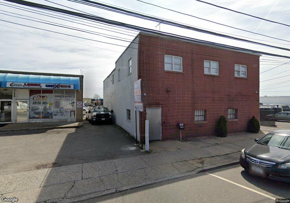
317 S Main St Freeport, NY 11520
Estimated Value: $725,867
3
Beds
1
Bath
11,551
Sq Ft
$63/Sq Ft
Est. Value
About This Home
This home is located at 317 S Main St, Freeport, NY 11520 and is currently estimated at $725,867, approximately $62 per square foot. 317 S Main St is a home located in Nassau County with nearby schools including Columbus Avenue School, Caroline G. Atkinson Intermediate School, and John W Dodd Middle School.
Ownership History
Date
Name
Owned For
Owner Type
Purchase Details
Closed on
Oct 29, 2014
Sold by
Little Apple Realty Llc
Bought by
317 S Main Rd Holdings Llc
Current Estimated Value
Home Financials for this Owner
Home Financials are based on the most recent Mortgage that was taken out on this home.
Original Mortgage
$300,000
Outstanding Balance
$231,243
Interest Rate
4.17%
Mortgage Type
Commercial
Estimated Equity
$494,624
Purchase Details
Closed on
Mar 31, 2005
Sold by
Reilly Francis
Bought by
Little Apple Realty Llc
Create a Home Valuation Report for This Property
The Home Valuation Report is an in-depth analysis detailing your home's value as well as a comparison with similar homes in the area
Home Values in the Area
Average Home Value in this Area
Purchase History
| Date | Buyer | Sale Price | Title Company |
|---|---|---|---|
| 317 S Main Rd Holdings Llc | $380,000 | None Available | |
| Little Apple Realty Llc | $525,000 | -- |
Source: Public Records
Mortgage History
| Date | Status | Borrower | Loan Amount |
|---|---|---|---|
| Open | 317 S Main Rd Holdings Llc | $300,000 |
Source: Public Records
Tax History Compared to Growth
Tax History
| Year | Tax Paid | Tax Assessment Tax Assessment Total Assessment is a certain percentage of the fair market value that is determined by local assessors to be the total taxable value of land and additions on the property. | Land | Improvement |
|---|---|---|---|---|
| 2025 | $25,641 | $7,090 | $2,189 | $4,901 |
| 2024 | $2,885 | $7,090 | $2,189 | $4,901 |
| 2023 | $23,215 | $7,090 | $2,189 | $4,901 |
| 2022 | $23,215 | $7,090 | $2,189 | $4,901 |
| 2021 | $33,871 | $6,709 | $2,189 | $4,520 |
| 2020 | $23,677 | $4,173 | $943 | $3,230 |
| 2019 | $23,471 | $4,173 | $943 | $3,230 |
| 2018 | $22,619 | $4,173 | $0 | $0 |
| 2017 | $16,514 | $4,173 | $943 | $3,230 |
| 2016 | $23,944 | $4,173 | $943 | $3,230 |
| 2015 | $2,901 | $4,173 | $943 | $3,230 |
| 2014 | $2,901 | $4,173 | $943 | $3,230 |
| 2013 | $2,743 | $4,173 | $943 | $3,230 |
Source: Public Records
Map
Nearby Homes
- 21 Stillwell Place
- 55 Southside Ave
- 60 Bedell St
- 18 Halsey St
- 51 Atlantic Ave
- 61 East Ave
- 274 Bedell St
- 47 East Ave
- 5 Sportsmans Ave
- 158 Church St
- 159 Southside Ave
- 125 Garfield St
- 308 Bedell St
- 121 Garfield St
- 142 Gordon Place
- 120 Sportsmans Ave
- 175 Archer St Unit 1C
- 175 Archer St Unit 3A
- 280 Guy Lombardo Ave Unit 5G
- 30 E Bedell St
- 319 S Main St
- 315 S Main St
- 319 S Main St
- 309 S Main St
- 301 S Main St
- 322 S Main St
- 322 S Main St Unit 2
- 322 S Main St Unit 1
- 335 S Main St
- 318 S Main St
- 314 S Main St
- 3 Archer St
- 337 S Main St
- 289 S Main St
- 9 Archer St
- 10 Southside Ave
- 10 Southside Ave Unit 2
- 10 Southside Ave Unit 1
- 15 Archer St
- 9 Southside Ave