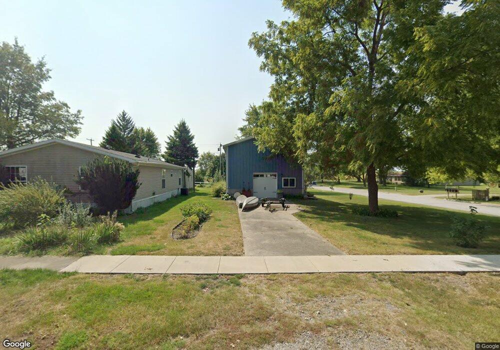
317 W Elm St Lone Tree, IA 52755
Estimated Value: $139,000 - $188,000
Studio
--
Bath
--
Sq Ft
7,013
Sq Ft Lot Lot
About This Home
This home is located at 317 W Elm St, Lone Tree, IA 52755 and is currently estimated at $162,468. 317 W Elm St is a home with nearby schools including Lone Tree Elementary School and Lone Tree Junior/Senior High School.
Ownership History
Date
Name
Owned For
Owner Type
Purchase Details
Closed on
Mar 23, 2015
Sold by
Ipsen David R and Ipsen Janis L
Bought by
Larson Daryl and Larson Dusty
Current Estimated Value
Home Financials for this Owner
Home Financials are based on the most recent Mortgage that was taken out on this home.
Original Mortgage
$19,000
Interest Rate
3.73%
Mortgage Type
Farmers Home Administration
Purchase Details
Closed on
Dec 20, 2006
Sold by
Havel Brian and Havel Brian P
Bought by
Ipsen David R and Ipsen Janis L
Home Financials for this Owner
Home Financials are based on the most recent Mortgage that was taken out on this home.
Original Mortgage
$14,024
Interest Rate
6.36%
Mortgage Type
FHA
Create a Home Valuation Report for This Property
The Home Valuation Report is an in-depth analysis detailing your home's value as well as a comparison with similar homes in the area
Purchase History
| Date | Buyer | Sale Price | Title Company |
|---|---|---|---|
| Larson Daryl | $19,000 | None Available | |
| Ipsen David R | $20,000 | None Available |
Source: Public Records
Mortgage History
| Date | Status | Borrower | Loan Amount |
|---|---|---|---|
| Closed | Larson Daryl | $19,000 | |
| Previous Owner | Ipsen David R | $14,024 |
Source: Public Records
Tax History
| Year | Tax Paid | Tax Assessment Tax Assessment Total Assessment is a certain percentage of the fair market value that is determined by local assessors to be the total taxable value of land and additions on the property. | Land | Improvement |
|---|---|---|---|---|
| 2025 | $1,664 | $129,000 | $23,300 | $105,700 |
| 2024 | $16 | $120,400 | $23,300 | $97,100 |
| 2023 | $1,374 | $120,400 | $23,300 | $97,100 |
| 2022 | $1,358 | $87,200 | $18,400 | $68,800 |
| 2021 | $1,422 | $87,200 | $18,400 | $68,800 |
| 2020 | $1,422 | $87,200 | $18,400 | $68,800 |
| 2019 | $1,296 | $87,200 | $18,400 | $68,800 |
| 2018 | $1,272 | $78,000 | $18,400 | $59,600 |
| 2017 | $1,072 | $78,000 | $18,400 | $59,600 |
| 2016 | $306 | $61,700 | $18,400 | $43,300 |
| 2015 | $306 | $0 | $0 | $0 |
| 2014 | $310 | $0 | $0 | $0 |
Source: Public Records
Map
Nearby Homes
- 221 W Commercial St
- 305 S Riggs St
- 500 S Center St
- 107 E Pioneer Rd
- 407 E Elm St
- 4985 640th St SE
- 0 Tri County Bridge Rd SE
- 25840 Golden Oak Ln Lot 1
- 25838 Golden Oak Ln Lot 7
- 25836 Golden Oak Ln Lot 8
- 25832 Golden Oak Ln Lot 12
- 25824 Golden Oak Ln Lot 9
- 25736 Golden Pond Ln Se Lot 17
- 25738 Golden Pond Ln Se Lot 16
- 1092 Walnut Ave Unit 301
- 1092 Walnut Ave Unit 220
- 1092 Walnut Ave Unit 117 Bld E
- Lot 2 116th Cir
- Lot 39 Walter Mapp Dr
- 1045 Vine Ave
Your Personal Tour Guide
Ask me questions while you tour the home.