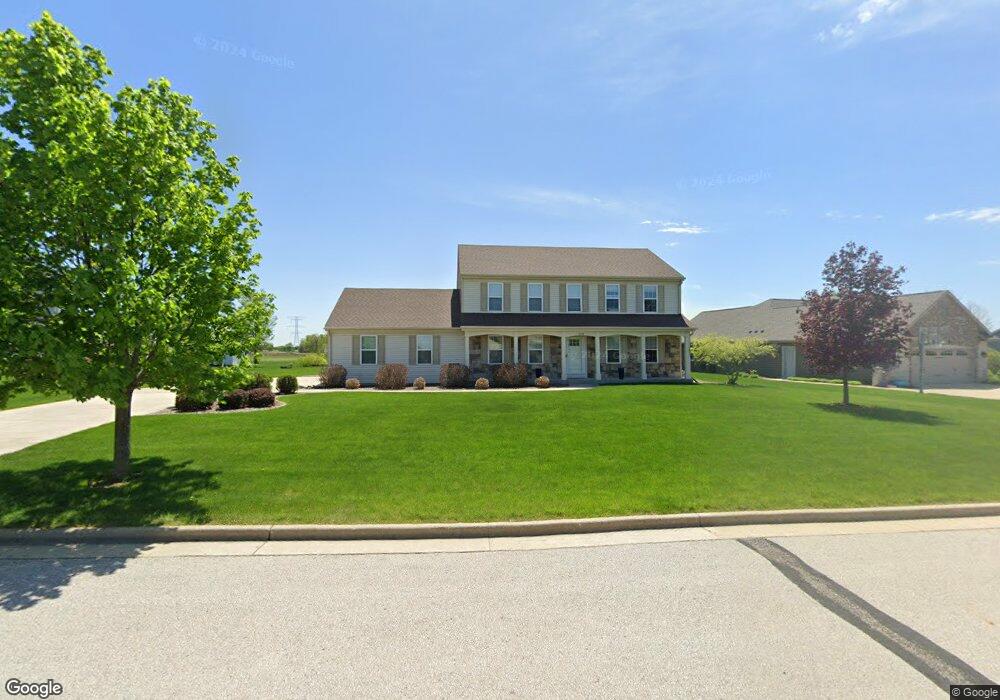
3170 Sherman Parc Cir Jackson, WI 53037
Estimated Value: $540,500
4
Beds
2
Baths
2,652
Sq Ft
$204/Sq Ft
Est. Value
About This Home
This home is located at 3170 Sherman Parc Cir, Jackson, WI 53037 and is currently priced at $540,500, approximately $203 per square foot. 3170 Sherman Parc Cir is a home located in Washington County with nearby schools including Rockfield Elementary School, Kennedy Middle School, and Germantown High School.
Ownership History
Date
Name
Owned For
Owner Type
Purchase Details
Closed on
Jul 11, 2018
Sold by
Hamlin Jeremy S and Wolf Dawn M
Bought by
Ore Robert H and Machotka Kelly
Current Estimated Value
Home Financials for this Owner
Home Financials are based on the most recent Mortgage that was taken out on this home.
Original Mortgage
$287,920
Outstanding Balance
$249,526
Interest Rate
4.5%
Mortgage Type
New Conventional
Purchase Details
Closed on
May 28, 2009
Sold by
Mn Holdings Inc
Bought by
Hamlin Jeremy S and Wolf Dawn M
Create a Home Valuation Report for This Property
The Home Valuation Report is an in-depth analysis detailing your home's value as well as a comparison with similar homes in the area
Home Values in the Area
Average Home Value in this Area
Purchase History
| Date | Buyer | Sale Price | Title Company |
|---|---|---|---|
| Ore Robert H | $359,900 | Merit Title Llc | |
| Hamlin Jeremy S | $69,000 | None Available |
Source: Public Records
Mortgage History
| Date | Status | Borrower | Loan Amount |
|---|---|---|---|
| Open | Ore Robert H | $287,920 | |
| Closed | Hamlin Jeremy S | $0 |
Source: Public Records
Tax History Compared to Growth
Tax History
| Year | Tax Paid | Tax Assessment Tax Assessment Total Assessment is a certain percentage of the fair market value that is determined by local assessors to be the total taxable value of land and additions on the property. | Land | Improvement |
|---|---|---|---|---|
| 2020 | $4,540 | $282,800 | $62,000 | $220,800 |
| 2019 | $4,176 | $282,800 | $62,000 | $220,800 |
| 2018 | $4,011 | $282,800 | $62,000 | $220,800 |
| 2017 | $3,906 | $282,800 | $62,000 | $220,800 |
| 2016 | $3,870 | $282,800 | $62,000 | $220,800 |
| 2015 | -- | $282,800 | $62,000 | $220,800 |
| 2014 | -- | $282,800 | $62,000 | $220,800 |
| 2013 | $4,259 | $282,800 | $62,000 | $220,800 |
Source: Public Records
Map
Nearby Homes
- W190N15739 Maple Fields Cir
- W190N15688 Maple Fields Cir
- W190N15670 Maple Fields Cir
- W190N15660 Maple Fields Cir
- W190N15704 Maple Fields Cir
- The Windsor Plan at Maple Fields
- The Sheridan Plan at Maple Fields
- The Hudson Plan at Maple Fields
- The Drake Plan at Maple Fields
- The Coral Plan at Maple Fields
- The Conway Plan at Maple Fields
- The Charleston Plan at Maple Fields
- The Catalina Plan at Maple Fields
- The Bridgeport Plan at Maple Fields
- The Bradford Plan at Maple Fields
- The Atwater Plan at Maple Fields
- The Adrian Plan at Maple Fields
- The Addison Plan at Maple Fields
- N156W19280 Eastgate Ct
- N161W19093 Oakland Dr Unit 31
- 3167 Sherman Parc Cir
- 3173 Sherman Parc Cir
- 3163 Sherman Parc Cir
- 3162 Sherman Parc Cir
- 3178 Sherman Parc Cir
- 3159 Sherman Parc Cir
- 3188 Sherman Parc Cir
- 3154 Sherman Parc Cir
- 3144 Sherman Parc Cir
- 3206 Sherman Parc Cir
- 3139 Sherman Parc Cir
- W206N16671 Blackberry Cir
- 3136 Sherman Parc Cir
- 3217 Sherman Parc Cir
- 3212 Sherman Parc Cir
- 2213 Sherman Rd
- 3125 Sherman Parc Cir
- 3220 Sherman Parc Cir
- 3128 Sherman Rd
- 2219 Sherman Parc Ct