Estimated Value: $347,000 - $561,000
3
Beds
2
Baths
2,213
Sq Ft
$191/Sq Ft
Est. Value
About This Home
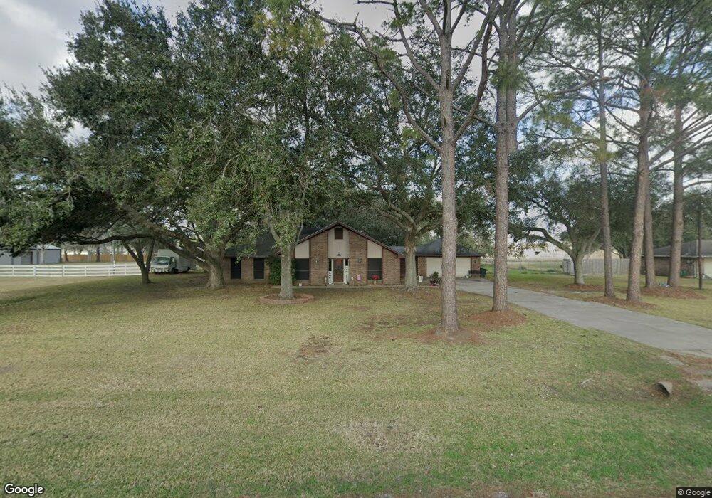
This home is located at 3172 County Road 536, Alvin, TX 77511 and is currently estimated at $423,704, approximately $191 per square foot. 3172 County Road 536 is a home located in Brazoria County with nearby schools including Hood-Case Elementary School, G.W. Harby Junior High School, and Alvin High School.
Ownership History
Date
Name
Owned For
Owner Type
Purchase Details
Closed on
Apr 29, 2005
Sold by
Cave Donald R and Cave Willie Grace
Bought by
Pourcio Michael Dale and Pourcio Michelle Leigh
Current Estimated Value
Home Financials for this Owner
Home Financials are based on the most recent Mortgage that was taken out on this home.
Original Mortgage
$132,000
Outstanding Balance
$69,223
Interest Rate
5.93%
Mortgage Type
Fannie Mae Freddie Mac
Estimated Equity
$354,481
Purchase Details
Closed on
Mar 10, 2003
Sold by
Cendant Mobility Financial Corp
Bought by
Cave Donald R and Cave Willie Grace
Home Financials for this Owner
Home Financials are based on the most recent Mortgage that was taken out on this home.
Original Mortgage
$126,900
Interest Rate
5.15%
Mortgage Type
Purchase Money Mortgage
Create a Home Valuation Report for This Property
The Home Valuation Report is an in-depth analysis detailing your home's value as well as a comparison with similar homes in the area
Home Values in the Area
Average Home Value in this Area
Purchase History
| Date | Buyer | Sale Price | Title Company |
|---|---|---|---|
| Pourcio Michael Dale | -- | Stc | |
| Cave Donald R | -- | Texas American Title Company |
Source: Public Records
Mortgage History
| Date | Status | Borrower | Loan Amount |
|---|---|---|---|
| Open | Pourcio Michael Dale | $132,000 | |
| Previous Owner | Cave Donald R | $126,900 | |
| Closed | Pourcio Michael Dale | $33,000 |
Source: Public Records
Tax History Compared to Growth
Tax History
| Year | Tax Paid | Tax Assessment Tax Assessment Total Assessment is a certain percentage of the fair market value that is determined by local assessors to be the total taxable value of land and additions on the property. | Land | Improvement |
|---|---|---|---|---|
| 2025 | $4,156 | $331,744 | $102,730 | $306,280 |
| 2023 | $4,156 | $274,168 | $133,550 | $314,000 |
| 2022 | $5,311 | $249,244 | $68,490 | $212,120 |
| 2021 | $5,028 | $229,000 | $68,490 | $160,510 |
| 2020 | $4,632 | $219,990 | $57,070 | $162,920 |
| 2019 | $4,335 | $187,260 | $43,090 | $144,170 |
| 2018 | $4,170 | $179,650 | $43,090 | $136,560 |
| 2017 | $4,143 | $176,370 | $37,920 | $138,450 |
| 2016 | $4,157 | $185,700 | $25,060 | $160,640 |
| 2014 | $3,114 | $148,770 | $20,880 | $127,890 |
Source: Public Records
Map
Nearby Homes
- 1688 County Road 144
- 3046 County Road 529
- 0 County Road 540
- 1950 County Road 540
- 2052 County Road 540
- 1871 County Road 936
- 1816 County Road 936b
- 1259 County Road 147
- 1690 County Road 965
- 1695 County Road 965
- 00 County Road 152
- 1236 County Road 634
- 2257 County Road 529
- 0 Cr 152 Unit 10927738
- 4190 County Road 145
- 3744 County Road 949b
- 3751 County Road 949b
- 000 Herring at Cr 144 Rd
- 1513 County Road 149
- 426 Riesling Dr
- 3150 County Road 536
- 3299 C R 187
- 3163 County Road 536
- 3238 County Road 536
- 3106 County Road 536
- 3299 County Road 187
- 3203 County Road 536
- 3249 County Road 536
- 3279 County Road 187
- 3082 County Road 536
- 1798 County Road 928
- 3298 County Road 187
- 3087 County Road 536
- 3174 County Road 536a
- 3249 County Road 187
- 3279 County Road 536
- 3148 County Road 536a
- 3276 County Road 187
- 3122 County Road 536a
- 3238 County Road 536a