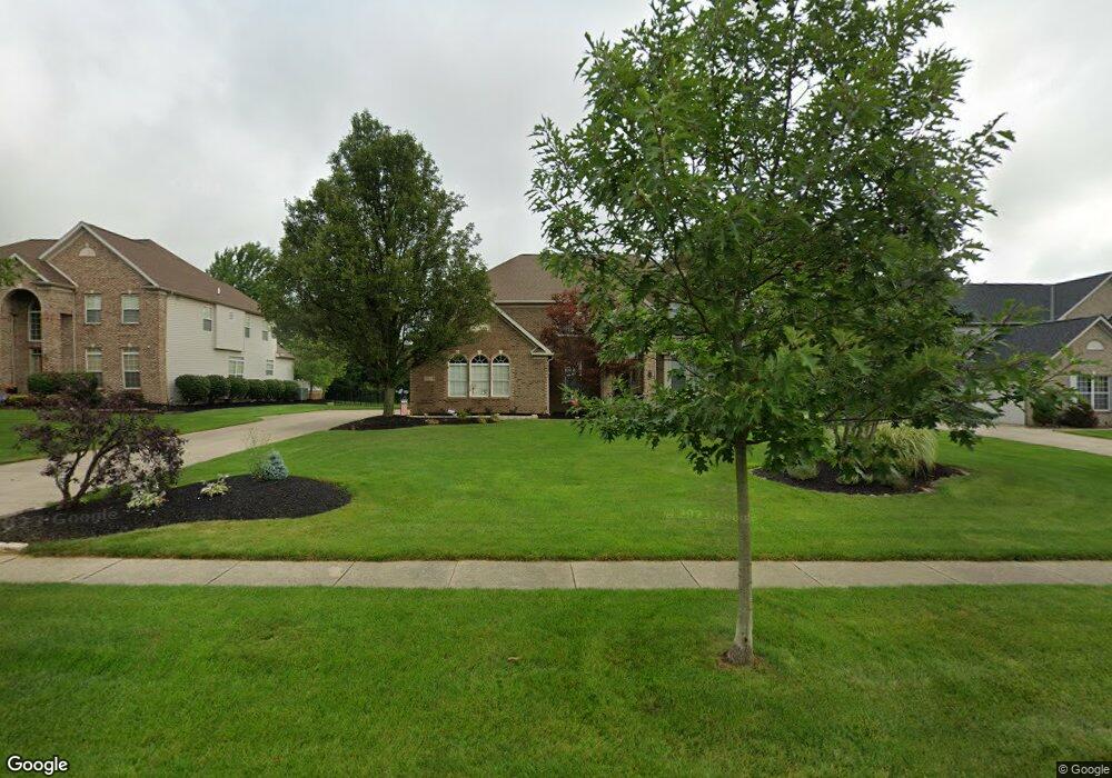
3173 Abrams Dr Twinsburg, OH 44087
Estimated Value: $568,000 - $699,000
4
Beds
3
Baths
3,288
Sq Ft
$190/Sq Ft
Est. Value
About This Home
This home is located at 3173 Abrams Dr, Twinsburg, OH 44087 and is currently estimated at $624,379, approximately $189 per square foot. 3173 Abrams Dr is a home located in Summit County with nearby schools including Wilcox Primary School, Dodge Intermediate School, and Samuel Bissell Elementary School.
Ownership History
Date
Name
Owned For
Owner Type
Purchase Details
Closed on
Mar 23, 2018
Sold by
Gubanc Thomas J and Gubanc Angela M
Bought by
Lary James J and Leary Lisa Deanglo
Current Estimated Value
Home Financials for this Owner
Home Financials are based on the most recent Mortgage that was taken out on this home.
Original Mortgage
$2,000,000
Outstanding Balance
$1,711,398
Interest Rate
4.32%
Mortgage Type
New Conventional
Estimated Equity
-$1,087,019
Purchase Details
Closed on
May 27, 2002
Sold by
Kimball Hill Abrams Farm Ltd Partnership
Bought by
Gubanc Thomas J and Gubanc Angela M
Home Financials for this Owner
Home Financials are based on the most recent Mortgage that was taken out on this home.
Original Mortgage
$275,400
Interest Rate
6.87%
Create a Home Valuation Report for This Property
The Home Valuation Report is an in-depth analysis detailing your home's value as well as a comparison with similar homes in the area
Home Values in the Area
Average Home Value in this Area
Purchase History
| Date | Buyer | Sale Price | Title Company |
|---|---|---|---|
| Lary James J | $400,000 | Fireland Title | |
| Gubanc Thomas J | $344,326 | Advanced Title |
Source: Public Records
Mortgage History
| Date | Status | Borrower | Loan Amount |
|---|---|---|---|
| Open | Lary James J | $2,000,000 | |
| Previous Owner | Gubanc Thomas J | $275,400 |
Source: Public Records
Tax History
| Year | Tax Paid | Tax Assessment Tax Assessment Total Assessment is a certain percentage of the fair market value that is determined by local assessors to be the total taxable value of land and additions on the property. | Land | Improvement |
|---|---|---|---|---|
| 2024 | $8,421 | $174,983 | $34,969 | $140,014 |
| 2023 | $8,421 | $174,983 | $34,969 | $140,014 |
| 2022 | $6,791 | $125,888 | $25,158 | $100,730 |
| 2021 | $6,823 | $125,888 | $25,158 | $100,730 |
| 2020 | $6,618 | $125,890 | $25,160 | $100,730 |
| 2019 | $6,186 | $109,970 | $29,180 | $80,790 |
| 2018 | $6,062 | $109,970 | $29,180 | $80,790 |
| 2017 | $5,379 | $109,970 | $29,180 | $80,790 |
| 2016 | $5,346 | $103,440 | $29,180 | $74,260 |
| 2015 | $5,379 | $103,440 | $29,180 | $74,260 |
| 2014 | $5,368 | $103,440 | $29,180 | $74,260 |
| 2013 | $5,109 | $98,530 | $29,180 | $69,350 |
Source: Public Records
Map
Nearby Homes
- 9717 Firelands Dr
- 9278 Liberty Rd
- 3047 Cannon Rd
- 2933 Cannon Rd Unit 2937
- 2779 Tinkers Ln Unit 10
- 3659 Shady Timber Dr
- 2551 Edgebrook Crossing Unit 71
- 10242 Brighton Cir
- 2975 Waterford Dr Unit 5
- 3082 Willowbrook Dr
- 10373 Glenway Dr Unit 202
- 3624 Nautilus Trail
- 2609 E Aurora Rd
- 11241 Stanley Ln
- 9026 Twin Hills Pkwy Unit 12F
- 9924 Pebble Beach Cove
- 10273 Luman Ln
- 10240 Orchard Hill Ln Unit I23
- 2269 Sherwin Dr
- 10424 Oviatt Ln
- 3183 Abrams Dr
- 3163 Abrams Dr
- 3193 Abrams Dr
- 3153 Abrams Dr
- 3020 Steffan Woods Dr
- 3170 Abrams Dr
- 3180 Abrams Dr
- 3038 Steffan Woods Dr
- 3028 Steffan Woods Dr
- 3143 Abrams Dr
- 3160 Abrams Dr
- 3048 Steffan Woods Dr
- 3190 Abrams Dr
- 3050 Steffan Woods Dr
- 3150 Abrams Dr
- 3012 Steffan Woods Dr
- 3200 Abrams Dr
- 9387 Grace Dr
- 3133 Abrams Dr
- 3021 Steffan Woods Dr
Your Personal Tour Guide
Ask me questions while you tour the home.