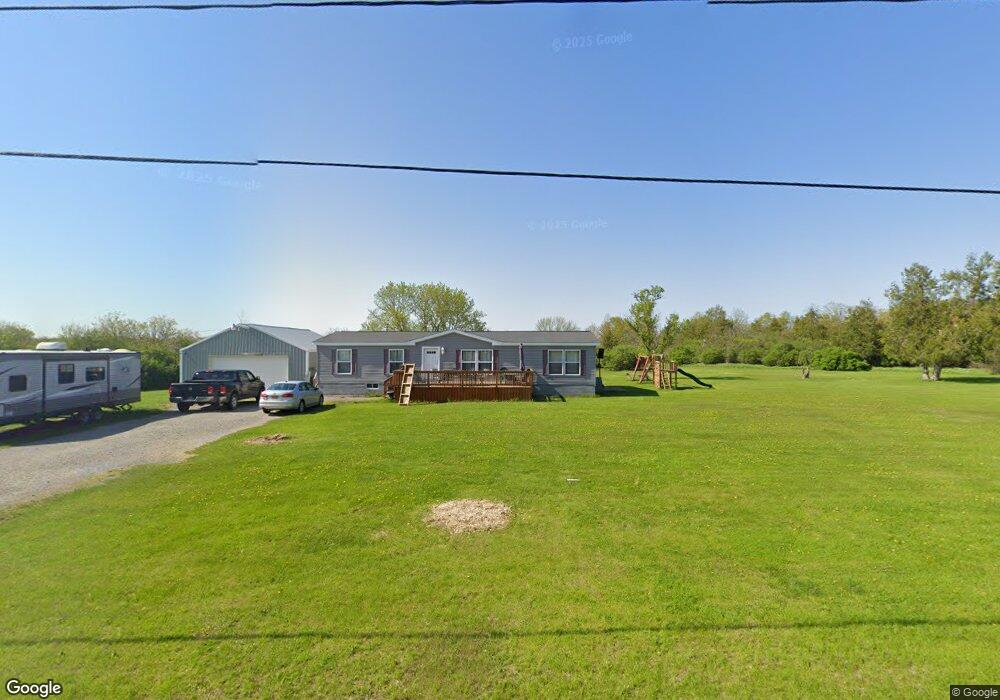
31767 Burnt Rock Rd Cape Vincent, NY 13618
Estimated Value: $95,000 - $242,000
3
Beds
2
Baths
1,512
Sq Ft
$111/Sq Ft
Est. Value
About This Home
This home is located at 31767 Burnt Rock Rd, Cape Vincent, NY 13618 and is currently estimated at $167,703, approximately $110 per square foot. 31767 Burnt Rock Rd is a home with nearby schools including Thousand Islands High School.
Ownership History
Date
Name
Owned For
Owner Type
Purchase Details
Closed on
Oct 8, 2013
Sold by
Rickard Sally A
Bought by
Sanford Leslie
Current Estimated Value
Home Financials for this Owner
Home Financials are based on the most recent Mortgage that was taken out on this home.
Original Mortgage
$52,000
Outstanding Balance
$20,434
Interest Rate
4.61%
Mortgage Type
New Conventional
Estimated Equity
$147,269
Purchase Details
Closed on
Oct 7, 2013
Sold by
Sanford Leslie F
Bought by
Diabo
Home Financials for this Owner
Home Financials are based on the most recent Mortgage that was taken out on this home.
Original Mortgage
$52,000
Outstanding Balance
$20,434
Interest Rate
4.61%
Mortgage Type
New Conventional
Estimated Equity
$147,269
Purchase Details
Closed on
Apr 6, 2006
Sold by
Babcock John
Bought by
Sanford Leslie
Purchase Details
Closed on
Dec 14, 2000
Sold by
Jefferson County Of
Bought by
Babcock John M
Create a Home Valuation Report for This Property
The Home Valuation Report is an in-depth analysis detailing your home's value as well as a comparison with similar homes in the area
Home Values in the Area
Average Home Value in this Area
Purchase History
| Date | Buyer | Sale Price | Title Company |
|---|---|---|---|
| Sanford Leslie | $12,000 | -- | |
| Diabo | $55,000 | Ashley Lyon | |
| Sanford Leslie | $11,500 | -- | |
| Babcock John M | $3,500 | -- |
Source: Public Records
Mortgage History
| Date | Status | Borrower | Loan Amount |
|---|---|---|---|
| Open | Diabo | $52,000 |
Source: Public Records
Tax History Compared to Growth
Tax History
| Year | Tax Paid | Tax Assessment Tax Assessment Total Assessment is a certain percentage of the fair market value that is determined by local assessors to be the total taxable value of land and additions on the property. | Land | Improvement |
|---|---|---|---|---|
| 2024 | $1,111 | $56,100 | $22,900 | $33,200 |
| 2023 | $1,050 | $56,100 | $22,900 | $33,200 |
| 2022 | $1,061 | $56,100 | $22,900 | $33,200 |
| 2021 | $1,085 | $56,100 | $22,900 | $33,200 |
| 2020 | $705 | $53,200 | $22,900 | $30,300 |
| 2019 | $702 | $53,200 | $22,900 | $30,300 |
| 2018 | $702 | $53,200 | $22,900 | $30,300 |
| 2017 | $703 | $53,200 | $22,900 | $30,300 |
| 2016 | $694 | $53,200 | $22,900 | $30,300 |
| 2015 | -- | $53,200 | $22,900 | $30,300 |
| 2014 | -- | $40,800 | $22,900 | $17,900 |
Source: Public Records
Map
Nearby Homes
- 29548 Ashland Rd
- 8799 Mill St
- 8573 Church St
- 8929 State Route 12e
- 28363 Lotts Grove Rd
- 34765 County Road 7
- 34308 State Route 12e
- 35303 State Route 12e
- 7176 Beadles Point Rd
- 8227 Catfish Point Rd
- 0 Nys Rte 12e Unit S1645815
- 0 Beaver Meadow Mews Unit S1631669
- 27560 County Route 57
- 27180 Montonna Shores Rd N
- 27454 County Route 57
- 27787 County Route 179
- 0 Wood Rd Unit S1636395
- 36998 Linda Island
- 37000 Rock Beach Rd N
- 27226 County Route 57
- 31755 Burnt Rock Rd
- 31744 Burnt Rock Rd
- 8784 County Rte 8
- 31666 Burnt Rock Rd
- 8900 County Route 8
- 8765 County Route 8
- 8707 County Route 8
- 31564 Burnt Rock Rd
- 9219 County Route 8
- 8681 County Route 8
- 31569 Burnt Rock Rd
- 9316 County Route 8
- 31560 Burnt Rock Rd
- 31494 Burnt Rock Rd
- 31489 Burnt Rock Rd
- 31341 Ashland Rd
- 31471 Burnt Rock Rd
- 31187 Ashland Rd
- 31700 Swallia Rd
- 32120 MacOmb Settlement Rd