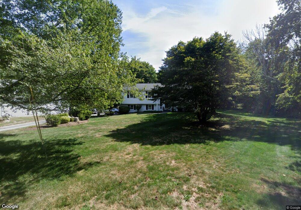
3177 Sharps Lot Rd Dighton, MA 02715
Estimated Value: $547,000 - $720,000
3
Beds
2
Baths
1,344
Sq Ft
$461/Sq Ft
Est. Value
About This Home
This home is located at 3177 Sharps Lot Rd, Dighton, MA 02715 and is currently estimated at $619,403, approximately $460 per square foot. 3177 Sharps Lot Rd is a home located in Bristol County with nearby schools including Dighton-Rehoboth Regional High School, SCEC Life Academy, and Swansea Wood School.
Ownership History
Date
Name
Owned For
Owner Type
Purchase Details
Closed on
Jul 24, 1991
Sold by
Miranda Frank and Miranda Helen
Bought by
Berube Kenneth J
Current Estimated Value
Home Financials for this Owner
Home Financials are based on the most recent Mortgage that was taken out on this home.
Original Mortgage
$115,000
Interest Rate
9.58%
Mortgage Type
Purchase Money Mortgage
Create a Home Valuation Report for This Property
The Home Valuation Report is an in-depth analysis detailing your home's value as well as a comparison with similar homes in the area
Home Values in the Area
Average Home Value in this Area
Purchase History
| Date | Buyer | Sale Price | Title Company |
|---|---|---|---|
| Berube Kenneth J | $169,000 | -- |
Source: Public Records
Mortgage History
| Date | Status | Borrower | Loan Amount |
|---|---|---|---|
| Closed | Berube Kenneth J | $115,000 | |
| Closed | Berube Kenneth J | $115,000 | |
| Previous Owner | Berube Kenneth J | $93,000 |
Source: Public Records
Tax History Compared to Growth
Tax History
| Year | Tax Paid | Tax Assessment Tax Assessment Total Assessment is a certain percentage of the fair market value that is determined by local assessors to be the total taxable value of land and additions on the property. | Land | Improvement |
|---|---|---|---|---|
| 2025 | $6,620 | $527,100 | $141,600 | $385,500 |
| 2024 | $6,527 | $477,100 | $138,700 | $338,400 |
| 2023 | $6,255 | $448,700 | $138,700 | $310,000 |
| 2022 | $6,059 | $424,000 | $135,200 | $288,800 |
| 2021 | $5,742 | $387,200 | $122,600 | $264,600 |
| 2020 | $5,692 | $380,000 | $136,500 | $243,500 |
| 2019 | $5,543 | $369,800 | $136,500 | $233,300 |
| 2018 | $5,139 | $345,800 | $116,500 | $229,300 |
| 2017 | $4,920 | $331,900 | $134,800 | $197,100 |
| 2016 | $5,015 | $329,300 | $138,700 | $190,600 |
| 2015 | $4,885 | $330,100 | $142,600 | $187,500 |
| 2014 | $4,901 | $321,800 | $142,600 | $179,200 |
Source: Public Records
Map
Nearby Homes
- 48 Laurie Ln
- 3075 Club House Dr
- 3064 Clubhouse Dr
- R61 Clubhouse Dr Unit R61
- 32 Clubhouse Dr Unit RR32
- 3055 Clubhouse Dr Unit 80
- 3051 Clubhouse Dr Unit 78
- 3049 Clubhouse Dr Unit 77
- 3035 Clubhouse Dr
- 3035 Clubhouse Dr Unit 8
- 3035 Clubhouse Dr Unit 7
- 3035 Clubhouse Dr Unit 6
- 3035 Clubhouse Dr Unit 5
- 3035 Clubhouse Dr Unit 4
- 3035 Clubhouse Dr Unit 3
- 3035 Clubhouse Dr Unit 2
- 3035 Clubhouse Dr Unit 1
- 3057 Clubhouse Dr
- 2660 Courtlyn Rd
- 2535 Williams St
- 3111 Sharps Lot Rd
- 3065 Sharps Lot Rd
- 3189 Sharps Lot Rd
- 1780 Sharps Lot Rd
- 3147 Sharps Lot Rd
- 3169 Sharps Lot Rd
- 2900 Amaral Way
- 2917 Williams St
- 0 Sharps Lot Rd
- 2555 Anderson Dr
- 3203 Sharps Lot Rd
- 0 Williams St Unit 72311126
- 0 Williams + Main
- 0 Williams St Unit 71091956
- 0 Williams St Unit 71121013
- 0 Williams St Unit 71117833
- 0 Williams St Unit 73296430
- 0 Williams St Unit 73267165
- 0 Williams St Unit 73032498
- 0 Williams St