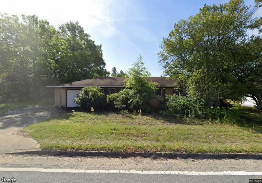
3179 Millerfield Rd Macon, GA 31211
Estimated Value: $71,000 - $133,000
3
Beds
1
Bath
1,185
Sq Ft
$87/Sq Ft
Est. Value
About This Home
This home is located at 3179 Millerfield Rd, Macon, GA 31211 and is currently estimated at $103,486, approximately $87 per square foot. 3179 Millerfield Rd is a home located in Bibb County with nearby schools including Martin Luther King Jr. Elementary School, Appling Middle School, and Northeast High School.
Ownership History
Date
Name
Owned For
Owner Type
Purchase Details
Closed on
Sep 12, 2023
Sold by
Cabiness Alfreda H and Hill Ronald
Bought by
Scottco Mgmt Management 5 Llc
Current Estimated Value
Purchase Details
Closed on
Apr 4, 2023
Sold by
Tax Commissioner And Ex Officio Sheriff
Bought by
Scottco Mgmt Management 5 Llc
Purchase Details
Closed on
May 5, 2005
Sold by
Scott Gregory
Bought by
Scottco Management 5 Llc
Purchase Details
Closed on
Aug 29, 2002
Create a Home Valuation Report for This Property
The Home Valuation Report is an in-depth analysis detailing your home's value as well as a comparison with similar homes in the area
Home Values in the Area
Average Home Value in this Area
Purchase History
| Date | Buyer | Sale Price | Title Company |
|---|---|---|---|
| Scottco Mgmt Management 5 Llc | $14,400 | None Listed On Document | |
| Scottco Mgmt Management 5 Llc | $12,000 | None Listed On Document | |
| Scottco Management 5 Llc | -- | None Available | |
| Scottco Management 5 Llc | -- | None Available | |
| -- | $68,000 | -- |
Source: Public Records
Tax History Compared to Growth
Tax History
| Year | Tax Paid | Tax Assessment Tax Assessment Total Assessment is a certain percentage of the fair market value that is determined by local assessors to be the total taxable value of land and additions on the property. | Land | Improvement |
|---|---|---|---|---|
| 2025 | $804 | $32,709 | $5,535 | $27,174 |
| 2024 | $831 | $32,709 | $5,535 | $27,174 |
| 2023 | $831 | $32,709 | $5,535 | $27,174 |
| 2022 | $888 | $25,635 | $4,847 | $20,788 |
| 2021 | $666 | $17,520 | $2,181 | $15,339 |
| 2020 | $633 | $16,309 | $2,181 | $14,128 |
| 2019 | $401 | $10,254 | $2,181 | $8,073 |
| 2018 | $795 | $10,254 | $2,181 | $8,073 |
| 2017 | $384 | $10,254 | $2,181 | $8,073 |
| 2016 | $355 | $10,254 | $2,181 | $8,073 |
| 2015 | $601 | $12,273 | $2,181 | $10,092 |
| 2014 | $1,115 | $19,790 | $4,653 | $15,137 |
Source: Public Records
Map
Nearby Homes
- 2940 Shurling Dr
- 3145 Pasadena Dr
- 2954 Tyler Place
- 3048 Bethune Ave
- 2035 Fairway Dr
- 3128 Commodore Dr
- 0 Shady Rd
- 3339 Club Dr
- 1940 Manson Rd
- 0 Shady Road Plaza
- 2720 Jordan Ave
- 3380 Warpath Rd
- 3154 Bethune Ave
- 2750 Lakeshore Dr
- 2675 Andy Dr
- 2792 Skyline Dr
- 2370 Recreation Rd
- 2815 New Clinton Rd
- 2229 New Clinton Rd
- 3320 Joycliff Rd
- 3171 Millerfield Rd
- 0 Millerfield Rd Unit 8690552
- 3176 Millerfield Rd
- 3192 Millerfield Rd
- 3182 Millerfield Rd
- 3161 Millerfield Rd
- 3204 Millerfield Rd
- 2916 Laney Ave
- 3212 Millerfield Rd
- 2909 Laney Ave
- 3219 Millerfield Rd
- 2915 Laney Ave
- 2930 Laney Ave
- 2923 Laney Ave
- 2936 Laney Ave
- 2929 Laney Ave
- 3113 Millerfield Rd
- 2935 Laney Ave
- 2940 Laney Ave
- 3239 Millerfield Rd