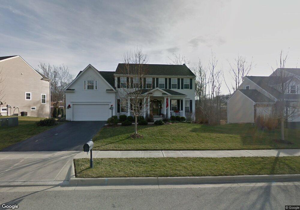
3179 Vinson Dr Unit 6895 Lewis Center, OH 43035
Orange NeighborhoodEstimated Value: $579,019 - $700,000
4
Beds
3
Baths
2,852
Sq Ft
$218/Sq Ft
Est. Value
About This Home
This home is located at 3179 Vinson Dr Unit 6895, Lewis Center, OH 43035 and is currently estimated at $622,005, approximately $218 per square foot. 3179 Vinson Dr Unit 6895 is a home located in Delaware County with nearby schools including Freedom Trail Elementary School, Olentangy Orange Middle School, and Orange High School.
Ownership History
Date
Name
Owned For
Owner Type
Purchase Details
Closed on
May 2, 2008
Sold by
M/I Homes Of Central Ohio Llc
Bought by
Peterson Jeffrey A and Peterson Jane E
Current Estimated Value
Home Financials for this Owner
Home Financials are based on the most recent Mortgage that was taken out on this home.
Original Mortgage
$367,150
Outstanding Balance
$232,514
Interest Rate
5.88%
Mortgage Type
Purchase Money Mortgage
Estimated Equity
$389,491
Create a Home Valuation Report for This Property
The Home Valuation Report is an in-depth analysis detailing your home's value as well as a comparison with similar homes in the area
Home Values in the Area
Average Home Value in this Area
Purchase History
| Date | Buyer | Sale Price | Title Company |
|---|---|---|---|
| Peterson Jeffrey A | $386,500 | Transohio Residential Title |
Source: Public Records
Mortgage History
| Date | Status | Borrower | Loan Amount |
|---|---|---|---|
| Open | Peterson Jeffrey A | $367,150 |
Source: Public Records
Tax History Compared to Growth
Tax History
| Year | Tax Paid | Tax Assessment Tax Assessment Total Assessment is a certain percentage of the fair market value that is determined by local assessors to be the total taxable value of land and additions on the property. | Land | Improvement |
|---|---|---|---|---|
| 2024 | $9,703 | $169,970 | $33,080 | $136,890 |
| 2023 | $9,601 | $169,970 | $33,080 | $136,890 |
| 2022 | $9,464 | $138,050 | $25,730 | $112,320 |
| 2021 | $9,518 | $138,050 | $25,730 | $112,320 |
| 2020 | $9,563 | $138,050 | $25,730 | $112,320 |
| 2019 | $8,356 | $125,130 | $25,730 | $99,400 |
| 2018 | $8,394 | $125,130 | $25,730 | $99,400 |
| 2017 | $8,337 | $128,670 | $23,210 | $105,460 |
| 2016 | $9,177 | $128,670 | $23,210 | $105,460 |
| 2015 | $8,377 | $128,670 | $23,210 | $105,460 |
| 2014 | $8,489 | $128,670 | $23,210 | $105,460 |
| 2013 | $8,412 | $124,610 | $23,210 | $101,400 |
Source: Public Records
Map
Nearby Homes
- 7631 Pleasant Colony Ct
- 3679 Birkland Cir
- 3902 Rivers Run Dr
- 2383 Bold Venture Dr
- 2715 Tucker Trail
- 3313 Glen Oaks Ct
- 2165 Ben Brush Place
- 2216 Reeves Ave
- 1627 Bristol Commons Place
- 3138 E Powell Rd
- 6964 Saint Ninians St
- 1923 Myrtle St
- 0 E Orange Rd Unit lot 1
- 0 E Orange Rd
- 2347 Jaxton Ct
- 1955 Royal Oak Dr
- 4515 McAlister Park Dr
- 4527 McAlister Park Dr
- 1746 E Powell Rd
- 7633 Storrington Place
- 3179 Vinson Dr
- 3205 Vinson Dr
- 3178 Vinson Dr Unit 892
- 3231 Vinson Dr
- 3196 Vinson Dr
- 3158 Vinson Dr
- 3210 Vinson Dr
- 3247 Vinson Dr
- 3228 Vinson Dr
- 3177 Farmers Delight Dr
- 3242 Vinson Dr
- 3147 Marcliff Dr
- 3159 Farmers Delight Dr
- 3193 Farmers Delight Dr
- 3165 Marcliff Dr
- 3267 Vinson Dr
- 3217 Farmers Delight Dr
- 3243 Farmers Delight Dr
- 3264 Vinson Dr
- 3261 Farmers Delight Dr