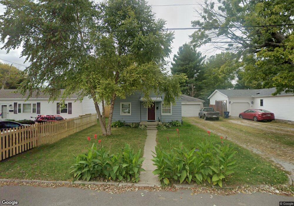
318 A St Wilmington, OH 45177
Estimated Value: $63,000 - $153,000
1
Bed
1
Bath
576
Sq Ft
$182/Sq Ft
Est. Value
About This Home
This home is located at 318 A St, Wilmington, OH 45177 and is currently estimated at $104,584, approximately $181 per square foot. 318 A St is a home located in Clinton County with nearby schools including East End Elementary School, Denver Place Elementary School, and Roy E. Holmes Elementary School.
Ownership History
Date
Name
Owned For
Owner Type
Purchase Details
Closed on
Jul 25, 2022
Sold by
Tong Family Joint Revocable Trust
Bought by
Winnefeld Alex
Current Estimated Value
Purchase Details
Closed on
Aug 1, 2017
Sold by
Tong Johnnie and Tong Deborah
Bought by
Tong Family Joint Revocable Trust Agreem
Purchase Details
Closed on
Sep 9, 2015
Sold by
Tong Johnnie R
Bought by
Tong Johnnie R and Tong Deborah K
Home Financials for this Owner
Home Financials are based on the most recent Mortgage that was taken out on this home.
Interest Rate
3.89%
Purchase Details
Closed on
Jan 1, 1990
Bought by
Simkins Margaret
Create a Home Valuation Report for This Property
The Home Valuation Report is an in-depth analysis detailing your home's value as well as a comparison with similar homes in the area
Home Values in the Area
Average Home Value in this Area
Purchase History
| Date | Buyer | Sale Price | Title Company |
|---|---|---|---|
| Winnefeld Alex | $50,000 | None Listed On Document | |
| Tong Family Joint Revocable Trust Agreem | -- | Attorney | |
| Tong Johnnie R | $85,000 | -- | |
| Simkins Margaret | -- | -- |
Source: Public Records
Mortgage History
| Date | Status | Borrower | Loan Amount |
|---|---|---|---|
| Previous Owner | Tong Johnnie R | -- |
Source: Public Records
Tax History Compared to Growth
Tax History
| Year | Tax Paid | Tax Assessment Tax Assessment Total Assessment is a certain percentage of the fair market value that is determined by local assessors to be the total taxable value of land and additions on the property. | Land | Improvement |
|---|---|---|---|---|
| 2024 | $641 | $17,720 | $2,840 | $14,880 |
| 2023 | $611 | $17,720 | $2,840 | $14,880 |
| 2022 | $421 | $11,490 | $2,560 | $8,930 |
| 2021 | $426 | $11,490 | $2,560 | $8,930 |
| 2020 | $400 | $11,490 | $2,560 | $8,930 |
| 2019 | $350 | $9,170 | $2,810 | $6,360 |
| 2018 | $371 | $9,170 | $2,810 | $6,360 |
| 2017 | $344 | $9,170 | $2,810 | $6,360 |
| 2016 | $321 | $8,450 | $2,110 | $6,340 |
| 2015 | $316 | $8,450 | $2,110 | $6,340 |
| 2013 | $333 | $8,800 | $2,110 | $6,690 |
Source: Public Records
Map
Nearby Homes
- 328 A St
- 174 B St
- 841 Ohio Ave
- 18 E Kentucky Ave
- 977 N South St
- 995 N South St
- 988 N South St
- 966 N South St
- 1015 N South St
- 987 N South St
- 1005 N South St
- 996 N South St
- 31 Fairland Ave
- 555 Cross Creek Dr
- 584 Howard St
- 813 N Lincoln St
- 360 Summit St
- 125 E Kentucky Ave
- 215 Leyland Park Dr Unit 1C
- 421 N Spring St