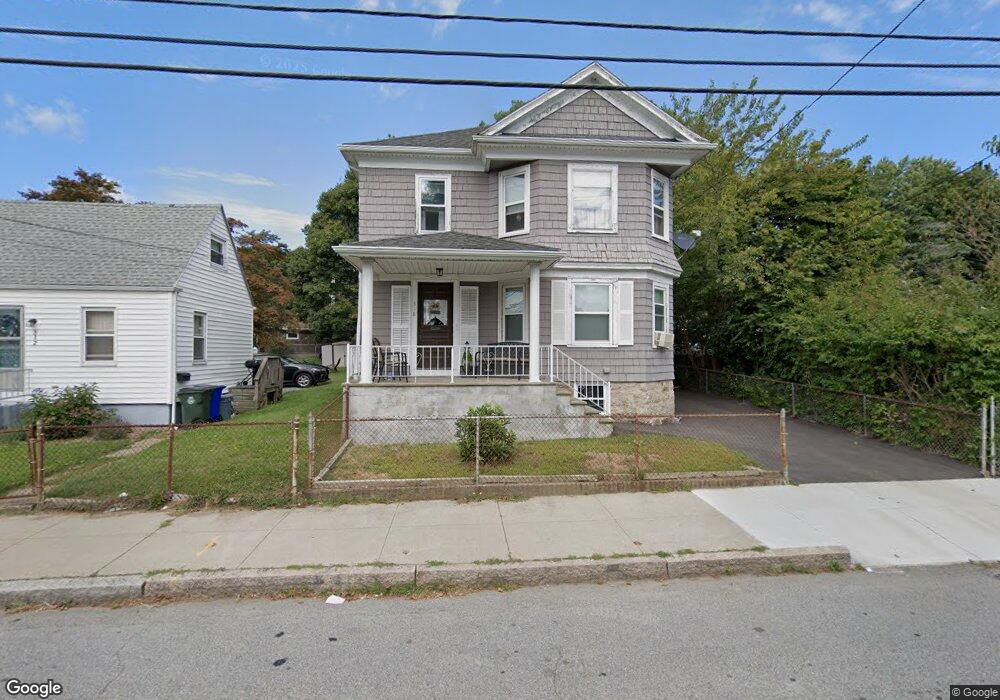
318 Anthony St Fall River, MA 02721
Maplewood NeighborhoodEstimated Value: $396,000 - $621,000
5
Beds
2
Baths
2,448
Sq Ft
$203/Sq Ft
Est. Value
About This Home
This home is located at 318 Anthony St, Fall River, MA 02721 and is currently estimated at $495,808, approximately $202 per square foot. 318 Anthony St is a home located in Bristol County with nearby schools including Letourneau Elementary School, Matthew J. Kuss Middle School, and B M C Durfee High School.
Ownership History
Date
Name
Owned For
Owner Type
Purchase Details
Closed on
Jun 2, 2011
Sold by
Fnma
Bought by
Perreira David
Current Estimated Value
Home Financials for this Owner
Home Financials are based on the most recent Mortgage that was taken out on this home.
Original Mortgage
$142,542
Outstanding Balance
$99,274
Interest Rate
4.85%
Mortgage Type
Purchase Money Mortgage
Estimated Equity
$396,534
Purchase Details
Closed on
May 14, 2010
Sold by
Campbell Dorothy M
Bought by
Federal National Mortgage Association
Purchase Details
Closed on
Jul 14, 2003
Sold by
Oconnell Hilda S
Bought by
Campbell Dorothy M
Home Financials for this Owner
Home Financials are based on the most recent Mortgage that was taken out on this home.
Original Mortgage
$183,600
Interest Rate
5.45%
Mortgage Type
Purchase Money Mortgage
Create a Home Valuation Report for This Property
The Home Valuation Report is an in-depth analysis detailing your home's value as well as a comparison with similar homes in the area
Home Values in the Area
Average Home Value in this Area
Purchase History
| Date | Buyer | Sale Price | Title Company |
|---|---|---|---|
| Perreira David | $125,000 | -- | |
| Federal National Mortgage Association | $198,167 | -- | |
| Campbell Dorothy M | $229,500 | -- |
Source: Public Records
Mortgage History
| Date | Status | Borrower | Loan Amount |
|---|---|---|---|
| Open | Campbell Dorothy M | $142,542 | |
| Previous Owner | Campbell Dorothy M | $183,600 |
Source: Public Records
Tax History
| Year | Tax Paid | Tax Assessment Tax Assessment Total Assessment is a certain percentage of the fair market value that is determined by local assessors to be the total taxable value of land and additions on the property. | Land | Improvement |
|---|---|---|---|---|
| 2025 | $4,385 | $383,000 | $124,000 | $259,000 |
| 2024 | $4,035 | $351,200 | $119,300 | $231,900 |
| 2023 | $3,704 | $301,900 | $102,300 | $199,600 |
| 2022 | $3,397 | $269,200 | $93,000 | $176,200 |
| 2021 | $3,141 | $227,100 | $86,000 | $141,100 |
| 2020 | $2,829 | $195,800 | $82,300 | $113,500 |
| 2019 | $2,680 | $183,800 | $78,400 | $105,400 |
| 2018 | $2,539 | $173,700 | $76,900 | $96,800 |
| 2017 | $2,381 | $170,100 | $78,500 | $91,600 |
| 2016 | $2,453 | $180,000 | $81,800 | $98,200 |
| 2015 | $2,314 | $176,900 | $78,700 | $98,200 |
| 2014 | $2,386 | $189,700 | $82,900 | $106,800 |
Source: Public Records
Map
Nearby Homes
- 93 Lawton St
- 125 Carl St
- 478 Tucker St
- 539 Aetna St
- 59 Wayne St
- 186 Spencer St
- 59 Denver St
- 495 Chicago St
- 143 Meeson St
- 250 Nelson St
- 250 Laurel St
- 191 Glasgow St Unit 2
- 311 S Oxford St
- 119 Pebble St
- 545 Brayton Ave
- 21 Boyden St
- 340 Vale St
- 0 Stafford Rd Unit 1393774
- 0 Stafford Rd Unit 73431501
- 248 Jefferson St
- 312 Anthony St
- 334 Anthony St
- 347 Lawton St
- 347 Lawton St Unit 2
- 339 Lawton St Unit 2B
- 339 Lawton St Unit 2
- 339 Lawton St
- 290 Anthony St
- 313 Anthony St
- 319 Lawton St
- 307 Anthony St
- 358 Anthony St
- 291 Anthony St
- 343 Anthony St
- 379 Lawton St
- 309 Lawton St
- 272 Anthony St
- 272 Anthony St Unit 2
- 344 Lawton St
- 389 Lawton St
Your Personal Tour Guide
Ask me questions while you tour the home.