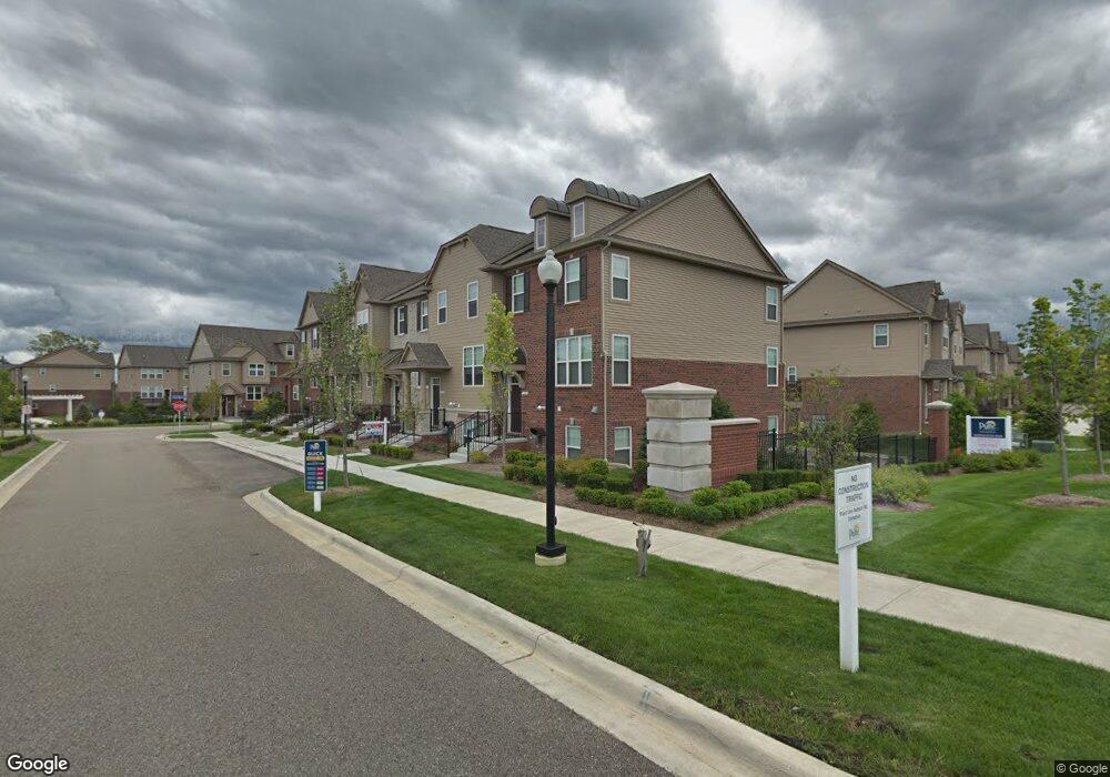
318 Glenhurst Blvd Unit Bldg-Unit Rochester Hills, MI 48307
Estimated Value: $412,934 - $473,000
--
Bed
4
Baths
--
Sq Ft
14.44
Acres
About This Home
This home is located at 318 Glenhurst Blvd Unit Bldg-Unit, Rochester Hills, MI 48307 and is currently estimated at $444,234. 318 Glenhurst Blvd Unit Bldg-Unit is a home located in Oakland County with nearby schools including Hampton Elementary School, Reuther Middle School, and Rochester High School.
Ownership History
Date
Name
Owned For
Owner Type
Purchase Details
Closed on
Dec 20, 2019
Sold by
Perez Manuel Osvaldo Moreno
Bought by
Perez Manuel Osvaidomoreno and Gallegos Cynthia Acosta
Current Estimated Value
Purchase Details
Closed on
Oct 8, 2018
Sold by
Patina Luiz
Bought by
Moreno Perez Manuel Osvaldo
Home Financials for this Owner
Home Financials are based on the most recent Mortgage that was taken out on this home.
Original Mortgage
$299,250
Outstanding Balance
$260,964
Interest Rate
4.5%
Mortgage Type
New Conventional
Estimated Equity
$183,270
Purchase Details
Closed on
Dec 12, 2016
Sold by
Pulte Homes Of Michigan Llc
Bought by
Palma Luiz
Home Financials for this Owner
Home Financials are based on the most recent Mortgage that was taken out on this home.
Original Mortgage
$271,989
Interest Rate
4.13%
Mortgage Type
New Conventional
Create a Home Valuation Report for This Property
The Home Valuation Report is an in-depth analysis detailing your home's value as well as a comparison with similar homes in the area
Home Values in the Area
Average Home Value in this Area
Purchase History
| Date | Buyer | Sale Price | Title Company |
|---|---|---|---|
| Perez Manuel Osvaidomoreno | -- | None Available | |
| Perez Manuel Osvaldo Moreno Perez | -- | None Available | |
| Moreno Perez Manuel Osvaldo | $315,000 | Liberty Title | |
| Palma Luiz | $302,210 | None Available |
Source: Public Records
Mortgage History
| Date | Status | Borrower | Loan Amount |
|---|---|---|---|
| Open | Moreno Perez Manuel Osvaldo | $299,250 | |
| Previous Owner | Palma Luiz | $271,989 |
Source: Public Records
Tax History Compared to Growth
Tax History
| Year | Tax Paid | Tax Assessment Tax Assessment Total Assessment is a certain percentage of the fair market value that is determined by local assessors to be the total taxable value of land and additions on the property. | Land | Improvement |
|---|---|---|---|---|
| 2022 | $2,873 | $162,790 | $0 | $0 |
| 2018 | $4,705 | $149,280 | $0 | $0 |
Source: Public Records
Map
Nearby Homes
- 2653 Helmsdale Cir
- 2817 Hartwick Dr
- 2605 Helmsdale Cir
- 525 Oxford Ct
- 740 Eastbridge Ct
- 653 Glasgow Ct Unit 207
- 830 Dartmouth Dr
- 372 Daylily Dr
- 134 W Auburn Rd
- 2770 Hickory Lawn Rd
- 3118 Hickory Lawn Rd
- 980 Briston Dr
- 535 Tennyson Unit 48
- 513 Tennyson
- 3285 Norton Lawn
- 120 Montmorency Rd
- 3615 Hazelton Ave
- 2198 S Rochester Rd
- 2198 London Bridge Dr
- 309 Coldiron Dr
- 318 Glenhurst Blvd
- 314 Glenhurst Blvd
- 911 Barclay Cir
- 334 Glenhurst Blvd
- 915 Barclay Cir
- 919 Barclay Cir Unit 37
- 317 Glenhurst Blvd
- 329 Glenhurst Blvd
- 2657 Helmsdale Cir
- 2657 Helmsdale Cir
- 2690 Helmsdale Cir Unit 31
- 2690 Helmsdale Cir
- 2678 Helmsdale Cir
- 939 Barclay Cir Unit 45
- 939 Barclay Cir
- 939 Barclay Cir Unit 58
- 2666 Helmsdale Cir
- 2662 Helmsdale Cir
- 2710 Helmsdale Cir
- 2658 Helmsdale Cir