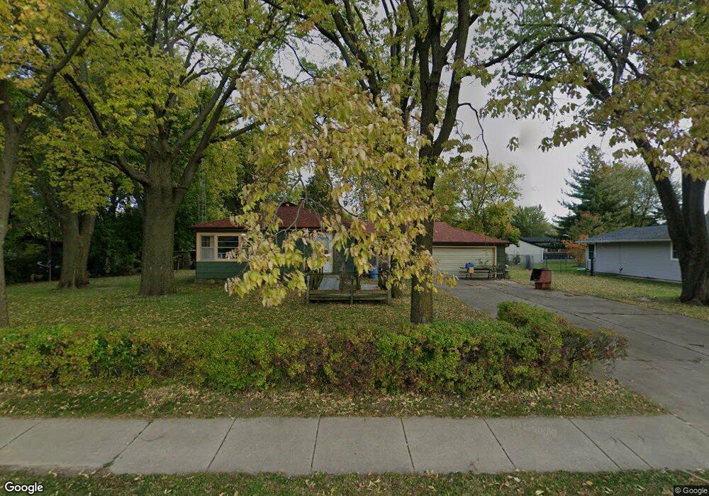
318 W Mckinley Rd Ottawa, IL 61350
Estimated Value: $73,641 - $193,000
--
Bed
--
Bath
1,120
Sq Ft
$114/Sq Ft
Est. Value
About This Home
This home is located at 318 W Mckinley Rd, Ottawa, IL 61350 and is currently estimated at $127,410, approximately $113 per square foot. 318 W Mckinley Rd is a home located in LaSalle County with nearby schools including Ottawa Township High School, Marquette Academy, and Ottawa Christian Academy.
Ownership History
Date
Name
Owned For
Owner Type
Purchase Details
Closed on
Feb 25, 2021
Sold by
Dettore Michael B
Bought by
Tabor Gary L and Tabor Gayleen M
Current Estimated Value
Purchase Details
Closed on
Oct 6, 2007
Sold by
Dettore John A
Bought by
Dettore Michael B
Create a Home Valuation Report for This Property
The Home Valuation Report is an in-depth analysis detailing your home's value as well as a comparison with similar homes in the area
Home Values in the Area
Average Home Value in this Area
Purchase History
| Date | Buyer | Sale Price | Title Company |
|---|---|---|---|
| Tabor Gary L | $55,000 | None Available | |
| Tabor Gary T | $55,000 | None Available | |
| Dettore Michael B | -- | None Available |
Source: Public Records
Tax History Compared to Growth
Tax History
| Year | Tax Paid | Tax Assessment Tax Assessment Total Assessment is a certain percentage of the fair market value that is determined by local assessors to be the total taxable value of land and additions on the property. | Land | Improvement |
|---|---|---|---|---|
| 2024 | $1,115 | $0 | $0 | $0 |
| 2023 | $1,115 | $10,559 | $10,011 | $548 |
| 2022 | $1,360 | $44,684 | $17,888 | $26,796 |
| 2021 | $3,863 | $41,894 | $16,771 | $25,123 |
| 2020 | $3,634 | $39,945 | $15,991 | $23,954 |
| 2019 | $2,503 | $38,744 | $15,510 | $23,234 |
| 2018 | $2,501 | $37,755 | $15,114 | $22,641 |
| 2017 | $2,491 | $36,935 | $14,786 | $22,149 |
| 2016 | $3,273 | $35,617 | $14,258 | $21,359 |
| 2015 | $3,095 | $34,086 | $13,645 | $20,441 |
| 2012 | -- | $34,750 | $13,911 | $20,839 |
Source: Public Records
Map
Nearby Homes
- 1403 James Ct
- 422 View St
- 1405 James Ct
- 913 Marcy St
- 1436 Catherine St
- 1001 4h Rd
- 931 Knottingham Dr
- 760 Guthrie St
- 753 Fort St
- Lot 27 Seminole Dr
- Lot 28 Seminole Dr
- Lot 26 Seminole Dr
- 1401 Seminole Dr
- 1110 Wacker Dr
- Lot 5 Cassidy Ave
- 317 Maryland Ave
- 229 W Moore St
- 200 E Allen St
- 501 Mason St
- 645 Cornell St